Dry Seasonal Conditions Through the Weekend Showery Rains Monday

Weather in 5/Joe & Joe Weather Show Latest Podcast
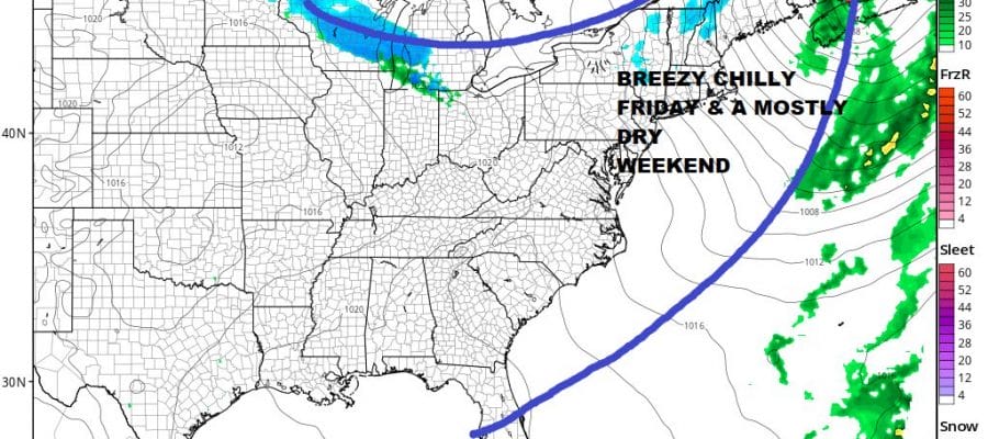
Dry Seasonal Conditions Through the Weekend Showery Rains Monday
The week’s warm day played out pretty much as advertised. Most highs today reached the mid to upper 50s. We saw a few warm spots in Southern Pennsylvania and Southern New Jersey southward reach 60 or so. A cold front is moving through here this evening. We have seem some showers on the radar loop moving offshore. As we go through tonight the wind will pick up and skies should at least partially clear. Most lows will be in the 30s to around 40 degrees.
SATELLITE

WEATHER RADAR

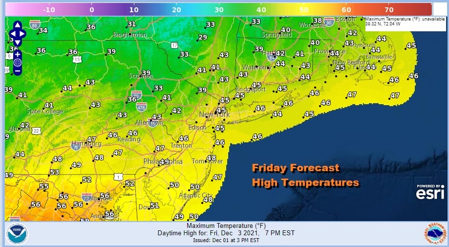
Friday sees a strengthening storm offshore and that will keep things on the windy side. Look for a mix of sun and clouds most highs will be in the 40s though it will be a little lower in the Hudson Valley and the Catskills and a little higher across Maryland and Delaware.
I really don’t see much happening over the weekend as the next front is going to reach the coast until sometime later Monday. So we will settle with sunshine and a few clouds for Saturday with most highs in the 40s and sunshine with some arriving clouds on Sunday and highs will be in the 40s to around 50 or so.

This is just a very ho hum snooze fest of a pattern. We get a cold front on Monday with some late day showers. Highs Monday will be in the mid 50s to around 60. It will turn colder behind it and another system will move in with more rain Tuesday night into Wednesday. This system may have enough cold air to produce some snow at the start in Central and Northern New England and along and north of I-90 but it mostly gets washed away anyhow.
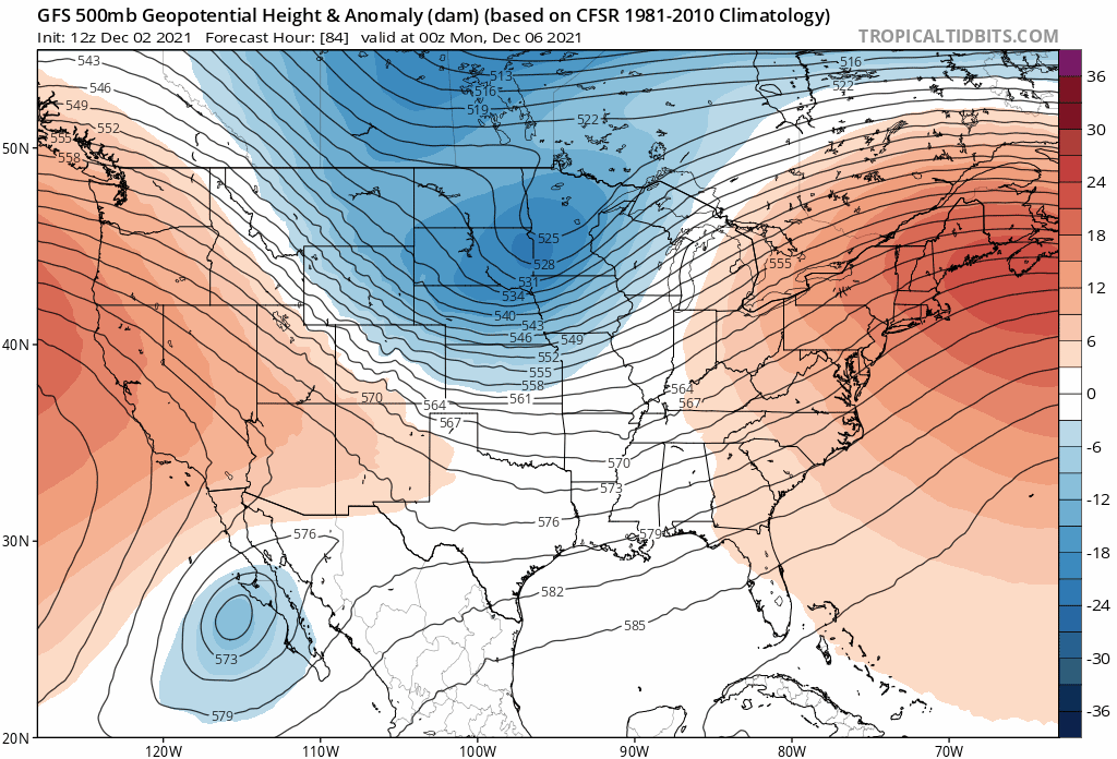
This is the upper air pattern for next week and it is about as unfavorable for snow in the Eastern US as you can get. Notice where the trough drops into the west and the corresponding strong ridge that tries to develop in the East. This is going to be the dominant pattern for the next 2 weeks or so and there are no signs of it breaking down through mid month. The only way it can snow in a pattern like this is if (and that’s a big if) you get a system that flattens the ridge in the east enough to allow for a little cold air to bleed southward into New England and the Northeast. Otherwise it will be a snow drought overall through mid month.
BE SURE TO DOWNLOAD THE FREE METEOROLOGIST JOE CIOFFI WEATHER APP &
ANGRY BEN’S FREE WEATHER APP “THE ANGRY WEATHERMAN!

MANY THANKS TO TROPICAL TIDBITS & F5 WEATHER FOR THE USE OF MAPS
Please note that with regards to any severe weather, tropical storms, or hurricanes, should a storm be threatening, please consult your local National Weather Service office or your local government officials about what action you should be taking to protect life and property.


