A Weekend of Seasonal Temperatures Rain Arrives Monday With Cold Front

Weather in 5/Joe & Joe Weather Show Latest Podcast
A Weekend of Seasonal Temperatures Rain Arrives Monday With Cold Front
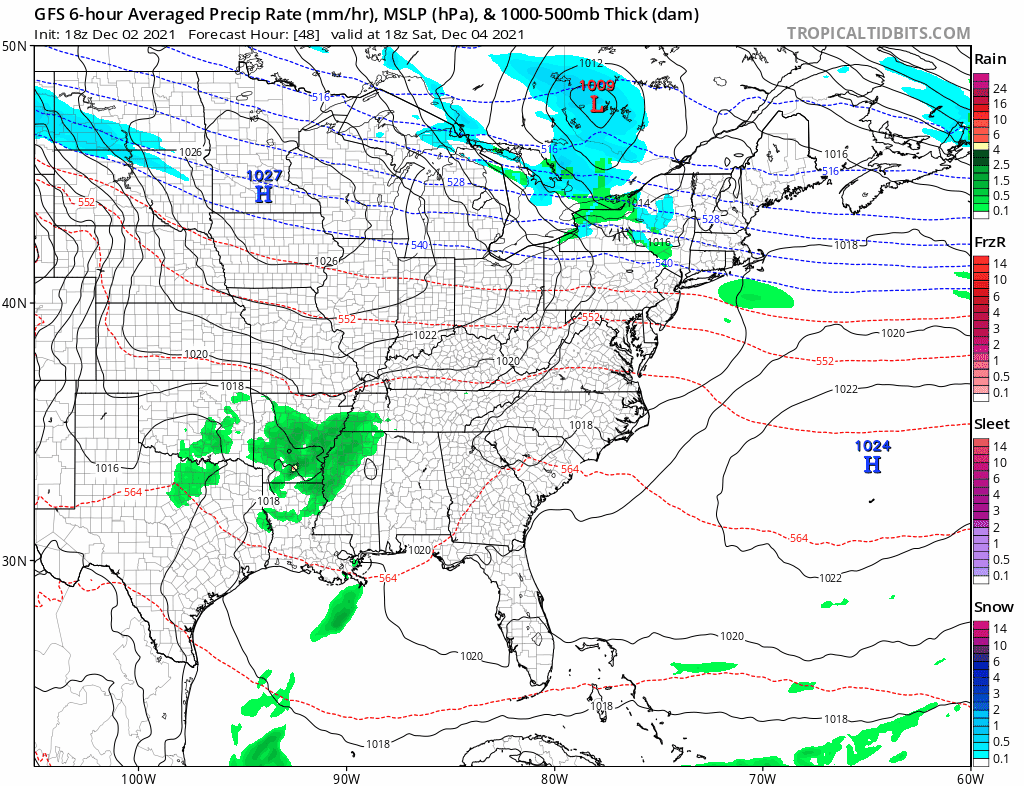
It is the first weekend of the last month of 2021 and we are not seeing much in the way of anything problematic. A cold front moved through yesterday and passed offshore. We do have an upper air disturbance crossing Pennsylvania and New Jersey which explains some of the cloud cover. We topped out today mostly in the 40s to around 50 in points south. There really isn’t much happening over the weekend as the gfs loop shows weak high pressure over us over the weekend.
SATELLITE

WEATHER RADAR

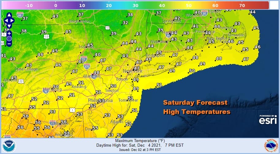
Tonight we will see patchy clouds intermixed with clear skies. Most lows will be in the upper 20s to middle 30s. Saturday should be a nice day with sunshine. There shouldn’t be too much in the way of cloud cover nor should there be much in the way of wind. Highs will be in the 40s to around 50.
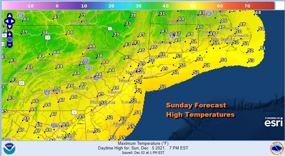
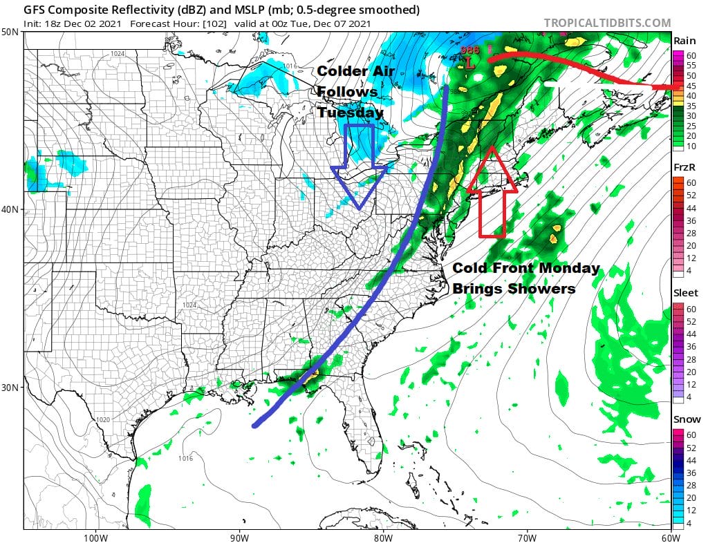
Sunday we begin to see winds turning around to the south ahead of the next cold front that will be moving east in a fast pattern. That is likely to continue with no blocking to speak of. Sunday should be an okay day with partly sunny skies. We will probably see more sun in the morning and more clouds in the afternoon. Most highs again will be in the 40s to around 50.
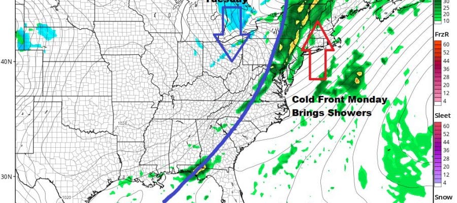
Monday sees the sharp cold front pushing on what will likely be a breezy day and perhaps we can call it windy along the coast. There might be some scattered showers overnight into Monday morning but more numerous showers will come in the late afternoon evening. Highs will reach the mid 50s to lower 60s.
Forecasting in a fast moving west to east pattern is usually rather straight forward. Even though the pattern isn’t favorable for a snow event it is not impossible for it to snow. However you do have to have systems time out perfectly. The northern part of the jet would have to suppress the ridge in the east just enough to allow for cold air to wedge in. The European model and to a lesser extent the Gfs model hint at this next Wednesday Thursday. The European in particular has been showing this idea for a few days. We will take a look at how the models handle this over the weekend.
BE SURE TO DOWNLOAD THE FREE METEOROLOGIST JOE CIOFFI WEATHER APP &
ANGRY BEN’S FREE WEATHER APP “THE ANGRY WEATHERMAN!

MANY THANKS TO TROPICAL TIDBITS & F5 WEATHER FOR THE USE OF MAPS
Please note that with regards to any severe weather, tropical storms, or hurricanes, should a storm be threatening, please consult your local National Weather Service office or your local government officials about what action you should be taking to protect life and property.


