
Dry Cooler Weather Arriving Clouds Rain Wednesday Dry Cool Thursday Into Friday
We aren’t looking anything especially dire this week. It appears Wednesday will be problematic with low pressure offshore and an onshore flow. In the meantime we are enjoying another nice start to the day but look for a some clouds and a gusty wind to develop this afternoon as a weather front moves offshore, low pressure to the northeast strengthens and high pressure builds down from Canada. It looks like we may have hit the ighs for the day already in the upper 60s and lower 70s.
SATELLITE

REGIONAL RADAR

You can see the clouds on the satellite picture close by just inland of the coast. Radars are picking up on some light showers with the cold front that is moving through. Other than that from standpoint of precipitation should should be mostly dry through Tuesday. Sunshine Tuesday will give way to late day arriving clouds. most highs will be in the mid 50s to lower 60s so a good 10 degrees cooler than today and 5 degrees below average.
LOCAL RADAR NEW YORK CITY

LOCAL RADAR PHILADELPHIA


Let us move on to Tuesday night into Wednesday night. Low pressure moves across the Ohio Valley and then redevelops off the Virginia coast. This creates an onshore flow and some rain which arrives early Wednesday morning and then lasts on and off into early Thursday morning. Highs Wednesday will be just in the 50s.
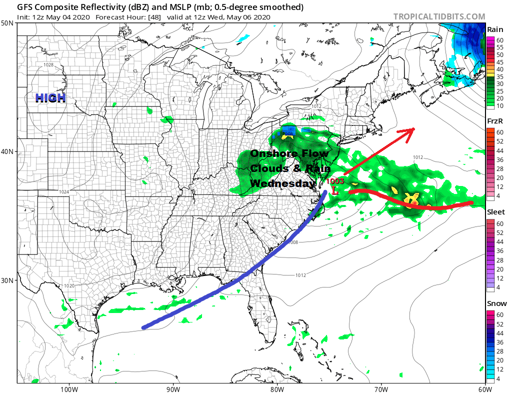
This low moves out to the northeast and another follows but we should be drying out Thursday with some sunshine. Highs will be in the mid 50s to lower 60s. Then we will see the onshore flow set up again for Friday with arriving clouds and rain developing later in the day lasting into early Saturday morning. Friday highs will likely be in the 50s.
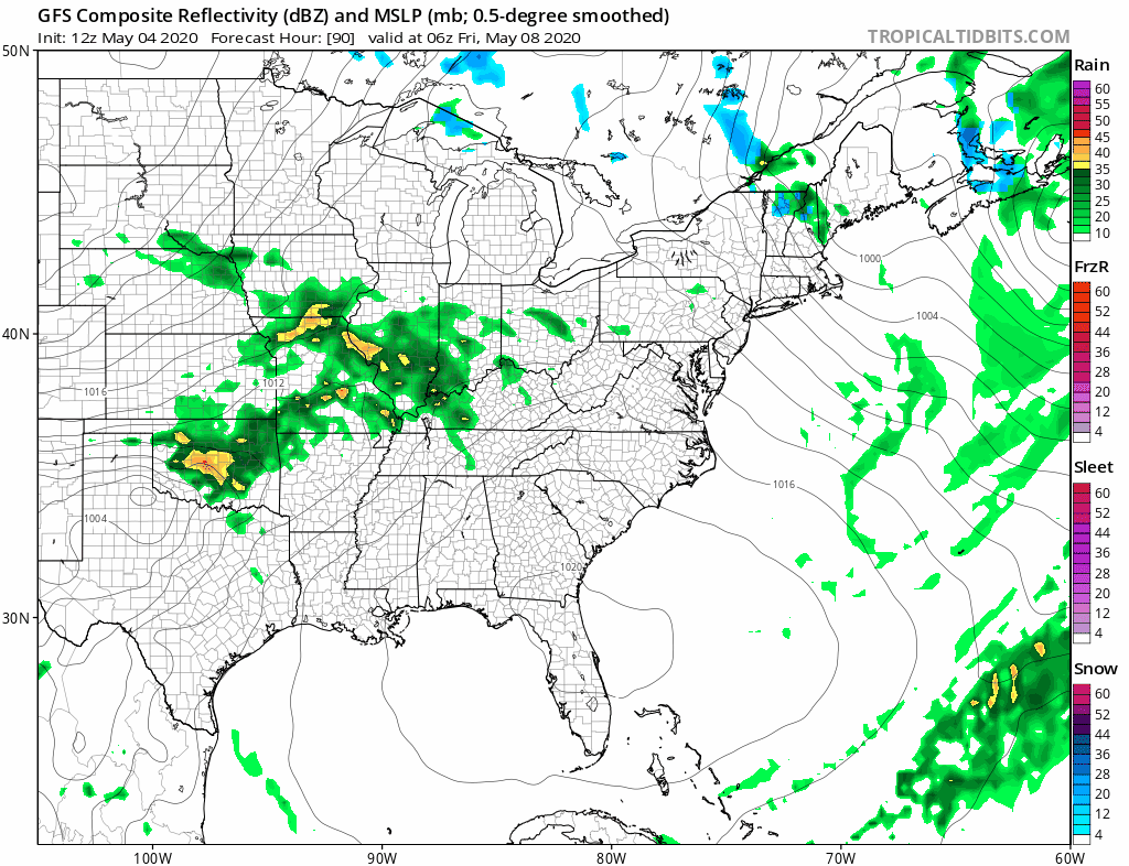
Behind this low will be a shot of rather chilly air for this time of year that will take over for the weekend. Saturday we will see some sunshine and clouds, a gusty wind with highs just in the 50s. This could set us up for some late spring freezes inland Saturday night into Sunday morning. Sunday is Mother’s Day and it will be a nice day of sunshine but it comes with a gusty wind and highs just in the 50s after a very cold start in the 30s. The colder than normal pattern continues into next week but there is a hint of a pattern change around mid month or shortly beyond that.
BE SURE TO DOWNLOAD THE FREE METEOROLOGIST JOE CIOFFI WEATHER APP &
ANGRY BEN’S FREE WEATHER APP “THE ANGRY WEATHERMAN!
MANY THANKS TO TROPICAL TIDBITS FOR THE USE OF MAPS
Please note that with regards to any severe weather, tropical storms, or hurricanes, should a storm be threatening, please consult your local National Weather Service office or your local government officials about what action you should be taking to protect life and property.


