Dry Cold Monday Snow Tuesday A Few Inches Possible In Some Areas

Weather in 5/Joe & Joe Weather Show Latest Podcast
Dry Cold Monday Snow Tuesday A Few Inches Possible In Some Areas
We do get to breathe a bit today as we are in between weather systems. Yesterday’s storm brought widespread 5 to 9 inch snows across much of Eastern Pennsylvania to Southern New England. Much lower amounts were measured in South Central and parts of Southeast Pennsylvania though there were some notable exceptions to that north and west of Philadelphia. Amounts in Maryland were mostly in the range of a few inches. Now it is on to the next system but before that we have sunshine for today. Temperatures this morning bottomed in the teens and low 20s. Highs today will be mostly in the upper 20s and lower 30s.
SATELLITE

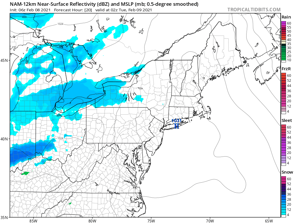
Skies are generally clear on the satellite and the radars are getting a one day break from showing snow. That break will end later tonight as snow begins to streak in from the west setting up snow for Tuesday for parts of the area.
F5 WEATHER RADARS


During tonight we will cloud up as the first of several systems heads our way from the southwest. This first one seems to be the weakest of the bunch and it is going to take a course where the snow will occur north of a line from Allentown Pa to NYC and across Long Island. Watch the southern end of this carefully for a subtle shift in either direction
This system has the potential for putting down as little as a coating on the southern end of the snow shield to a few inches. It is also one of those types of systems that can create some local surprises and it needs to be monitored closely for that possibility.
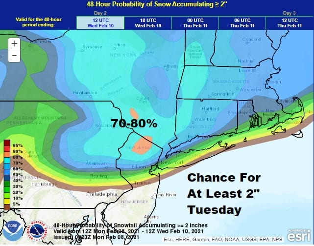
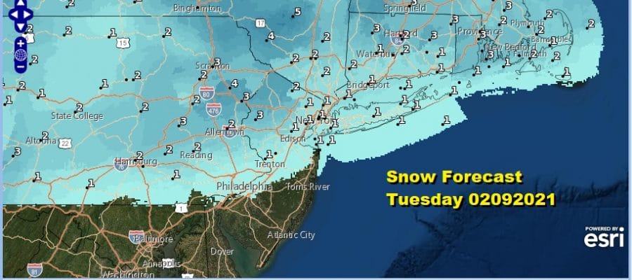
The risks per the Weather Prediction Center are clear on the map above. Follow the 50% line in the dark blue as a good indicator where the southern end of the accumulating snow area might be. There might also be a little bit of rain from this as well along the immediate coast south into New Jersey before this all comes to an end later Tuesday. Temperatures will start the day cold and then some areas will rise into the 30s during the afternoon.

Snow forecasts show the potential for a few inches on the NWS forecast map and we have no argument but again watch for the area to possibly tug a little further south. Once this goes we catch another break of dry cold weather on Wednesday. We will see sunshine Wednesday with most highs in the low to mid 30s. Clouds will start increasing later Wednesday as the next weather system approaches from the lower Ohio Valley.
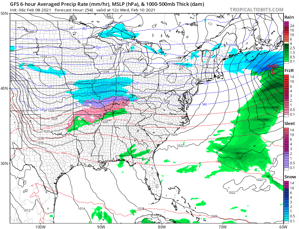
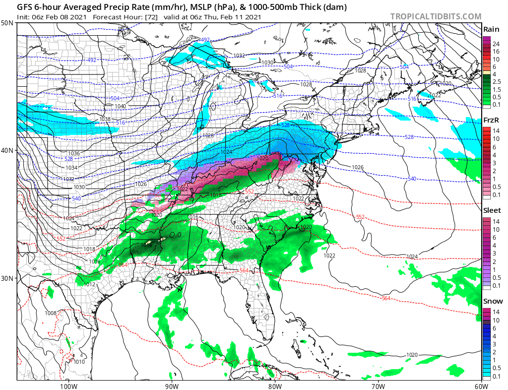
This is a bowling alley pattern with a west southwest flow in the upper atmosphere and that combines with a colder flow from Canada. We are on the edge of the arctic air for much of the time over the next seven days and how that ebbs and flows will determine what we could see regarding addition snow risks along the way. Wednesday night into Thursday’s system looks a little more potent than Tuesday’s and it also will be further south.
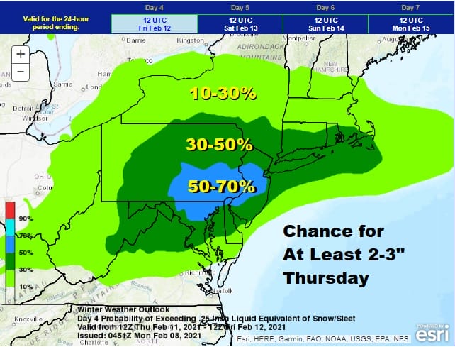
It has been on the radar screen of the Weather Prediction Center for the last few days and they grow more bullish with each passing day regarding the likelihood of accumulating snow of at least 2 to 3 inches. When it is in the long range, it is a good idea to pay attention. The Thursday system is basically a stalled frontal boundary to the south with waves rippling along it. The GFS model and others hint at a double wave structure which could put us in line for another round of snow Friday. This is a bit iffy at this point as this is something that doesn’t happen often. Usually it is one and done.
Each passing wave puts us a little deeper into the cold air and the boundary to the south remains intact and could produce yet another wave and another round of snow over the weekend!
BE SURE TO DOWNLOAD THE FREE METEOROLOGIST JOE CIOFFI WEATHER APP &
ANGRY BEN’S FREE WEATHER APP “THE ANGRY WEATHERMAN!
MANY THANKS TO TROPICAL TIDBITS & F5 WEATHER FOR THE USE OF MAPS
Please note that with regards to any severe weather, tropical storms, or hurricanes, should a storm be threatening, please consult your local National Weather Service office or your local government officials about what action you should be taking to protect life and property.


