Drought Relief Rain Probable Into Weekend
Drought Relief Rain Probable Into Weekend
The first shot of rain that moved through last night and this morning didn’t really amount to too much with most areas getting less than a quarter of an inch. But this weather front does start the process for more rain later this week. You can see the spinning upper air storm over the Great Lakes beginning its slow dive south southeastward into the Ohio Valley. This sets the ball in motion for some rain to gradually develop in areas later Wednesday into Wednesday night and then spread northward and continue possibly into Friday morning.


Over the short term with the rain pretty much done with, we could see some brightening of skies and some breaks of sunshine develop during this afternoon from west to east. The satellite loop does show dry air moving pretty quickly across Pennsylvania so it should reach the coast this afternoon. No issues tonight other than clouds. Temperatures today will be in the low to middle 70s and then cool off tonight into the 50s and lower 60s.
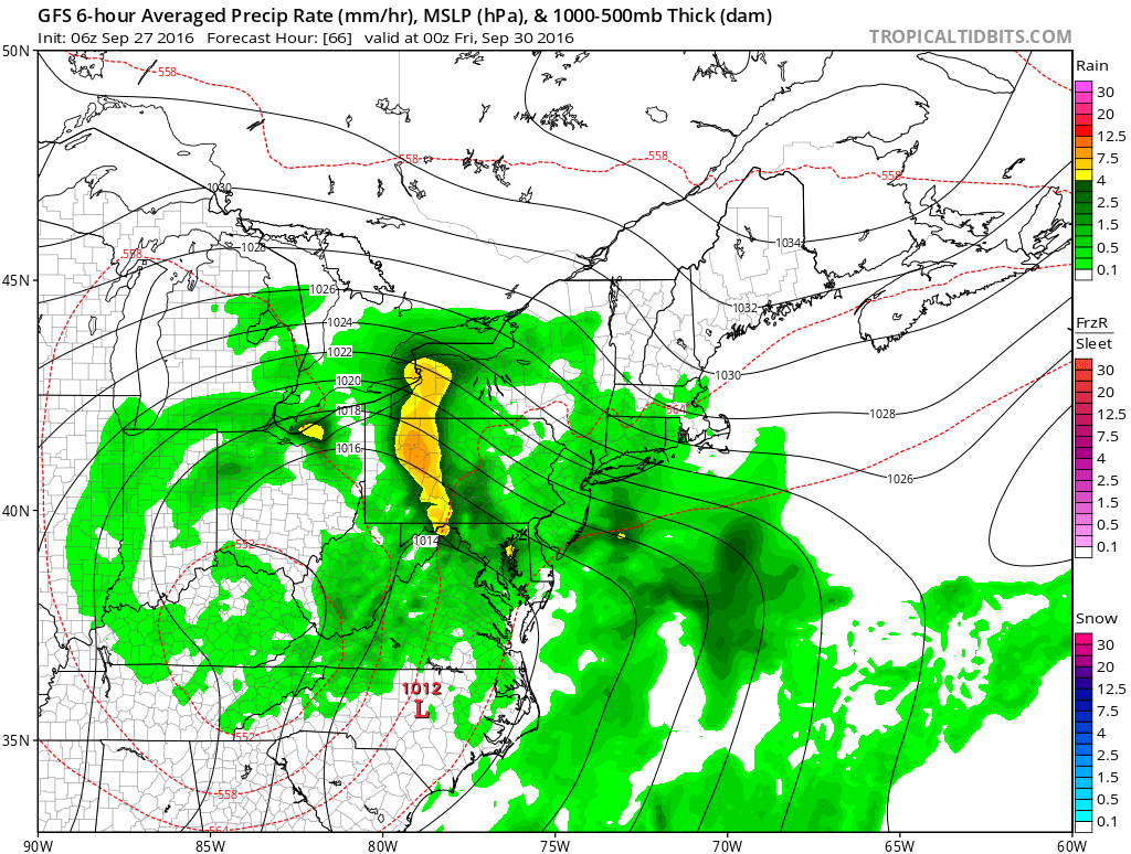
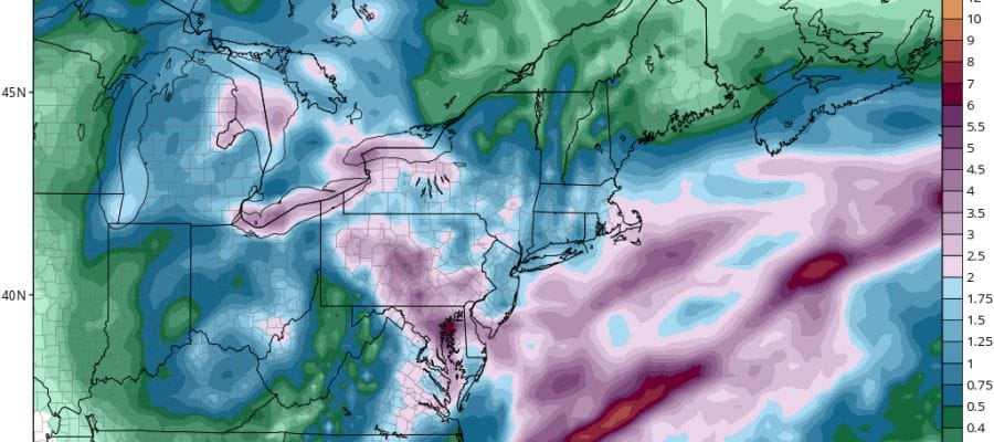
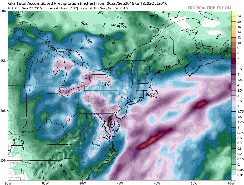
Wednesday clouds gradually return. Rain arrives in southern and western areas Wednesday night and then at the coast Thursday. As has been the case throughout the last few weeks it has been wise to be conservative when it comes to rainfall totals and indeed the GFS model has shifted the area of heavy rains west and south. The cumulative rainfall for the next 6 days is still on the order of at least a few inches in most places but the 4 to 6 inch amounts are shifted south and westward. How this ultimately sets up remains to be seen.
WINTER WEATHER OUTLOOK VIDEOS
In case you missed them I’ve been previewing the upcoming winter in a series of posts and videos. Here are the first 2. More will be coming along. Links to the latest posts are below.
EASTERN PENNSYLVANIA
NEW JERSEY
LONG ISLAND AND NEARBY
WINTER 2016-2017 PART 3 NEW JERSEY
WINTER 2016-2017 PART 1 OCEAN WATER TEMPERATURES
WINTER 2016-2017 PART 2 ARCTIC SEA ICE AND SIBERIAN SNOW COVER
FiOS1 News Weather Forecast For Long Island
FiOS1 News Weather Forecast For New Jersey
FiOS1 News Weather Forecast For Hudson Valley
NATIONAL WEATHER SERVICE SNOW FORECASTS
LATEST JOESTRADAMUS ON THE LONG RANGE

Weather App

Don’t be without Meteorologist Joe Cioffi’s weather app. It is really a meteorologist app because you get my forecasts and my analysis and not some automated computer generated forecast based on the GFS model. This is why your app forecast changes every 6 hours. It is model driven with no human input at all. It gives you an icon, a temperature and no insight whatsoever.
It is a complete weather app to suit your forecast needs. All the weather information you need is right on your phone. Android or I-phone, use it to keep track of all the latest weather information and forecasts. This weather app is also free of advertising so you don’t have to worry about security issues with your device. An accurate forecast and no worries that your device is being compromised.
Use it in conjunction with my website and my facebook and twitter and you have complete weather coverage of all the latest weather and the long range outlook. The website has been redone and upgraded. Its easy to use and everything is archived so you can see how well Joe does or doesn’t do when it comes to forecasts and outlooks.
Just click on the google play button or the apple store button on the sidebar for my app which is on My Weather Concierge. Download the app for free. Subscribe to my forecasts on an ad free environment for just 99 cents a month.
Get my forecasts in the palm of your hand for less than the cost of a cup of Joe!

MENTION JOE CIOFFI AND GET A 5% DISCOUNT


