Dismal Wednesday Showery Rains Into Early Friday, Strong Gusty Winds Developing Friday
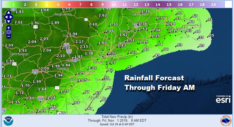
We didn’t see any major development that change our outlook for the next few days and for the developing storm that moves from the Rockies to the Great Lakes. We are sitting in a deck of low clouds with patchy light rain and drizzle along with some patchy fog. The coverage is rather uneven with some areas seeing visibility under a mile tonight while others are at 10 miles. Some places are getting a steady pelting of light rain and drizzle but other areas are getting less or nothing at all. This will continue overnight and on Wednesday as we set up for heavier rains coming in on Thursday. The rains on Halloween will be showery in nature which means there will be some breaks in between.
SATELLITE

REGIONAL RADAR

The radars are bit deceptive because the light rain and drizzle is lying in the very bottom 2000 feet of the atmosphere and the radars are having a tough time picking up on the light rain or drizzle. The local radars are showing some of that light rain and drizzle this evening and it is likely this will continue on and off overnight and on Wednesday.
LOCAL RADAR NEW YORK CITY

LOCAL RADAR PHILADELPHIA


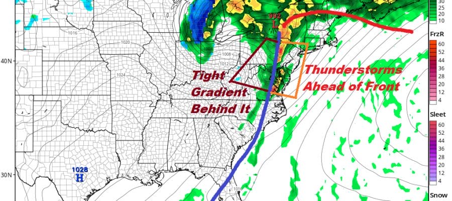
Wednesday we should see temperatures in the 60s with some spotty light rain or drizzle around. Late Wednesday night and on Halloween Thursday showery rains will develop ahead of low pressure that heads for the Great Lakes & Western NY. The storm will intensify so look for more numerous showers to develop later Thursday and Thursday night.
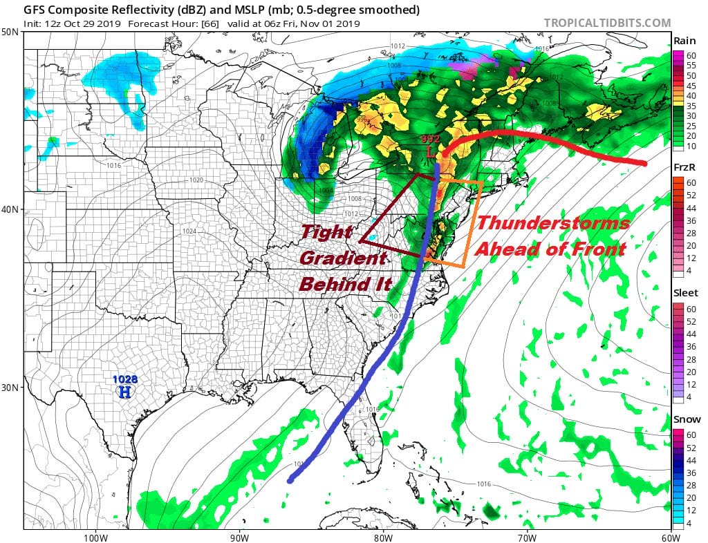
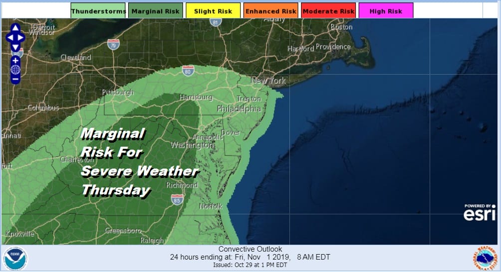
The strong front swinging through here early Friday morning will bring more showers and possibly a couple of thunderstorms. An early forecast from the Storm Prediction Center has the a marginal risk for severe weather from South Central Pennsylvania southward but we could see this areas expanded northeastward once we get to Thursday morning.
With the front early Friday morning will be strong northwest winds that will develop and we could see gusts of 40 mph or early Friday with leftover clouds giving way to some sunshine. Winds drop off and we should have a dry weekend with chilly temperatures. Highs will be just into the 50s on both weekend days.
BE SURE TO DOWNLOAD THE FREE METEOROLOGIST JOE CIOFFI WEATHER APP &
ANGRY BEN’S FREE WEATHER APP “THE ANGRY WEATHERMAN!
MANY THANKS TO TROPICAL TIDBITS FOR THE USE OF MAPS
Please note that with regards to any severe weather, tropical storms, or hurricanes, should a storm be threatening, please consult your local National Weather Service office or your local government officials about what action you should be taking to protect life and property.


