
December Climate of Extreme Heat Continues!
December climate is on the extreme end of the range of where temperatures normally fall. This pace is forecast to continue with only minor interruptions next weekend we get close to normal for a couple of days. On the pace we are headed this will be the warmest December on record and it will beat the prior record of 2001 by possibily a couple of degrees. This is at the top of the scale and shows how extremely out of whack the atmosphere is. Temperature records were broken this morning before Sunday breakfast was even digested. Here are a few.
RECORD EVENT REPORT
NATIONAL WEATHER SERVICE NEW YORK NY
935 AM EST SUN DEC 13 2015

...RECORD HIGH TEMPERATURE SET AT CENTRAL PARK...

A RECORD HIGH TEMPERATURE OF 64 DEGREES WAS SET AT CENTRAL PARK
TODAY. THIS TIES THE OLD RECORD OF 64 SET IN 1923.
RECORD EVENT REPORT
NATIONAL WEATHER SERVICE NEW YORK NY
1031 AM EST SUN DEC 13 2015

...RECORD HIGH TEMPERATURE SET AT NEWARK NJ...

A RECORD HIGH TEMPERATURE OF 64 DEGREES WAS SET AT NEWARK NJ TODAY.
THIS BREAKS THE OLD RECORD OF 63 SET IN 1946.
RECORD EVENT REPORT
NATIONAL WEATHER SERVICE NEW YORK NY
946 AM EST SUN DEC 13 2015

...RECORD HIGH TEMPERATURE SET AT ISLIP NY...

A RECORD HIGH TEMPERATURE OF 61 DEGREES WAS SET AT ISLIP NY TODAY.
THIS BREAKS THE OLD RECORD OF 60 SET IN 1990.
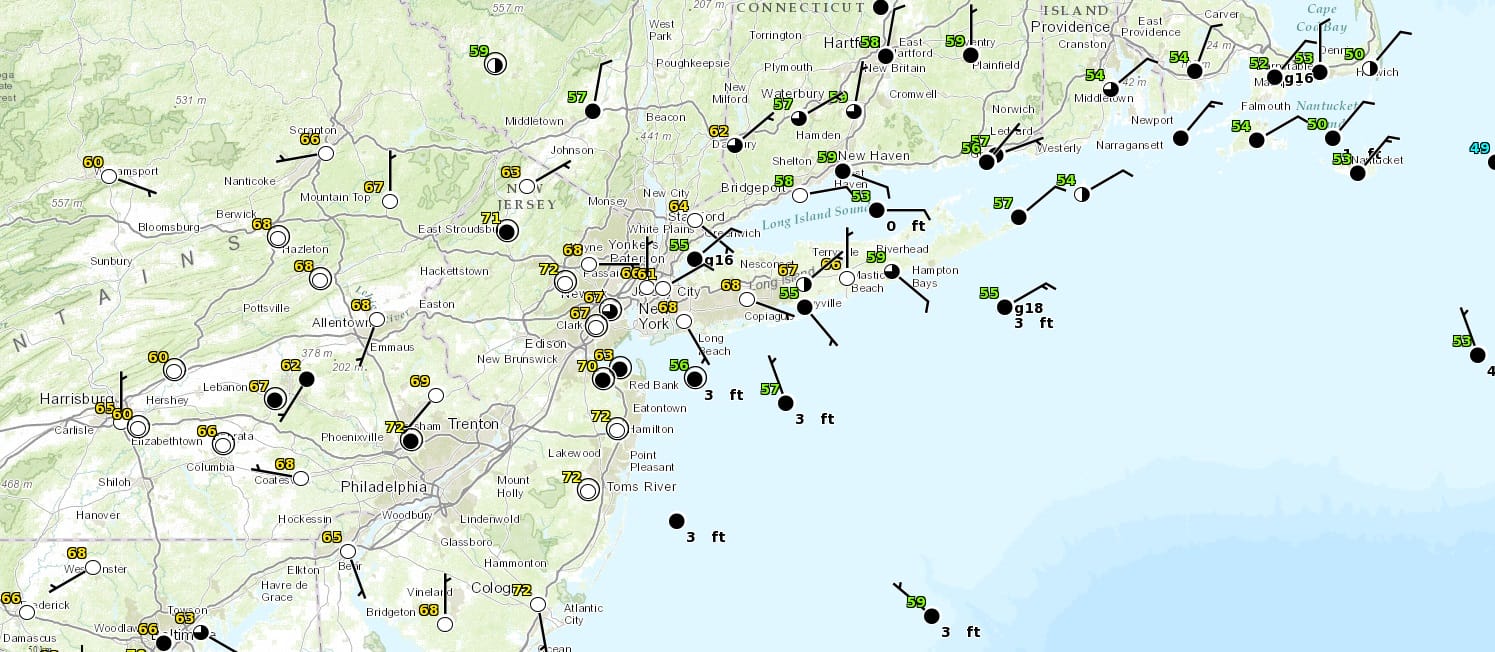
Other records have likely been set over much of New Jersey, Eastern Pennsylvania, Southeast New York and Connecticut. Here is a current temperature profile of our area.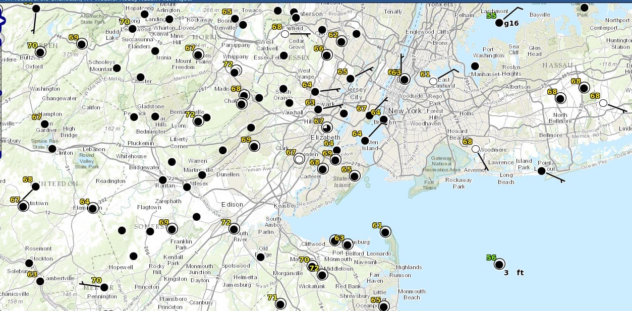

The long range outlook for the next 2 weeks features a continuation of the blowtorch pattern with just minor interruptions. One is coming next weekend for 2 days of normal temperatures and that is pretty much it. We will have more on that later this afternoon after football. Enjoy!!!
RAIN FOR MONDAY LOOKS LESS IMPRESSIVE
JOESTRADAMUS VIDEO ANALYSIS ON THE LONG RANGE
NEW YORK CITY & HUDSON VALLEY FORECAST