COLDER PATTERN DEVELOPS LONG RANGE
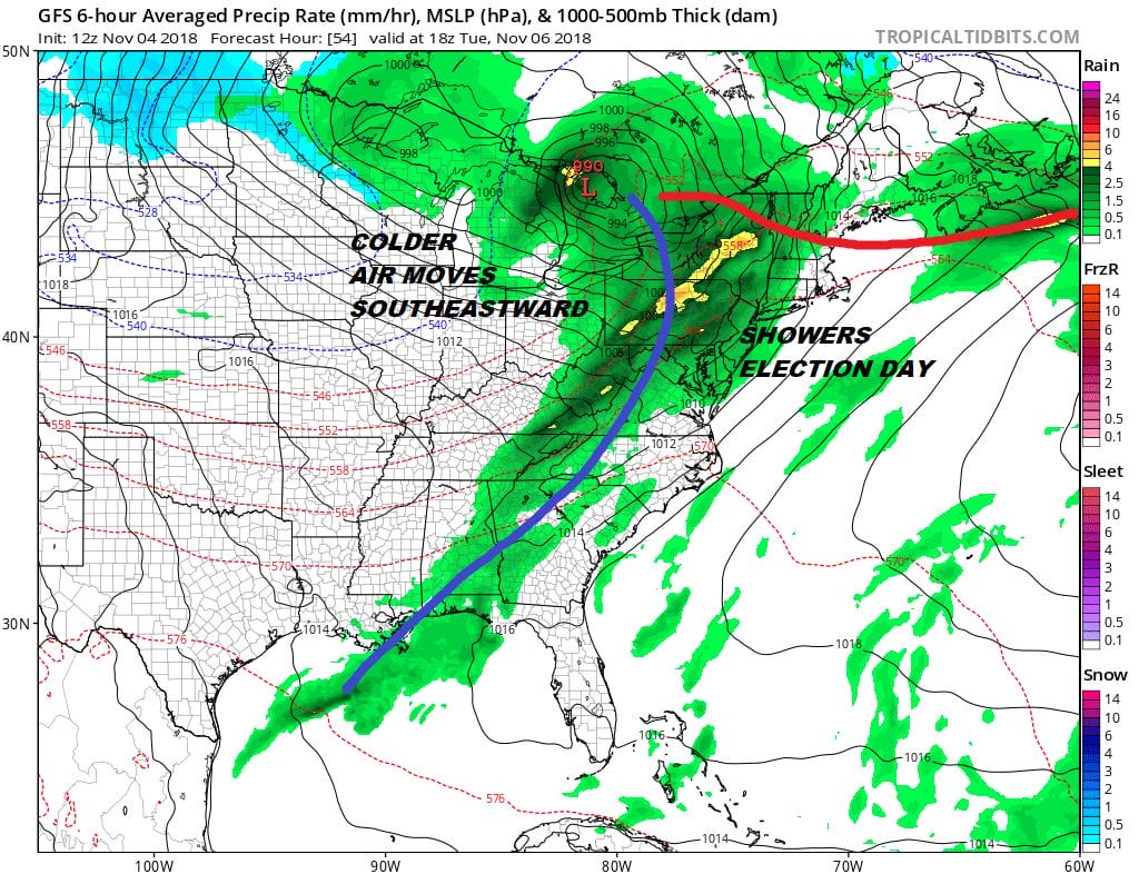
We have been watching the overall long range pattern gradually evolve over the last few weeks. The pattern remains active into the start of this week as we have another warm front/ cold front combination to deal with Monday and Tuesday. There will be some rain with an onshore flow on Monday and then the cold front arrives Tuesday election day with some showers as the front passes.
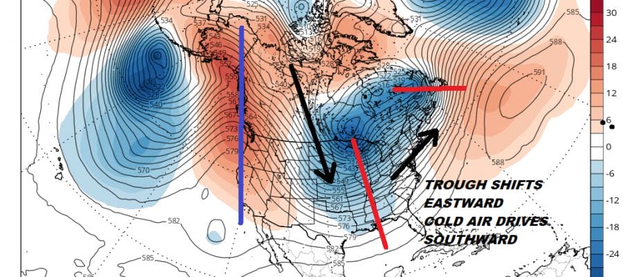
This system begins the process of a colder pattern developing in the eastern half of the US later this week and particularly next weekend. Weather models all seem to be on the same page with this with their usual degree of differences and uncertainties. The European model run is probably the more aggressive of the models as it begins to shift the upper trough further east. This will allow cold air to drive southward out of Canada and then shift eastward to the East Coast late in the weekend and for next weekend.
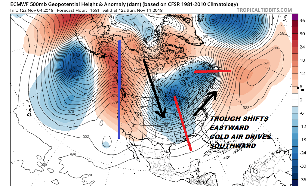
The colder air will likely need another mechanism to bring it in and that will probably occur with another cold front and another round of showers at the end of the week; probably for Friday and Friday night. The European gradually turns it colder over the weekend and into next week.
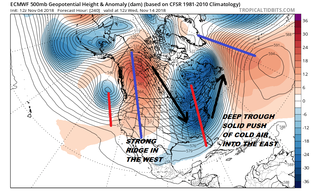
The European model (and to a lesser extent the GFS) show deep troughing in the East early next week and a strong ridge in the west. Models are hinting around at some sort of low developing with this as the cold air arrives. Regardless of any development it would seem that the interior of upstate NY could see their first round of lake effect snows in a pattern like this as well as some snow for interior New England. It is still way to early to take any snow threat elsewhere seriously in the long range outlook. The upper air pattern still seems to be evolving and trying to decide where the trough sets up and whether there will be any staying power to this pattern. That staying power will hinge on events in the Atlantic and whether a ridge in the Central Atlantic holds in the long term as well as the ridge in the Western US.
SUBSCRIBE TO PATREON FOR A WEATHER EXPERIENCE FREE OF ADS, EXCLUSIVE VIDEOS FOR MEMBERS ONLY AND MUCH MORE…STARTS AT $2 A MONTH..MESSAGE ME AT ANY TIME

MANY THANKS TO TROPICAL TIDBITS FOR THE USE OF MAPS
Please note that with regards to any tropical storms or hurricanes, should a storm be threatening, please consult your local National Weather Service office or your local government officials about what action you should be taking to protect life and property.
LATEST JOESTRADAMUS ON THE LONG RANGE