DOWNLOAD MY NEW FREE JOESTRADAMUS WEATHER APP FOR ANDROID

THE APP IS ABSOLUTELY FREE TO ALL BUT CONSIDERING SUBSCRIBING TO PATREON FOR A WEATHER EXPERIENCE FREE OF ADS, EXCLUSIVE VIDEOS FOR MEMBERS ONLY AND MUCH MORE…STARTS AT $2 A MONTH..MESSAGE ME AT ANY TIME

Colder Air Moving In Tonight Tuesday Rain Wind Late Thursday Friday
Yesterday’s rain and wind storm is long gone to the northeast and bringing snow to Northeastern New England (Maine). That low is strengthening today and with a big high to the west of us the pressure gradient will be tightening up considerably and that means gusty winds developing today and lasting overnight into Tuesday morning.
We are seeing some sunshine today but we are also seeing some clouds to the west and north. A cold front is dropping southeastward from the Great Lakes and upstate NY. There is a fast shot of cold air with that comes in for tonight into Tuesday morning. Look for sunshine and clouds, a gusty wind today and highs just in the low to mid 40s.
EASTERN SATELLITE

REGIONAL RADAR

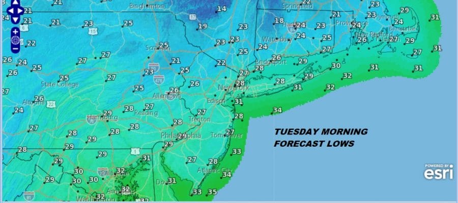
After spending the last two days with busy radars everything has quieted down. The regional radar shows snow in Maine. Local radars are silent and will be for the most part into Thursday. Tuesday morning will be cold wIth lows in the mid to upper 20s. Gusty winds will put wind chills down in the teens. Tuesday’s highs will not be much out of the mid to upper 30s.
Wednesday looks good and we will start Thursday dry but then here comes the next storm system as a deep trough swings across the Midwest and South and low pressure comes out of the Gulf States and heads northward up the Appalachians.
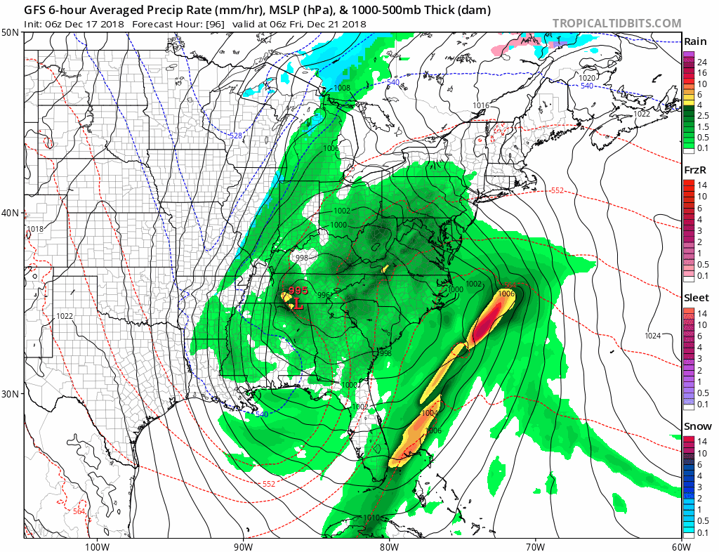
This is going to a wind and heavy rain event beginning later Thursday night and lasting into Friday night or even with showers lingering into early Saturday morning. Weather conditions improve after that. We should be okay from major storms after that through Christmas however the European model continues to insist on another weaker system moving into West Virginia and redeveloping to our southeast. This would be for late next Sunday night into Christmas Eve. It will be borderline cold enough snow if this happens. Not all the models have this as others keep this system very weak and almost impossible to find on upper air and surface maps. We will kick the can down the road for another day or two to see how much reality is here with the European model. It has had this feature for the last couple of days and doesn’t seem to want to let go of it.
MANY THANKS TO TROPICAL TIDBITS FOR THE USE OF MAPS
Please note that with regards to any tropical storms or hurricanes, should a storm be threatening, please consult your local National Weather Service office or your local government officials about what action you should be taking to protect life and property.

