
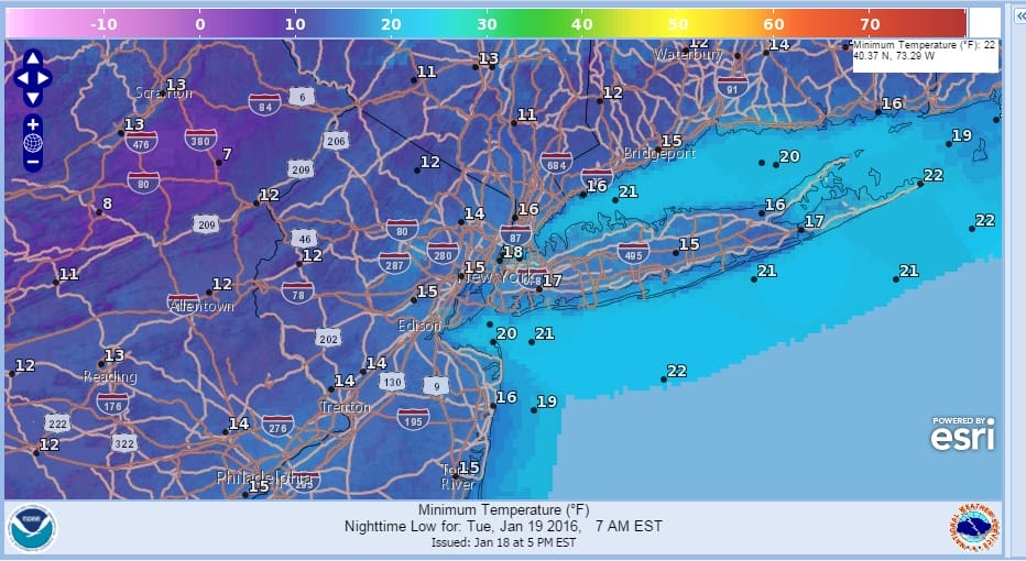
Cold Temperatures Dry Through Friday
It was very cold today for sure with strong winds and temperatures in the 20s. Wind chills were in the teens and single digits all day. Now tonight with partly to mostly clear skies lows will be in the teens and wind chills will continue to make it feel like it is in the single digits. Satellite loop shows clouds and snow showers coming off the Great Lakes as the lake effect machine is working overtime in parts of upstate New York. That will gradually relax during the day Tuesday and Tuesday evening.


Tuesday we will see plenty of sunshine and just some passing clouds on Tuesday with highs in the 20s to around 30 in most places. On Wednesday we will see sunshine and some arriving clouds but the next disturbance is going to weaken as it approaches us so no snow is forecast for Wednesday though highs will be in the 30s.
COLD TEMPERATURES DRY THROUGH FRIDAY
Now for Thursday and Friday high pressure builds back in from the north as cold air sets up across the Great Lakes and Northeast as we finish off the week. Thursday’s highs will be in the lower 30s and Friday’s highs will only be in the 20s to near 30. Both days will be dry with some sunshine Thursday followed by increasing clouds on Friday. This of course sets up for the weekend as models all show a storm along the Middle Atlantic coast.
The late afternoon GFS model continues what has been a remarkable run of models that began 5 days ago. Each run has been pretty much the same with just some slight variations here and there. Those are all short range forecast problems. What is important is that all models show an impressive storm for the weekend for the northeast and Middle Atlantic states and the models have not varied from this view on bit.
COLD TEMPERATURES DRY THROUGH FRIDAY
GFS MODEL FROM LATE THIS AFTERNOON
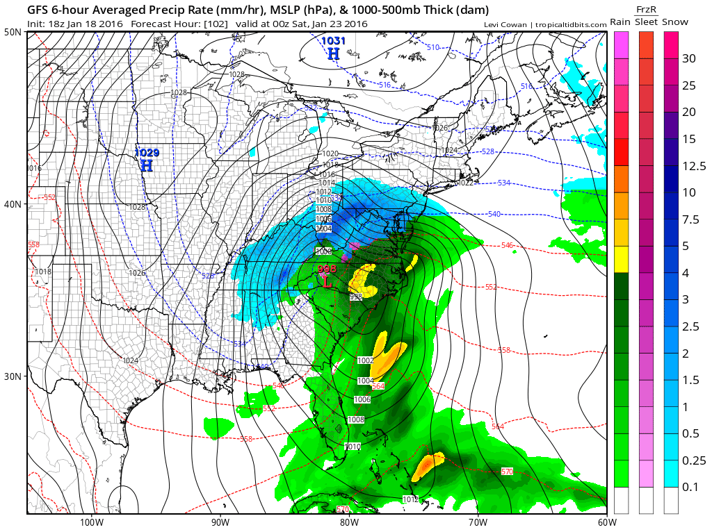
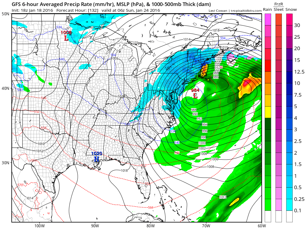
The GFS is close to the position on the previous run. Perhaps it is a little further southwest on the Low but at this point it is so close that it’s not worth arguing. I went back and looked at the last 5 runs and it is remarkable how close the models have been from run to run. The basic premise is unchanged. We will resolve short term issues like mixing or rain for some places as well as some early snowfall guess along about Wednesday. For now it is still full steam ahead.
NATIONAL WEATHER SERVICE SNOW FORECASTS
LATEST JOESTRADAMUS ON THE LONG RANGE
Weather App

Winter is here! Don’t be without Meteorologist Joe Cioffi’s weather app. It is a complete weather app to suit your forecast needs. All the weather information you need is right on your phone. Android or I-phone, use it to keep track of all the latest weather information and forecasts. This weather app is also free of advertising so you don’t have to worry about security issues with your device. An accurate forecast and no worries that your device is being compromised.
Use it in conjunction with my website and my facebook and twitterand you have complete weather coverage of all the latest weather and the long range outlook. The website has been redone and upgraded. Its easy to use and everything is archived so you can see how well Joe does or doesn’t do when it comes to forecasts and outlooks.
Just click on the google play button or the apple store button on the sidebar for my app which is onMy Weather Concierge. Download the app for free. Subscribe to my forecasts on an ad free environment for just 99 cents a month.
Get my forecasts in the palm of your hand for less than the cost of a cup of Joe!
![]()
![]()