
Cold Relief A Day Away
This is a short lived cold air mass. Cold relief is coming rather quickly as the core of the cold air mass moves by today. This will produce sunshine and clouds and perhaps even a few flurries. There were some over parts of Northeast Pennsylvania last night. With a little instability and the cold air overhead a flurry or two is not out of the question. Temperatures will in many areas not get out of the 30s while some coastal and urban areas may see lower 40s.
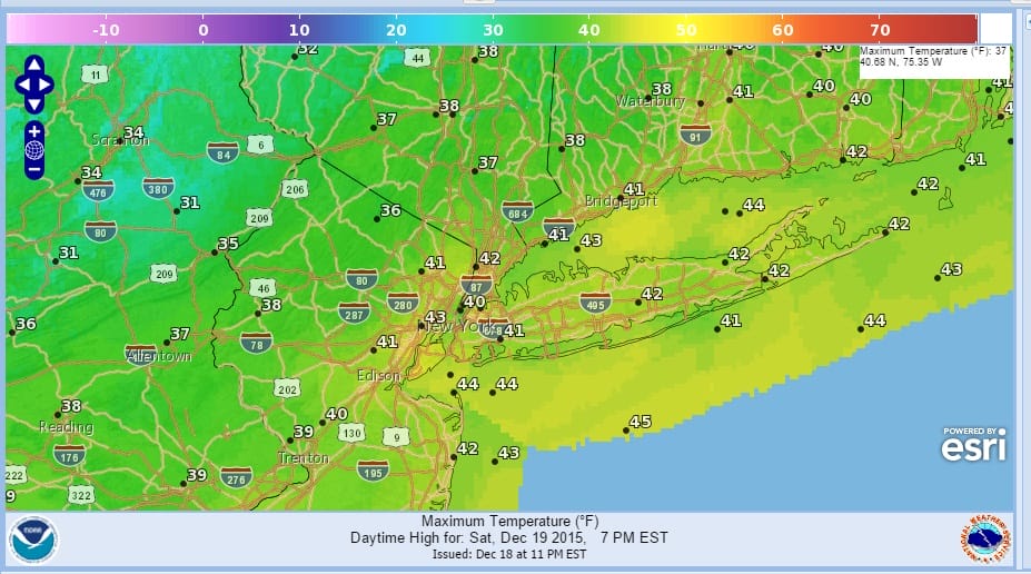
Cold air will be around into Sunday morning and tonight we are looking at clear skies. Less wind will provide some cold relief as lows bottom in the 20s in most inland spots and near or just over 30 elsewhere.


The reason why the cold relief comes so quickly is that the upper trough and jet stream pull out as fast as it moved in and this will be replaced by the ever present and dominant ridge off the east coast that will build right up into the middle of next week. Sunday we will see sunshine with highs mostly in the 40s everywhere. Then temperatures Sunday night won’t fall far as winds go southwest. Monday we will see some sunshine and high clouds with highs back into the 50s. There could be a shower Monday night as a weak front goes by. Tuesday will be dry but there could be a lot of clouds around. Then low pressure to our west begins to move north to the Great Lakes and we will see a warm front to our south. This will set up some overrunning rain Tuesday night into Wednesday. Once that warm front goes by we could see temperatures close to 60 late Wednesday but certainly on Thursday, Christmas Eve we are on track for record highs in the 60s to perhaps near 70 again in some places.
Once another cold front goes by with showers later in the day and evening on Christmas Eve it will turn cooler on Friday with clouds and some sun and highs in the low to mid 50s.
IS THE POLAR VORTEX ABOUT TO BE ATTACKED? JOESTRADAMUS EXPLAINS
MERRY CHRISTMAS FROM JOESTRADAMUS
Weather App

Winter is coming. Don’t be without Meteorologist Joe Cioffi’s weather app. It is a complete weather app to suit your forecast needs. All the weather information you need is right on your phone. Android or I-phone, use it to keep track of all the latest weather information and forecasts. This weather app is also free of advertising so you don’t have to worry about security issues with your device. An accurate forecast and no worries that your device is being compromised.
Use it in conjunction with my website and my facebook and twitterand you have complete weather coverage of all the latest weather and the long range outlook. The website has been redone and upgraded. Its easy to use and everything is archived so you can see how well Joe does or doesn’t do when it comes to forecasts and outlooks.
Just click on the google play button or the apple store button on the sidebar for my app which is onMy Weather Concierge. Download the app for free. Subscribe to my forecasts on an ad free environment for just 99 cents a month.
Get my forecasts in the palm of your hand for less than the cost of a cup of Joe!

![]()


