
Weather Pattern Change & The Polar Vortex Attack
Weather pattern change is never an easy thing. Some patterns break easier than others. This weather pattern has been particularly stubborn probably reflecting the very strong El Nino and the very strong and locked up polar vortex in the Arctic. We have seen the results of this with a record warm November and a record warm December. Weather pattern change always comes sooner rather and later and usually the seeds of the pattern destruction are sown by the pattern itself as warm air and cold air masses become displaced well out of their normal positions. They ultimately eat away at the dominant features and begin the change process.
What will finally cause weather pattern change will be reaching that tipping point. For example, latest model data indicates that the El Nino has begun to weaken. All models show the el nino weakening into next May though models tend to rush things. The question is where is the tipping point and when do we get there. There is going to be a point as the el nino weakens, that the rest of the atmosphere will begin to respond. Where that is I’m not sure but I suspect now that we are very close to that tipping point.
The second thing we should remember is that the pattern could change but I have said many times that weather pattern change does not necessarily mean it is going to change into something you like. We could for example get a breakdown in the polar vortex and blocking developing. However if the mean trough sets up too far west then it will be cold with coast huggers and snow to rain events. Or we could go into a dry northwest flow which mean basically cold but dry weather. Actually this touches on something that concerns me in that it may be one thing to see a breakdown of the warm pattern and switch to something colder, however we have been in a dry pattern for 8 months. This week we saw 2 rain events in 1 week which has not happened much in these 8 months. A breakdown of the dry pattern has to be part of this weather pattern change scenario.

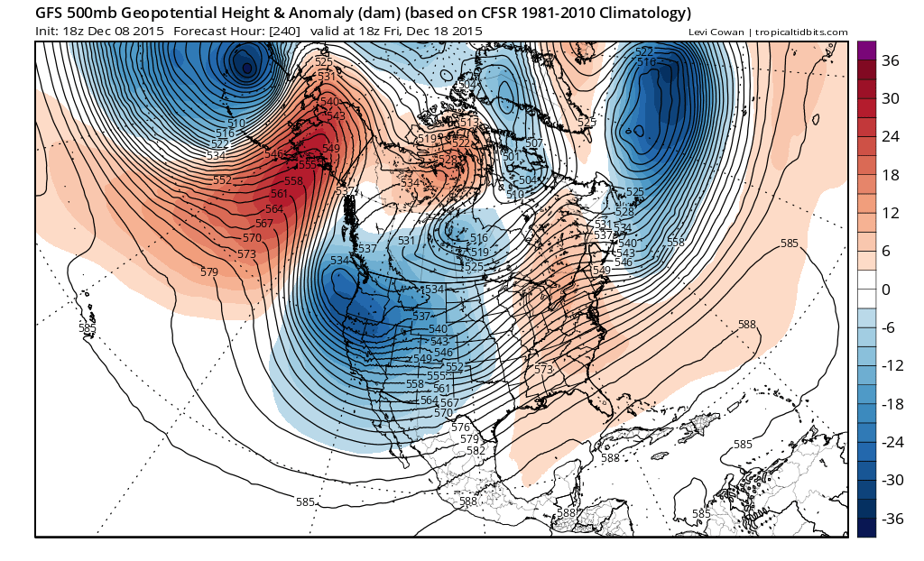
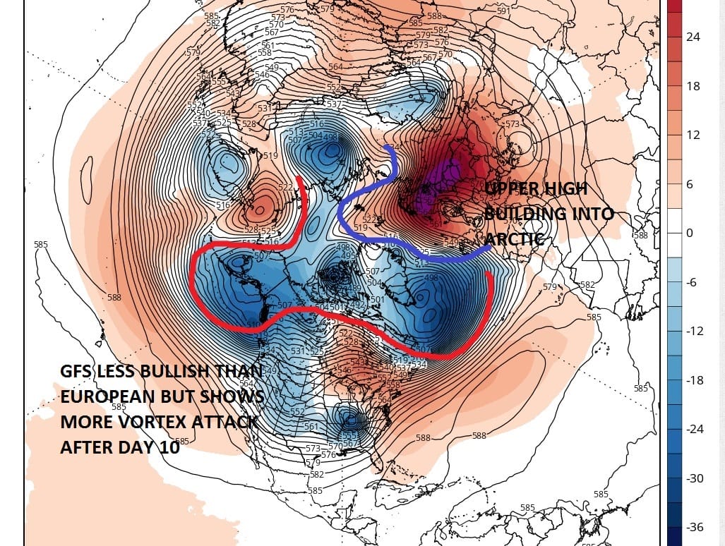
Today’s European run was very interesting regarding whether the weather pattern change process is finally about to get underway. One of the things that has caught my eye over the last number of days has been a big blocking high that develops over Europe. The models have been varying back and forth on this however the European today as well as the ensembles, built that high across the North Pole from the east and attacking the polar vortex. This is a key development. To confirm this of course we really need to get inside the very short range in order to really feel confident about this happening. The GFS was less bullish at this time frame but grows more bullish beyond day 10 with a similar idea.
The bottom line about whether we are going to see a significant weather pattern change is whether the change process gets into the time frame where we are actually seeing it and not just in theory. Also weather pattern change is a process and not an event so it will probably take several weeks to work through. Remember it could very well change and not necessarily change into something you will like.
Here is this morning’s video analysis of the GFS long range model
SHORT RANGE FORECAST FOR LONG ISLAND
SHORT RANGE FORECAST FOR NEW YORK CITY
LATEST JOESTRADAMUS POST ON EUROPEAN MODEL
JOESTRADAMUS IS A POET…MERRY CHRISTMAS!
Weather App

WEATHER APP
Winter is coming. Don’t be without Meteorologist Joe Cioffi’s weather app. It is a complete weather app to suit your forecast needs. All the weather information you need is right on your phone. Android or I-phone, use it to keep track of all the latest weather information and forecasts. This weather app is also free of advertising so you don’t have to worry about security issues with your device. An accurate forecast and no worries that your device is being compromised.
Use it in conjunction with my website and my facebook and twitterand you have complete weather coverage of all the latest weather and the long range outlook. The website has been redone and upgraded. Its easy to use and everything is archived so you can see how well Joe does or doesn’t do when it comes to forecasts and outlooks.
Just click on the google play button or the apple store button on the sidebar for my app which is onMy Weather Concierge. Download the app for free. Subscribe to my forecasts on an ad free environment for just 99 cents a month.
Get my forecasts in the palm of your hand for less than the cost of a cup of Joe!

![]()