Cold Night Dry Sunday Ahead Rain Monday Into Tuesday Snow Chance Wednesday?
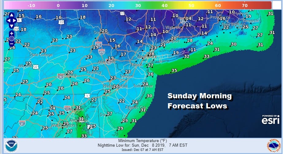
After a cold day of sunshine and some passing clouds we are headed for a clear cold night. Skies if they haven’t cleared out already will do so and temperatures are headed down into the 20s with teens in the usual colder inland spots and also in some coastal areas where light winds will allow for some radiational cooling to occur. This leads us into a nice Sunday of sunshine though some high clouds will being to arrive as the day wears on. Temperatures after the cold start should able to rebound into the 40s. There are no issues precipitation wise as the regional radar is quiet over virtually all of the Northeast into the Middle Atlantic states.
SATELLITE

REGIONAL RADAR

Clouds will thicken up Sunday night and temperatures will likely hold steady overnight in the 30s and 40s and warmer air moves northward. Monday we will be cloudy and warmer with highs reaching the 50s just about everywhere except north and northeast of NYC where snow cover should hold numbers down a bit until the warm air and the rain begin to eat away at it.

Rain starts to sweep up the coast Monday morning and it also begins to swing in from the west as the cold front makes its initial approach. It looks like we get a solid rain here into Monday night before the rain moves out to the northeast and most of it is gone by daybreak Tuesday.

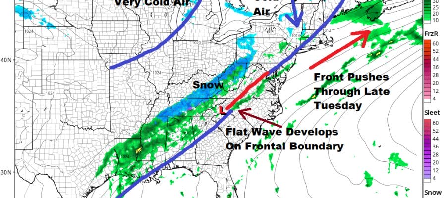
The front will move through late in the day Tuesday and ahead of it we will see clouds and maybe a few passing showers as highs reach the warm upper 50s and lower 60s. Then after the front moves offshore it slows down and stalls. It will have to wait for a second wave of low pressure as the map above shows to move along the front. This is where the forecast gets tricky. How much cold air gets in here before the wave goes by? This is always a dilemma in cases like this. Most times the cold air doesn’t arrive in time and you wind up with a round of rain that maybe changes to snow with little consequence.
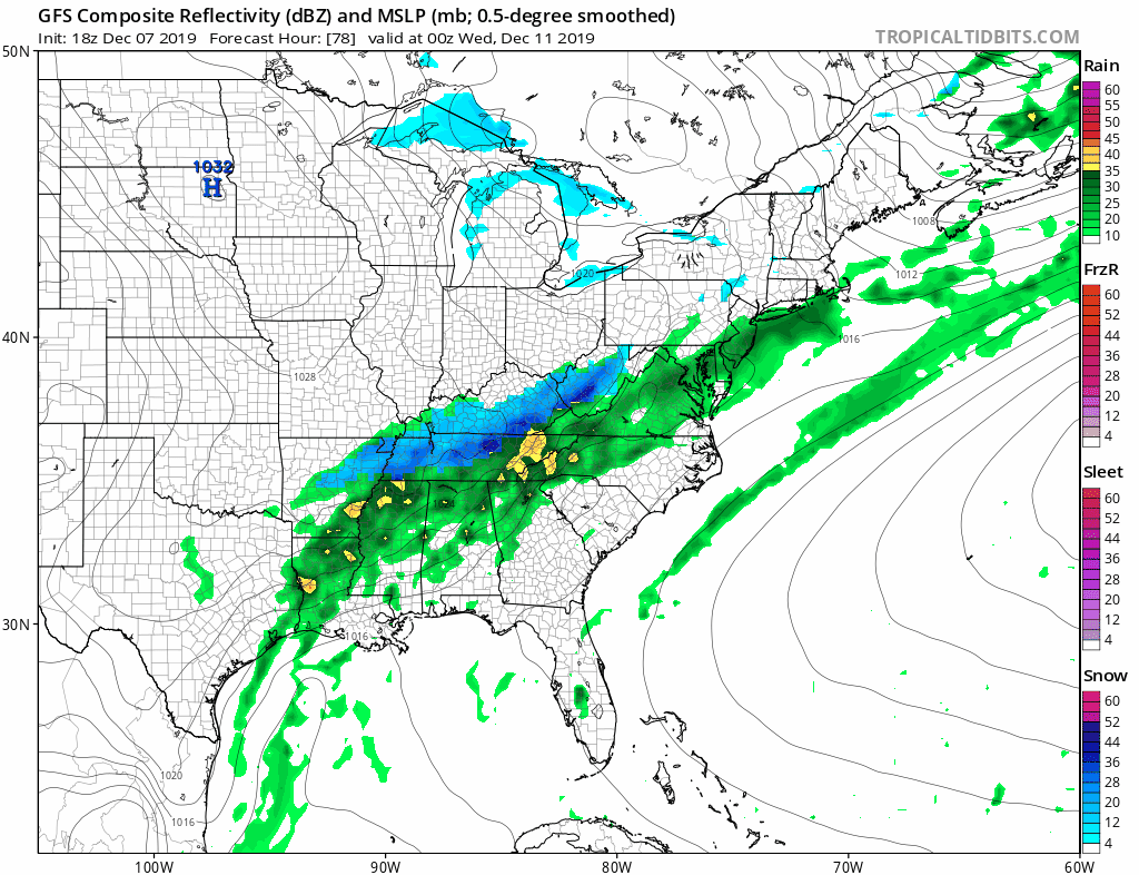
This is the latest GFS model run which changes rain to snow over most of the area but notice that it is a very narrow stripe of snow that we are talking about here. It is also not exactly producing a whole lot of precipitation overnight into early Wednesday morning; perhaps a quarter to a third of an inch. If this is the case how much do you wind up losing in the transition before anything even accumulates? Also the freezing line never makes it to the coast until after the wave is long gone. For now I would lean against any kind of accumulation at the coast though there might be a better chance inland which has a shot at getting cold enough for a few hours at least while there is precipitation still around. This is NOT a situation of an intensifying storm moving northeast but rather a flat-ish wave going by. You get what you get out of it and then it turns colder for the second half of next week. For now I’m not too concerned about anything other than a cheap thrill from this set up.
BE SURE TO DOWNLOAD THE FREE METEOROLOGIST JOE CIOFFI WEATHER APP &
ANGRY BEN’S FREE WEATHER APP “THE ANGRY WEATHERMAN!
MANY THANKS TO TROPICAL TIDBITS FOR THE USE OF MAPS
Please note that with regards to any severe weather, tropical storms, or hurricanes, should a storm be threatening, please consult your local National Weather Service office or your local government officials about what action you should be taking to protect life and property.


