
Rain Warmer Monday Watching Snow Cold Air Tuesday Night & Wednesday

We bottomed out this morning with temperatures in the teens and low 20s. The exceptions being the warmer urban centers which are closer to the mid 20s and some snow covered inland areas that are seeing lows in the single digits. We should have a good day of weather with sunshine and some high clouds as warmer air starts to move up the east coast. Temperatures should reach up into the 40s this afternoon. The radars are nice and quiet and should remain so into tonight before we start to see some rain developing along coastal areas to the south. That is destined to get here on Monday.
SATELLITE

REGIONAL RADAR

Low pressure is moving across the Southern Canada just north of the Great Lakes tonight into Monday and then headed into Eastern Canada with a long cold front extending southward. Atlantic moisture will start to move in overnight as clouds thicken and there could be a few brief scattered showers overnight along coastal areas before a more widespread area of showers spreads in from the west during the day on Monday. Temperatures tonight will be holding steady in the 30s and 40s and then rising into the 50s on Monday.
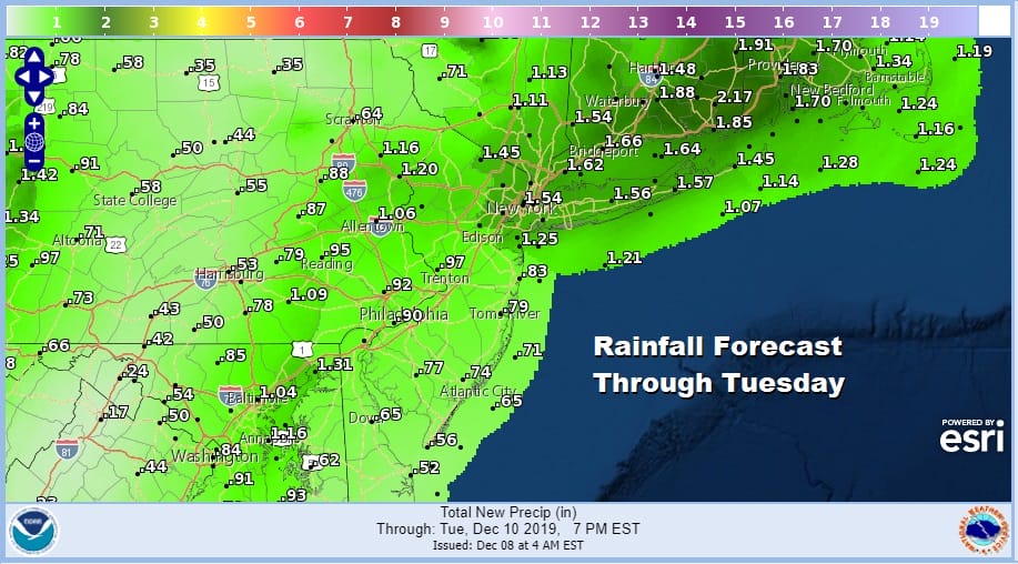
We will see areas of showers continuing to move through Monday night into early Tuesday morning. Rainfall amounts will be higher along the coast than inland with that influx of Atlantic Ocean moisture. An inch or more of rain seems likely from NYC north and east through Southern & Central New England. Deep snow cover in these areas could lead to some localized flooding.
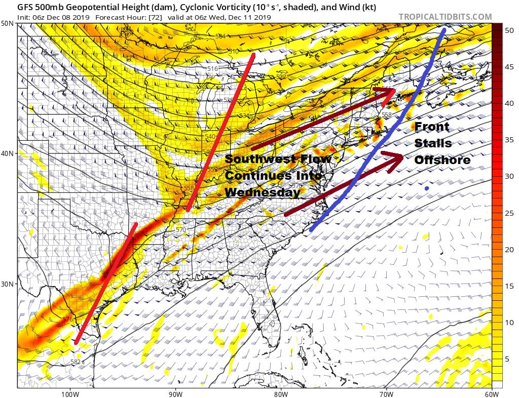
Our cold front will be moving offshore but it will slow down and stall thanks to a very broad trough and a southwest flow in the upper atmosphere. There will need to be one more wave of low pressure to develop and get the front completely through here. Rain will take a break for the first part of Tuesday but as the front nears and moves through it will start up again late in the day. Before the front passes we will see temperatures reach the upper 50s and lower 60s before dropping rather quickly behind it.
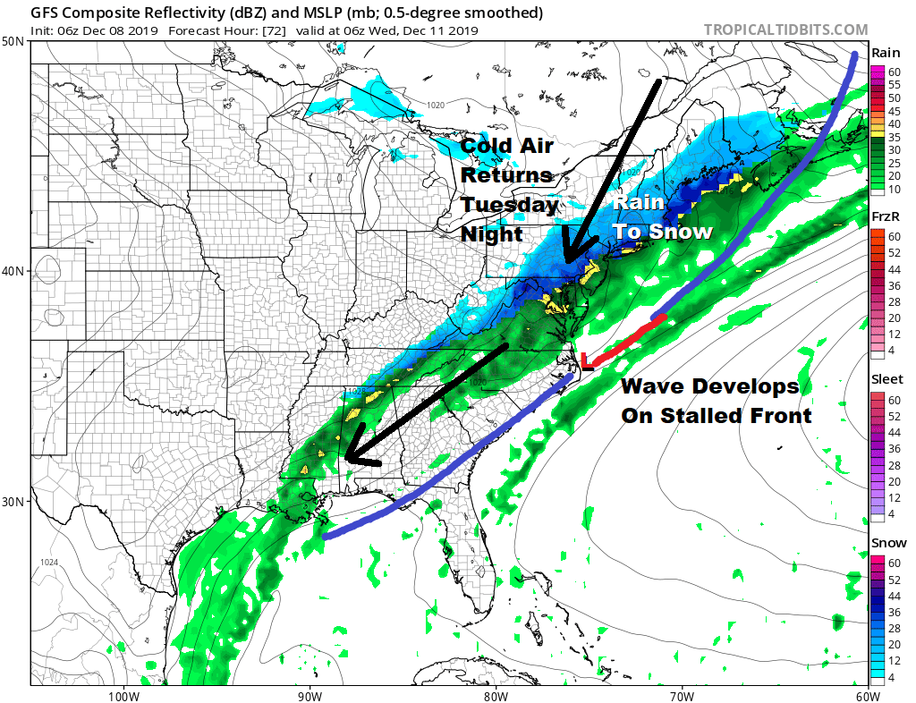
Now here comes the hard part of this forecast. The cold air behind the front is impressive enough. How much cold air gets in here is a question. Models suggest temperatures could drop close to the freezing mark by morning Wednesday especially inland. Another is how much moisture will this wave generate. Overnight models including the European have grown more bullish on liquid precipitation amounts generating a half an inch more of liquid as the cold air moves in. If you want to make a case for snow and allow for melting and the temperature issues this could be a 1 to 3/2 to 4 inch situation especially for inland areas. At this early stage i remain rather cautious and would like to see how models handle this as we get a little closer. Many times in situations like this the cold air comes in too late after the precipitation shuts off but the recent model runs suggest that this might be one of those instances where there might be more to work with. Timing suggests rain changing to snow Tuesday night which will occur quickly inland over Pennsylvania. northwest New Jersey and the Hudson Valley before midnight and along the coast afterwards. Intensity of the the precipitation is going to be key to cooling the atmosphere down. There is plenty of time to watch this play out so we will punt the football at this time and look for more clues later today and especially on Monday when things should become clearer.
BE SURE TO DOWNLOAD THE FREE METEOROLOGIST JOE CIOFFI WEATHER APP &
ANGRY BEN’S FREE WEATHER APP “THE ANGRY WEATHERMAN!
MANY THANKS TO TROPICAL TIDBITS FOR THE USE OF MAPS
Please note that with regards to any severe weather, tropical storms, or hurricanes, should a storm be threatening, please consult your local National Weather Service office or your local government officials about what action you should be taking to protect life and property.


