
DOWNLOAD MY NEW FREE JOESTRADAMUS WEATHER APP FOR ANDROID
THE APP IS ABSOLUTELY FREE TO ALL BUT CONSIDERING SUBSCRIBING TO PATREON FOR A WEATHER EXPERIENCE FREE OF ADS, EXCLUSIVE VIDEOS FOR MEMBERS ONLY AND MUCH MORE…STARTS AT $2 A MONTH..MESSAGE ME AT ANY TIME
Cold Night Dry Cold Monday
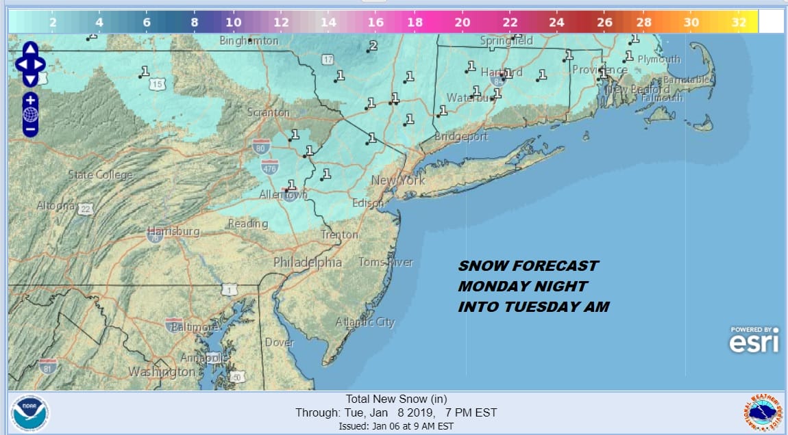
Burst of Snow Sleet Monday Night Tuesday Morning Inland
Cold air is arriving now on gust northwest winds and we seem to be losing a degree or two an hour at the moment. We are headed down into the 20s tonight with some teens well north and west of the warmer urban centers. Skies have partially cleared but we are seeing some clouds leftover from snow streamers that have come off the Great Lakes. Those should diminish overnight as dry air takes over.
EASTERN SATELLITE

REGIONAL RADAR

The regional radar shows what is left of those streamers moving southeastward. Some snow showers are dotting the radars in parts of Connecticut but they are diminishing very rapidly.
LOCAL RADAR NEW YORK CITY

LOCAL RADAR PHILADELPHIA


Monday we will see sunshine quickly give way to arriving clouds. It will be cold Monday with highs in the low to mid 30s. Then Monday night a warm front approaches and a narrow burst of precipitation develops ahead of it. Warmer air will be surging northward hitting the cold air and lifting up and over it. Eventually those warmer temperatures will work down to the ground by Tuesday morning but not before we get a few hours of light precipitation in the form of snow and sleet and perhaps even some freezing rain.
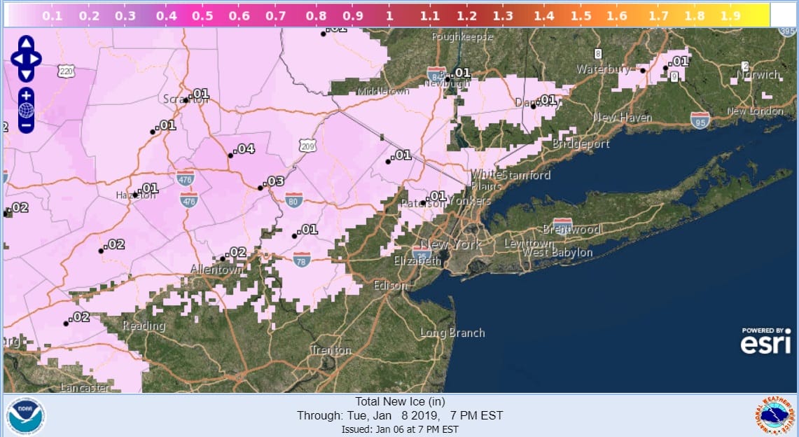
The map above shows the icing forecast which matches up pretty well with where we will see some mix precipitation out of this. Snow amounts could reach a coating to an inch in some places but this map is a good indication of where the highest risks for slick spots are located overnight Monday into daybreak Tuesday.
Another system approaches on Tuesday and we will be in the 40s. When the front passes we could see a few rain showers Tuesday evening. Then colder air from Canada begins to arrive and takes us through the rest of the week and into the weekend. While there is going to be a weather system to the south next weekend, right now it seems that it will stay south of us and remain weak. We will focus on that system next after this weak system moves through.
MANY THANKS TO TROPICAL TIDBITS FOR THE USE OF MAPS
Please note that with regards to any tropical storms or hurricanes, should a storm be threatening, please consult your local National Weather Service office or your local government officials about what action you should be taking to protect life and property.


