
Cold Night Ahead Below Normal Temperatures Into Wednesday

Weather in 5/Joe & Joe Weather Show Latest Podcast
Cold Night Ahead Below Normal Temperatures Into Wednesday
It was a nice day but a cold day across the area as we had the first of 3 below normal temperature days. We had plenty of sun but temperatures in many areas had a tough time getting out of the 30s. Clouds were around as well as a coastal low off the Carolinas fed in some high level moisture but those clouds are gone now and we are headed for a cold night.
SATELLITE

REGIONAL RADAR

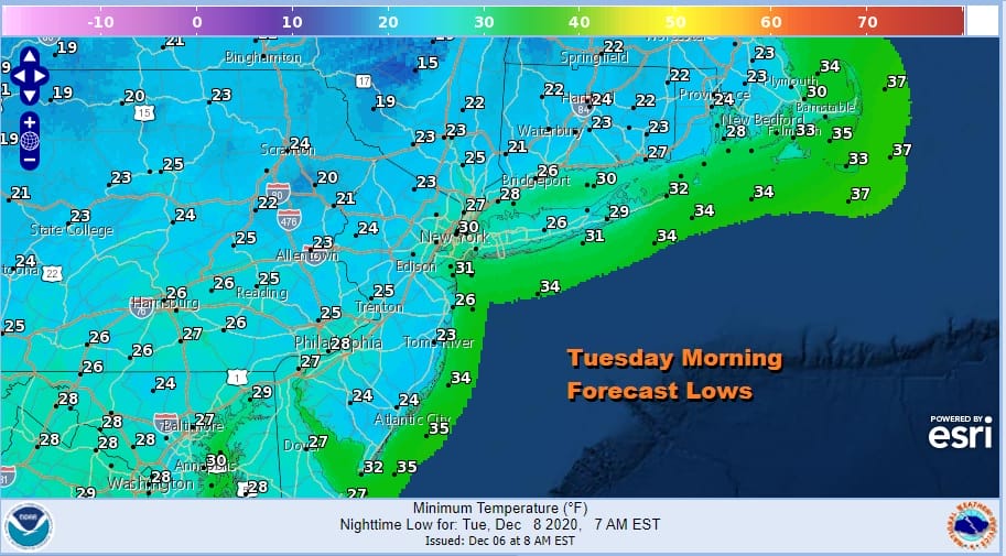
Not much is left on the radar with a few showers in Eastern North Carolina and some echoes left on the local radars. There are no issues tonight. Skies should be clear all night and temperatures will bottom out Tuesday morning in the 20s.
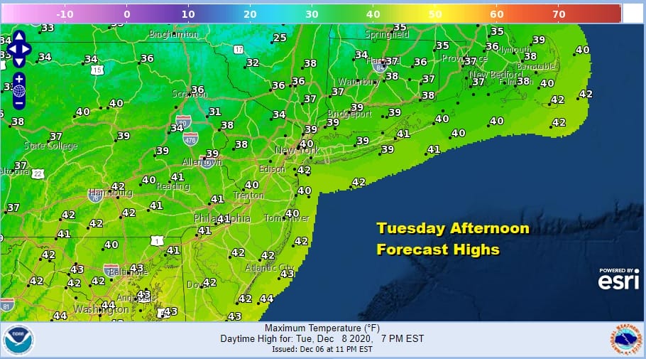
The northwest flow continues on Tuesday so it stays cold again. We should have sunshine with just a few passing clouds. Highs will reach the mid 30s to around 40 degrees.
Tuesday night will be another cold night with lows in the mid 20s to around 30s. Skies will start clear but some clouds will roll in during the early morning hours in advance of last upper air disturbance moving through before the upper trough pulls out and a warm begins.

The disturbance could kick off some snow showers Wednesday morning before it moves away. Some sunshine returns by afternoon and highs will be back into the 40s. The warm up continues into Thursday and Friday with some sunshine for both days. Highs Thursday will be in the 40s to near 50. and Friday’s highs should be in the upper 40s and lower 50s.

Saturday the next cold front approaches as low pressure heads to the Great Lakes and Southern Canada. Look for some showers around on Saturday but not an all day rain. Highs will be in the 50s to near 60 in some places. Some showers will still be around into early Sunday morning but with everything moving along it should improve during the day Sunday as clouds give way to afternoon sun. Some leftover highs will be in the 50s early in the day and then temperatures should settle in the 40s. No major storms are on the horizon at the moment.
BE SURE TO DOWNLOAD THE FREE METEOROLOGIST JOE CIOFFI WEATHER APP &
ANGRY BEN’S FREE WEATHER APP “THE ANGRY WEATHERMAN!
MANY THANKS TO TROPICAL TIDBITS FOR THE USE OF MAPS
Please note that with regards to any severe weather, tropical storms, or hurricanes, should a storm be threatening, please consult your local National Weather Service office or your local government officials about what action you should be taking to protect life and property.


