
Cold Front Passes Chilly Air Follows Rain Develops Late Sunday South To North

Weather in 5/Joe & Joe Weather Show Latest Podcast
The long awaited cold front has finally moved through albeit crawling offshore. It won’t adventure far to the south before it stalls out. It is a matter of timing before clouds take over again and rain begins to move up from south to north on Sunday. In the meantime tonight some drier air should allow for some partial clearing of skies overnight. Lows will be in the upper 30s well inland and in the 40s just about everywhere else. Nothing is on the regional or local radars that poses a problem through Sunday morning.
SATELLITE

REGIONAL RADAR

Sunday will start out with some sunshine but clouds will increase from south to north as the day wears on. A weak area of rain develops to the south along and west of an inverted trough that develops on the coast. It is basically what is left of tonight’s cold front.
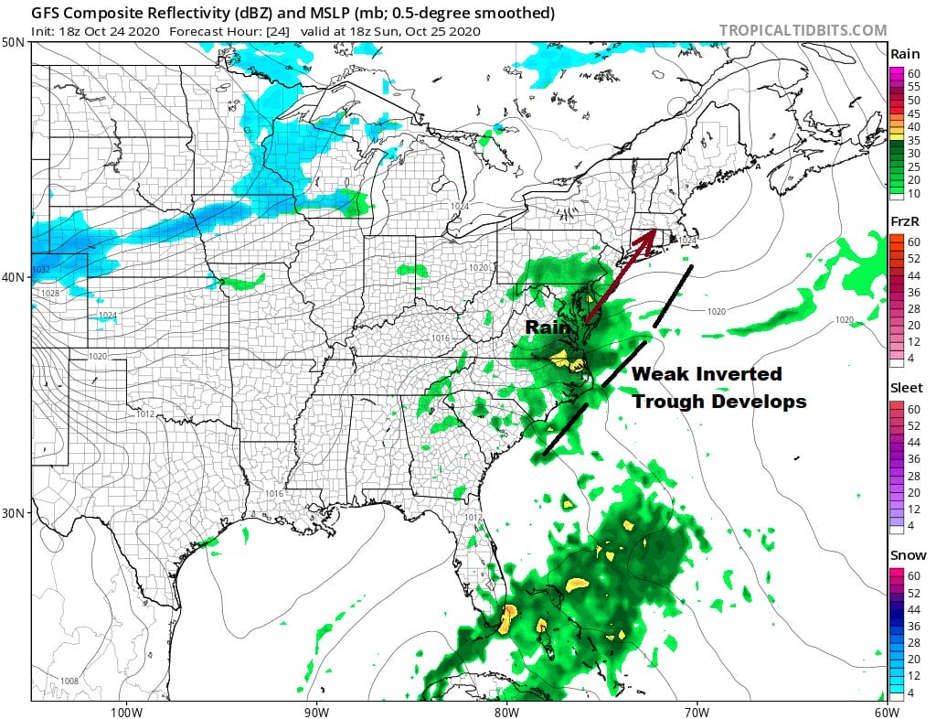
The GFS model seems overdone with the rain area but there will be some patches of rain that will head into Southern New Jersey and Southern Pennsylvania by mid afternoon Sunday and some of that will reach NYC & points north and northeast Sunday evening. It will be a chilly day Sunday with highs just in the 50s. Areas to the south where clouds and rain arrive earlier may not get out of the 40s.

Next week looks like it could be another gloom and doom kind of weak. Another front approaches and stalls just to the east and south late Monday and Monday night. While Monday likely will see little if any rain it will be a cloudy day with highs in the 60s.

A couple of weak ripples move along the frontal boundary opening the possibility of some passing showers or patchy rain Tuesday and again overnight into Wednesday. A more important scenario looks to set up for late week.
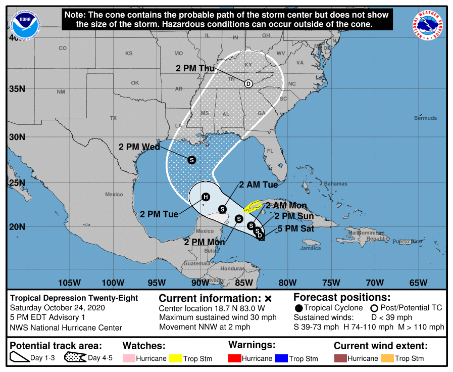
Part of the late week equation involves new Tropical Depression 28 in the Northwest Caribbean. If it develops into a tropical storm it will be named Zeta and it will tie the 2005 record for most named storms in a season and it will beat that record by 2 full months! This set up will be loaded with tropical moisture that will surge into the Southeast US and head northward up the east coast as the Gfs and other models show.
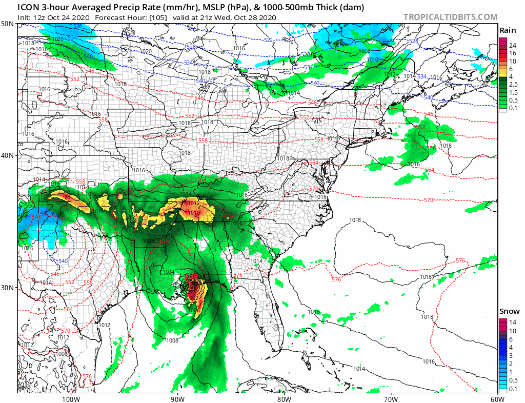
Above is another look via the icon model which along with the GFS brings some cold air into the mix late in the game. This is one of those situations where models love to bring cold air in only to have that cold air be less important come game time so we won’t address this possibility at the moment give it is 6 to 7 days from now.
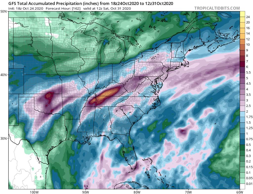
Rainfall amounts from the GFS this week are quite bullish but will depend on the outcome of the tropical system and how much of this moisture gets involved in the non tropical lows that develop in this scheme. Even if you cut these amounts in half it still says many areas from Eastern Pennsylvania to Southern New England could see a couple of inches of rain total. A shot of cold air follows next weekend for a couple days as we begin the month of November and go back to standard time.
BE SURE TO DOWNLOAD THE FREE METEOROLOGIST JOE CIOFFI WEATHER APP &
ANGRY BEN’S FREE WEATHER APP “THE ANGRY WEATHERMAN!
MANY THANKS TO TROPICAL TIDBITS FOR THE USE OF MAPS
Please note that with regards to any severe weather, tropical storms, or hurricanes, should a storm be threatening, please consult your local National Weather Service office or your local government officials about what action you should be taking to protect life and property.


