Cold Abates Friday Snow Chance Weekend
Cold Abates Friday Snow Chance Weekend
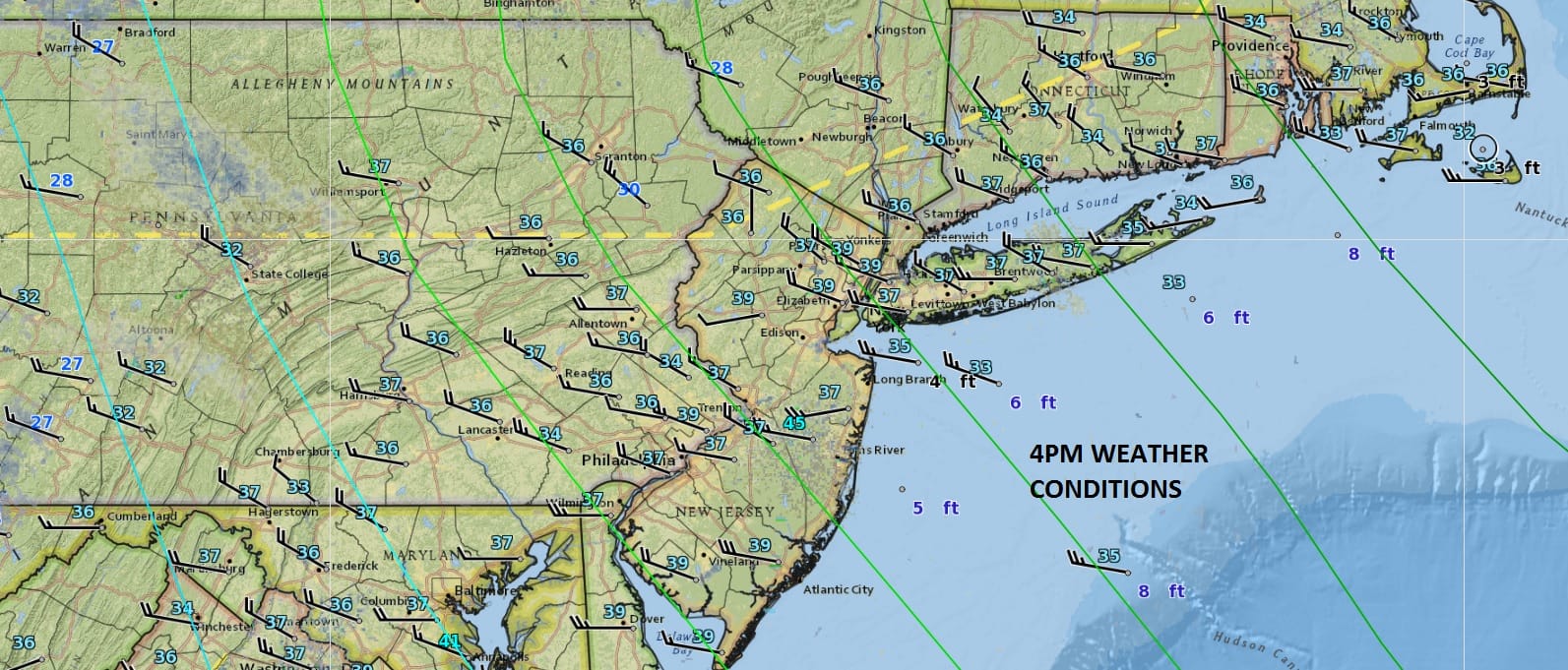
It feels a little better this afternoon as we have plenty of sunshine along the coast but there are some clouds to the northwest limiting the sun. Radars at least are quiet for the most part. Temperatures this afternoon have gotten above freezing by a few degrees which is certainly welcome. We should be close to or even over 50 this time of year but that isn’t happening until maybe next Monday. But we have a road to travel getting there and that does involve another chance for snow this weekend.
SATELLITE LOOP

REGIONAL RADAR

Skies will be clear tonight and temperatures once again will head down into the teens and low 20s. Friday we should see plenty of sunshine before clouds come in late in the day. Highs will be in the upper 30s and lower 40s which combined with the strong March sun should begin to eat away at the deep snow cover in areas inland of the coast and melt the snow and ice right along some coastal areas.
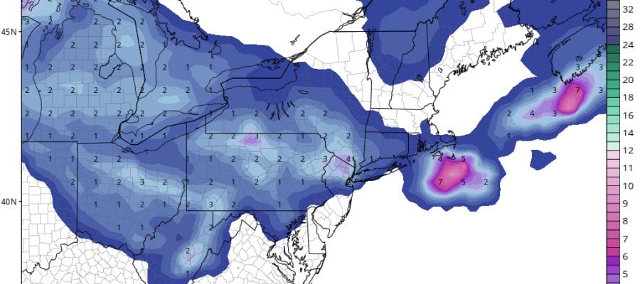
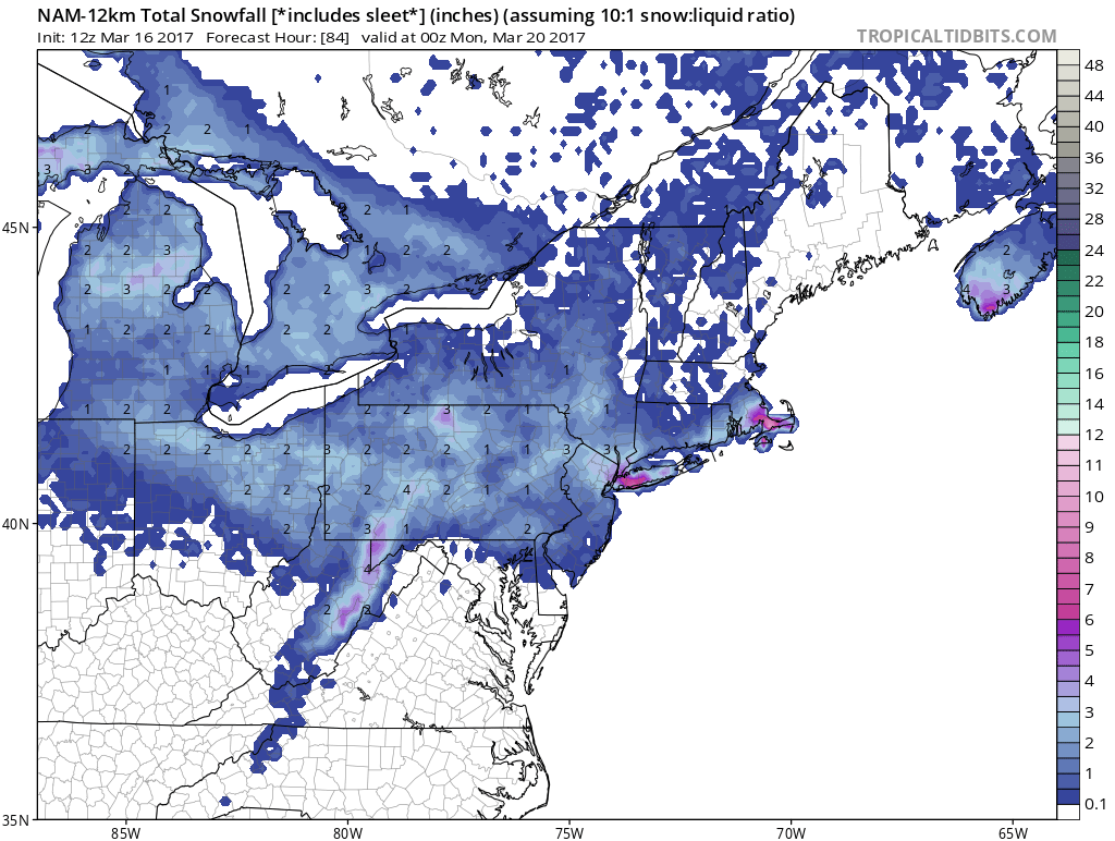
GFS SNOW FORECAST MAP FOR THE WEEKEND
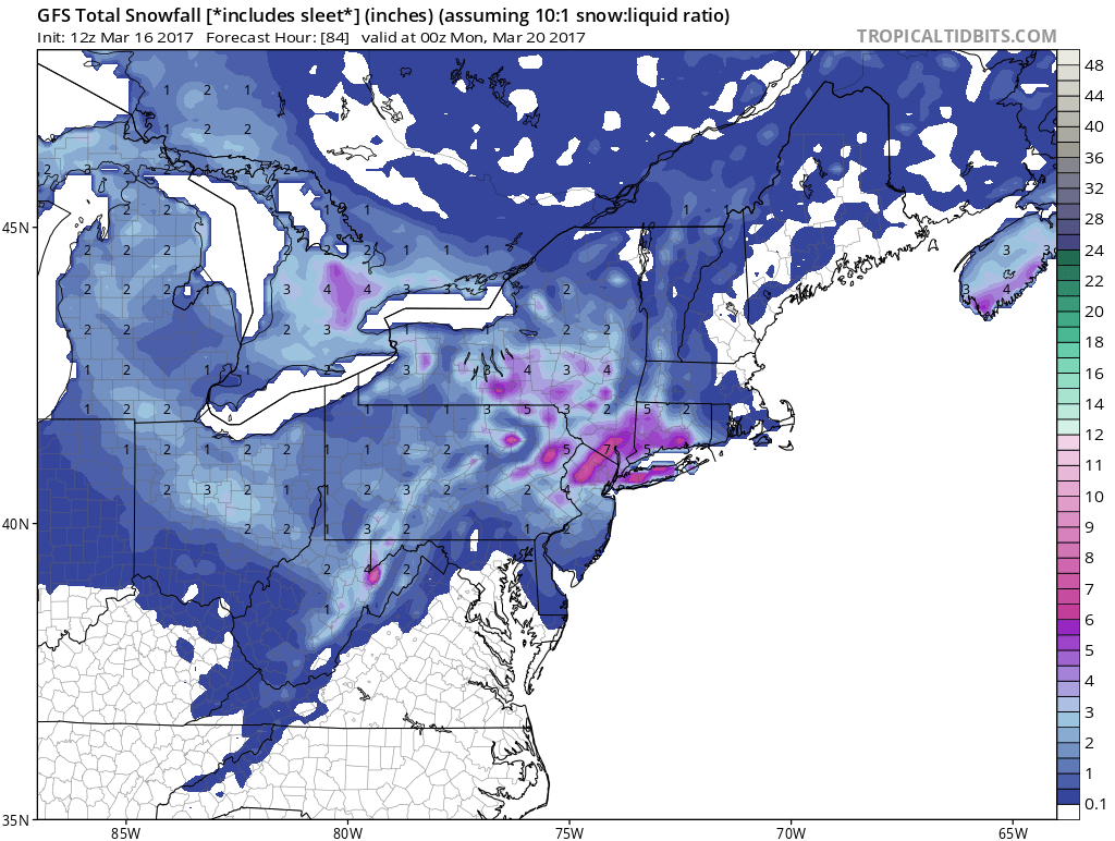
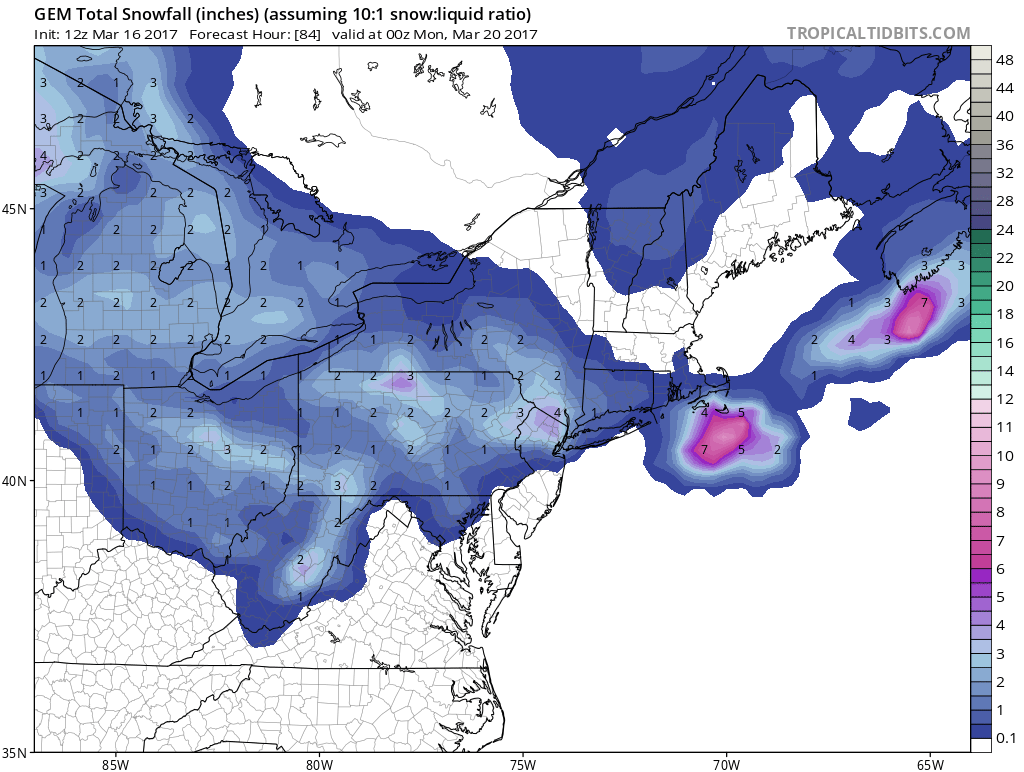
The forecast issue is the weekend. We will have marginal cold air and a low dropping down from the Great Lakes and reforming off the coast. There are two issues here. First is that this is not like what we just went through in terms of the setup. There is no southern feature here so it will all be in the north. Weather models are all over the place with this. It would seem that along the coast on Saturday we will have some light rain and wet snow that won’t amount to much. Then late in the day as the low develops offshore it starts to throw moisture back westward. Colder air will get involved and this means some wet snow. The second issue is that models are all over the place with this. We have the bullish GFS which would suggest a 4 to 6 inch snowfall is possible to the more benign NAM model which has a few inches in some places with a little more on Long Island, to the Canadian which has a coating to a few inches or so to the European which has basically a coating to a couple of inches. It is hard at this point to accept the bullish GFS model at this point. The NAM has worked and offers a good compromise forecast for the moment.
CANADIAN MODEL SNOW FORECAST
NAM MODEL SNOW FORECAST
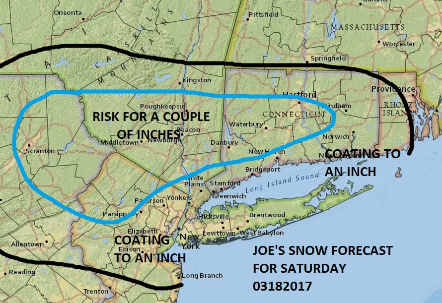
For now at least based on what we are dealing with, I’m going to just leave things as they are forecast wise. With models showing such a wide disparity in terms of development it makes sense to just leave things alone at the moment. Let’s just say it could be a coating to a few inches for somebody with the best chances across Northern New Jersey, Southern areas of the Hudson Valley..Connecticut south of route 84 down to the coast including Long Island. The risk for Long Island is some additional snow Saturday night with some coastal development but this too is uncertain at this point. For now now changes as we have plenty of time to watch this. My earlier call would look more like the Canadian and European models and less like the NAM and GFS model
 GET JOE A CIGAR IF YOU LIKE

SNOW REMOVAL COMPANIES FOR YOUR WINTER NEEDS
LONG ISLAND ROCKLAND COUNTY Connecticut

![]()

ROCKLAND COUNTY TRI STATE SNOW REMOVAL JOHNSTOWN PA


FiOS1 News Weather Forecast For Long Island
FiOS1 News Weather Forecast For New Jersey
FiOS1 News Weather Forecast For Hudson Valley
NATIONAL WEATHER SERVICE SNOW FORECASTS
LATEST JOESTRADAMUS ON THE LONG RANGE
Weather App

Don’t be without Meteorologist Joe Cioffi’s weather app. It is really a meteorologist app because you get my forecasts and my analysis and not some automated computer generated forecast based on the GFS model. This is why your app forecast changes every 6 hours. It is model driven with no human input at all. It gives you an icon, a temperature and no insight whatsoever.
It is a complete weather app to suit your forecast needs. All the weather information you need is right on your phone. Android or I-phone, use it to keep track of all the latest weather information and forecasts. This weather app is also free of advertising so you don’t have to worry about security issues with your device. An accurate forecast and no worries that your device is being compromised.
Use it in conjunction with my website and my facebook and twitter and you have complete weather coverage of all the latest weather and the long range outlook. The website has been redone and upgraded. Its easy to use and everything is archived so you can see how well Joe does or doesn’t do when it comes to forecasts and outlooks.
Just click on the google play button or the apple store button on the sidebar for my app which is on My Weather Concierge. Download the app for free. Subscribe to my forecasts on an ad free environment for just 99 cents a month.
Get my forecasts in the palm of your hand for less than the cost of a cup of Joe!


