Snow Forecasts National Weather Service 03162017
After a 1 to 2 foot snow storm for areas just inland of the coast, a few inches isn’t going to make a difference though it is going to be annoying to have to go out and clean up again. For now I’m leaving forecasts alone based on overall model views. I want to wait for more data later today. The situation is a bit different this time around as we have a weaker system and a bit of a different set up. Also as cold as it is, it may start as rain in some places at the beginning. My map from last night is below and it remains the same for now. The National Weather Service snow forecast maps are below and can serve as a comparison. Right now we are pretty close with our view but this might be a situation where the coast could wind up with more depending on how cold the atmosphere is.
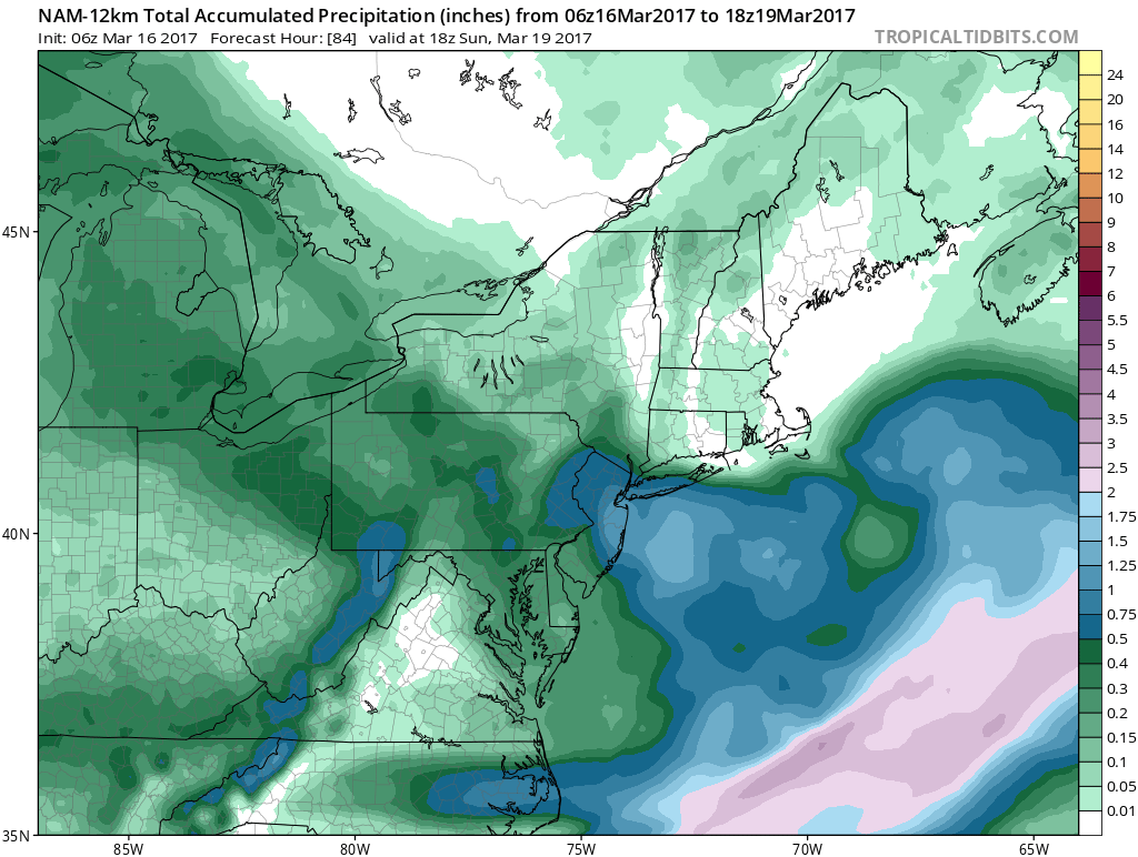
NAM MODE FORECAST SATURDAY INTO SUNDAY MORNING CLICK TO ANIMATE
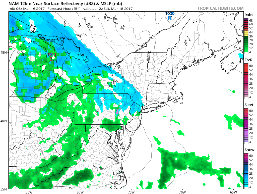
The NAM model above which you can click to animate shows a tight low developing just to our south and throwing moisture back into the cold air. The high to the north is key which will be bleeding cold air southward over very deep snow cover. Right now the weather is fine into early Saturday morning. The time frame for this is later Saturday and Saturday night. Most of what falls from this will fall Saturday night so if it is cold enough it will stick.
At the moment I think the biggest risk in this map is that I may have to shift that risk of a couple of inches further south to include NYC and Long Island and Northeastern New Jersey. We will address this later today.
JOE’S SNOW FORECAST MAP FOR SATURDAY AND SATURDAY NIGHT
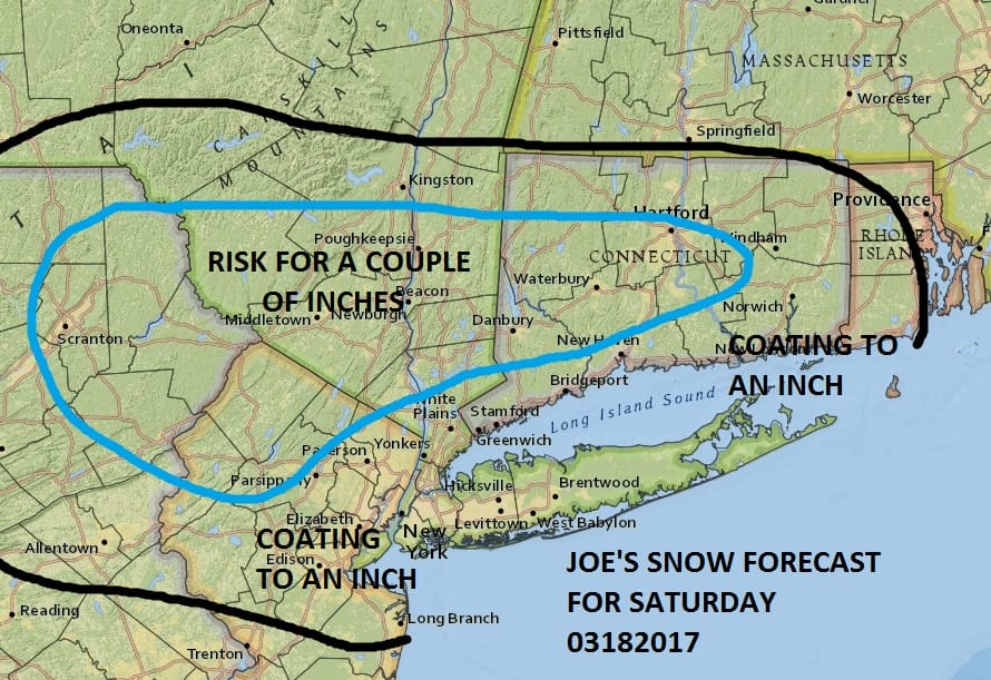

GET JOE A CIGAR IF YOU LIKE


This morning we are seeing more sunshine and very little in the way of cloud cover. Also we are not seeing any snow showers and snow squalls like we saw yesterday. The storm has now moved far enough north so that the atmosphere is stabilizing. We should see a fair amount of sunshine and we should see temperatures today break above freezing in most areas though it might be a bit of a struggle where there is deep snow cover. It will be another clear very cold night tonight and Friday will be nice and sunny most of the day with highs in the mid to upper 30s. Some 40 degree highs are possible in some areas.
Precipitation from the next weather system begins during Saturday and the bulk will fall late Saturday into Saturday night so that is the critical time frame and what will also be critical is how cold the atmosphere will be. Weather models are generous with total precipitation giving 3/4 inch to an inch of liquid so if it is cold enough, amounts may need to be raised.
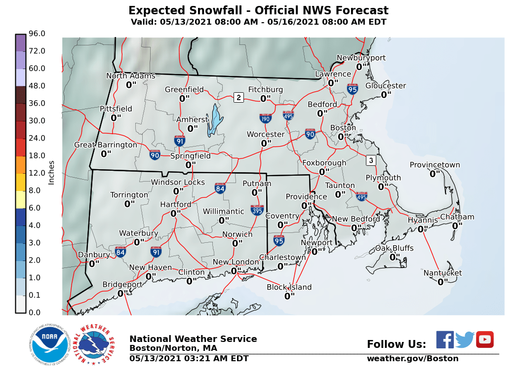
The maps below are the National Weather Service forecast snow maps with the most likely snowfall prediction.