Coastal Storm Threat Next Week Continues

MENTION JOE CIOFFI AND GET A 5% DISCOUNT
Coastal Storm Threat Next Week Continues
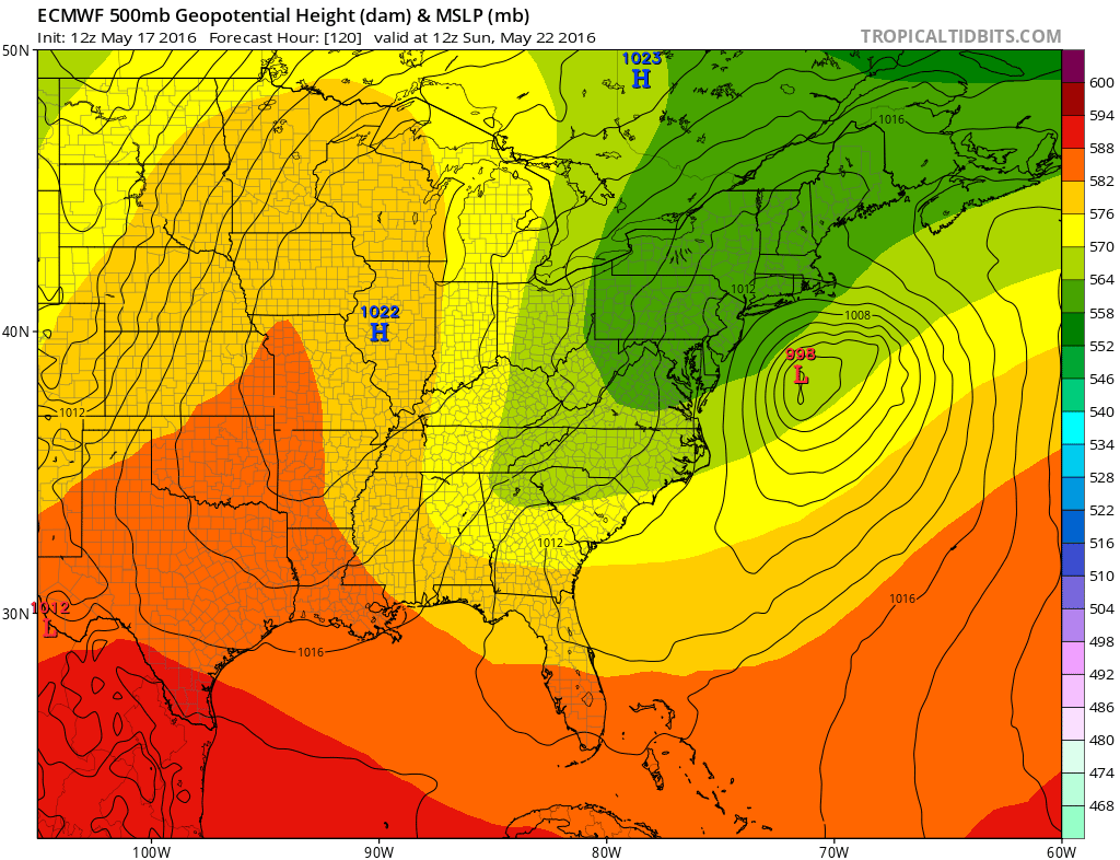
Latest afternoon model runs continue with the same idea indicated yesterday of a strong upper air “cut off” low developing along the east coast. Weather models actually take a fairly impressive surface system around the base of the cut off and riding it northward up the coast and then northwestward into Long Island by Tuesday. It is becoming hard to ignore this idea. The Euro model is the most aggressive with the surface low development but I would caution that this model lately has done this several times in the last month and in each case it was very much overdone. Nonetheless it seems to me that the possibility of some sort of gale center developing in the ocean and moving northward and then northwestward seems a reasonable possibility. Remember that we will be coming off a full moon and several days of an onshore flow so this could have coastal flooding implications.
Coastal Storm Threat Next Week Continues
GFS EURO MODEL UPPER AIR MONDAY
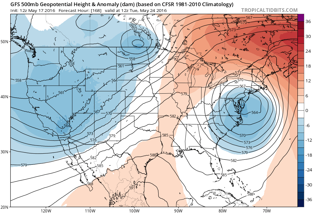

Both the Euro Model and the GFS model line up very well. Now this is going to be the second of 2 events. The first will be Saturday into Sunday morning as a lead wave develops and moves away to the northeast. This will bring some rain later Saturday into Sunday morning. The Euro model is a little further south with the first wave.
Coastal Storm Threat Next Week Continues
GFS EURO MODEL SURFACE SUNDAY MORNING
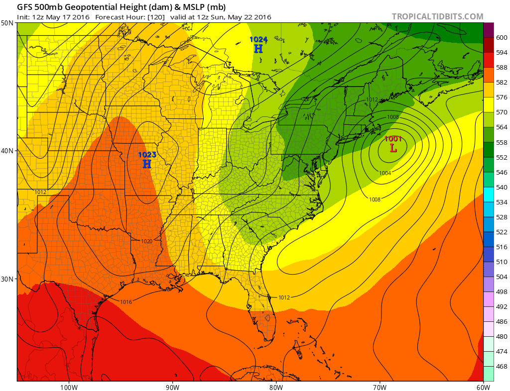
 Once this wave goes by an onshore flow will remain which will keep us rather moist and probably overcast through Monday when the upper air storm swings to the coast and the surface low develops and heads northward.
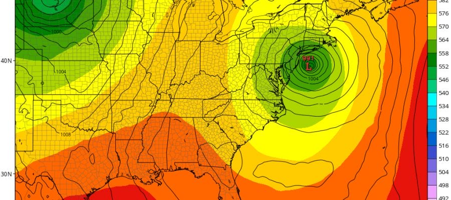
Coastal Storm Threat Next Week Continues
GFS EURO MODEL SURFACE TUESDAY MORNING
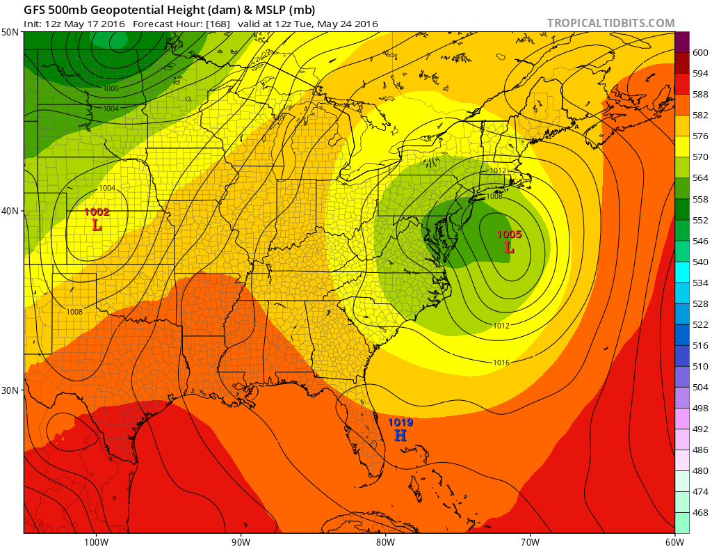
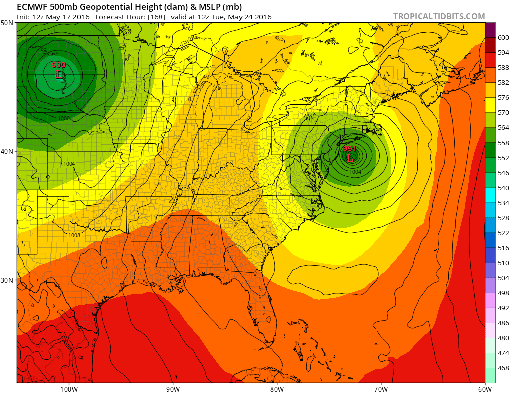
Again the European model at this point looks overdeveloped for Tuesday. I would want to wait several runs to see some confirmation of this as this model shows a very wrapped up gale center here. The weaker surface GFS would still mean gusty winds and some heavy rains moving inland from the ocean.
In the meantime the weather looks dry and under control from midday Wednesday through Friday with just some cloud issues. Stay tuned folks!
FiOS1 News Weather Forecast For Long Island
FiOS1 News Weather Forecast For New Jersey
FiOS1 News Weather Forecast For Hudson Valley
NATIONAL WEATHER SERVICE SNOW FORECASTS
LATEST JOESTRADAMUS ON THE LONG RANGE

NOMINATED FOR AN APPY AWARD FOR BEST WEATHER APP!!
Weather App

Don’t be without Meteorologist Joe Cioffi’s weather app. It is really a meteorologist app because you get my forecasts and my analysis and not some automated computer generated forecast based on the GFS model. This is why your app forecast changes every 6 hours. It is model driven with no human input at all. It gives you an icon, a temperature and no insight whatsoever.
It is a complete weather app to suit your forecast needs. All the weather information you need is right on your phone. Android or I-phone, use it to keep track of all the latest weather information and forecasts. This weather app is also free of advertising so you don’t have to worry about security issues with your device. An accurate forecast and no worries that your device is being compromised.
Use it in conjunction with my website and my facebook and twitter and you have complete weather coverage of all the latest weather and the long range outlook. The website has been redone and upgraded. Its easy to use and everything is archived so you can see how well Joe does or doesn’t do when it comes to forecasts and outlooks.
Just click on the google play button or the apple store button on the sidebar for my app which is on My Weather Concierge. Download the app for free. Subscribe to my forecasts on an ad free environment for just 99 cents a month.
Get my forecasts in the palm of your hand for less than the cost of a cup of Joe!
![]()

