Cloudy Nights And Morning Partly Sunny Afternoons Next Few Days

Weather in 5/Joe & Joe Weather Show Latest Podcast
Cloudy Nights And Morning Partly Sunny Afternoons Next Few Days
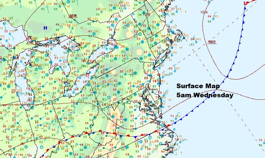
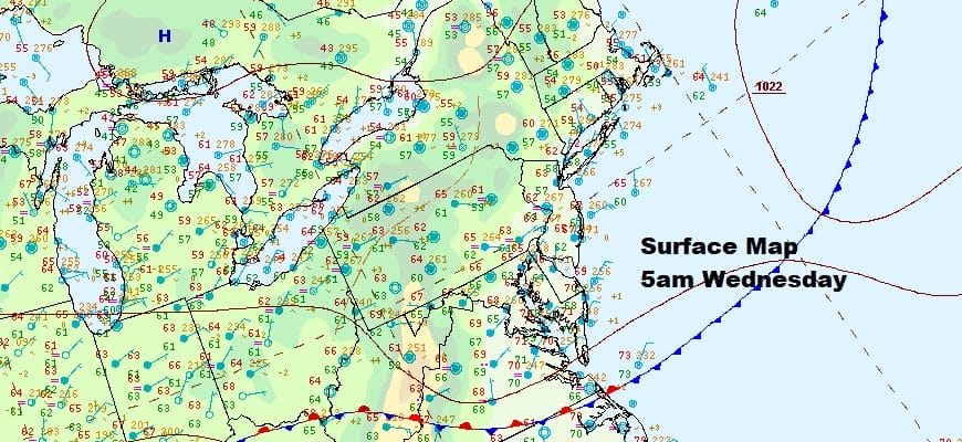
An upper ridge in the Eastern US is going to create somewhat stagnant conditions as far as the surface air mass is concerned. This is typical of this time of year where the longer October nights and a light onshore flow from off the ocean brings low clouds in at night and into the morning hours only to burn off to partly sunny skies as the day wears on. Some places will see their clouds burn off faster than others. The cold front that came through Monday is now stalled out in Southern Virginia and it will be sitting there for the rest of the week.
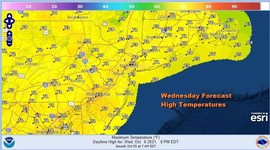
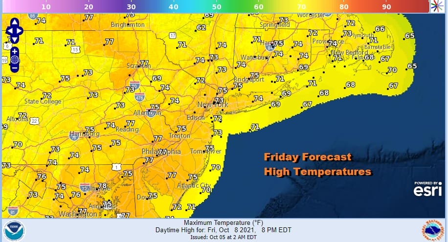
As far as temperatures are concerned we will be running a little above average here with most highs reaching the lower 70s with upper 60s right along the immediate coast. The one thing we don’t need to worry about is precipitation. Other than spotty overnight drizzle or mist we will be rain free for the rest of the week. The radars are quiet in the Northeast and Northern Mid Atlantic today.
SATELLITE

WEATHER RADAR

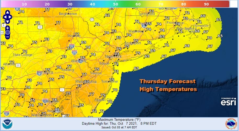
Not much changes over the next few days. The high to the north is going nowhere. The flow from the northeast continues. Thursday could see the sun burn through the morning low clouds the fastest of any day this week. That could take highs up to the low and middle 70s everywhere under developing partly sunny skies. Friday should be about the same.
Over the weekend the high to the north slides a little to the east into the Canadian Maritime Provinces and that will turn the wind a bit more to the east. This will likely result in nighttime and morning low clouds with some fog and drizzle. The burn off process for the weekend days will require more work and sunshine could be limited. However no widespread rain is forecast through Monday Columbus Day. Weekend highs will be in the upper 60s and lower 70s and nighttime lows will be in the 50s except lower 60s in warmer urban areas and along the coast.
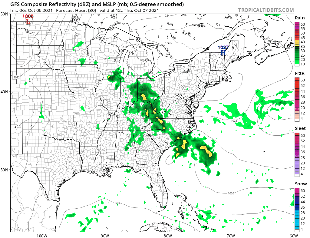
The easterly flow will be helped by low pressure developing off the North Carolina coast. It is a weak system and shows no signs of becoming tropical given hostile upper air conditions but it does enhance the moisture flow from off the ocean. We will likely be stuck in this pattern for much if not all of next week and no real air mass change will come until late next week or next weekend.
BE SURE TO DOWNLOAD THE FREE METEOROLOGIST JOE CIOFFI WEATHER APP &
ANGRY BEN’S FREE WEATHER APP “THE ANGRY WEATHERMAN!

MANY THANKS TO TROPICAL TIDBITS & F5 WEATHER FOR THE USE OF MAPS
Please note that with regards to any severe weather, tropical storms, or hurricanes, should a storm be threatening, please consult your local National Weather Service office or your local government officials about what action you should be taking to protect life and property.


