Onshore Flow Show Begins Clouds Today But Improvement Wednesday Thursday

Weather in 5/Joe & Joe Weather Show Latest Podcast
Onshore Flow Show Begins Clouds Today But Improvement Wednesday Thursday
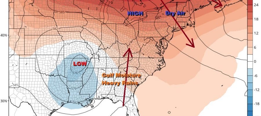
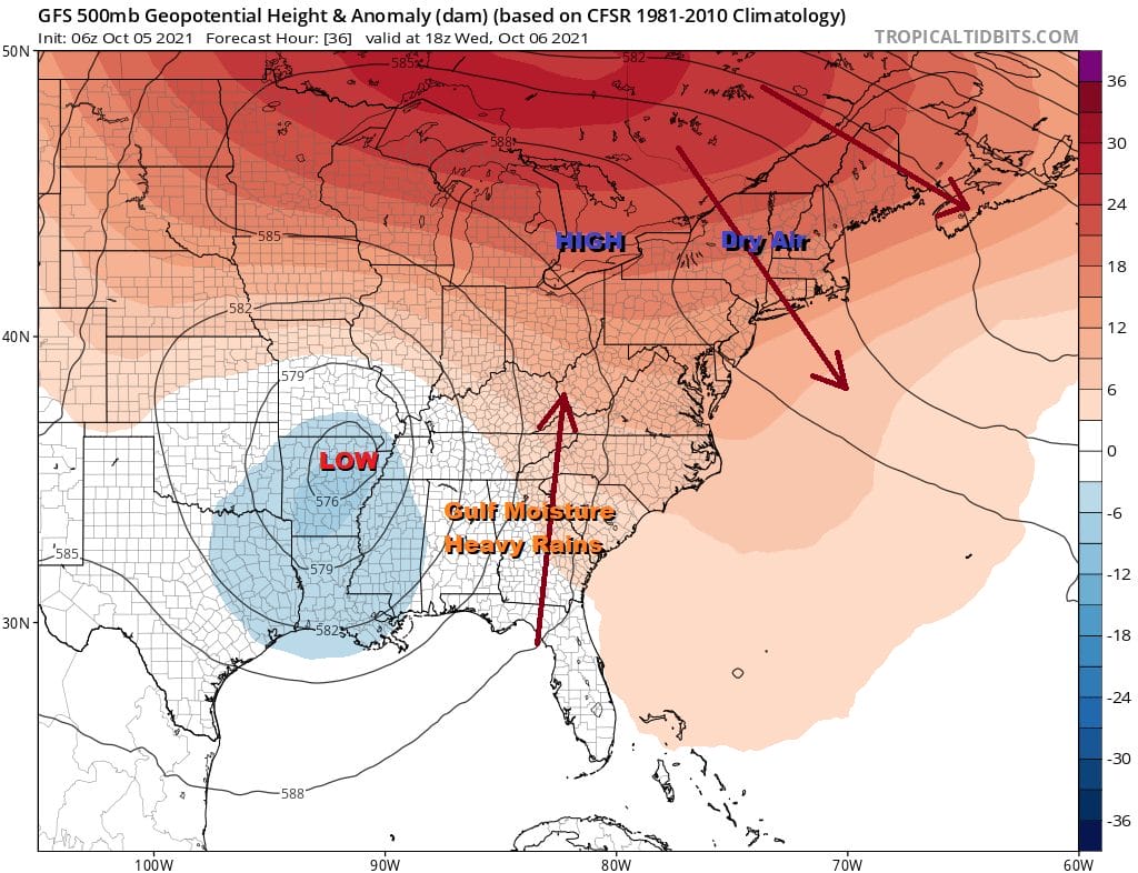
Yesterday we described our weather for the week ahead as the Onshore Flow Show and the curtain rises today on this pattern that will last through the weekend and into next week. The main issue will be how much dry air to our north in Southeastern Canada can drain southward. It seems given that the Northeast is under a northwest flow aloft, it should be successful in getting rid of at least some of the cloud cover as the week progresses.
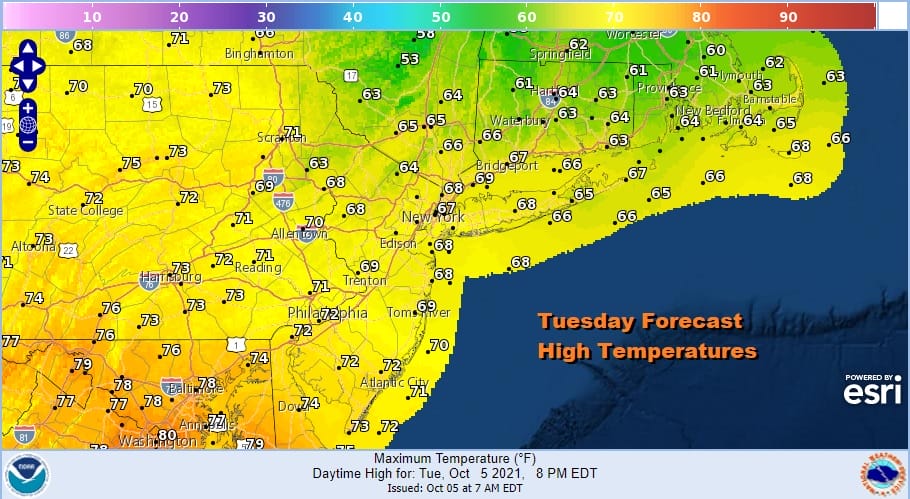
We still however, have to get through today with leftover clouds around and there could still be another scattered shower or two in the mix. Most of the area won’t see much if anything shower wise. Highs today will range from the upper 60s from NYC and Northern New Jersey north and east to low and even middle 70S for highs over Southern New Jersey, Southern Pennsylvania and points southward until the wind shifts to the northeast.
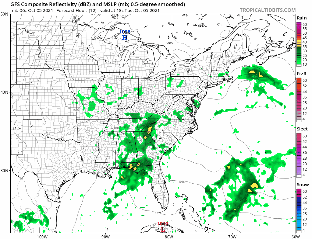
Some places saw rain overnight but the satellite and radars show that rain is now offshore and to the west there isn’t much going on shower wise. The front is stalling out across Southern New Jersey and Southern Pennsylvania and will push a little further south tonight and Wednesday.
SATELLITE

WEATHER RADAR

We should see skies at least partially clear out tonight especially inland and that leads us to Wednesday where skies should be partly sunny over most of the area. The onshore flow might lead to some residual early morning clouds but the sun should burn off. As long as the wind remains northeast we should be able to hold on to partly sunny conditions at least through Thursday. High temperatures will be in the low to mid 70s both days except 60s at the shore and nights will be in the 50s except for warmer urban areas and the coast where lows will be closer to 60.
The outlook becomes a little more obscure at the end of the week with the high to the northeast and the onshore flow continuing This is a pattern that leads to clouds developing at night and then watching them slowly burn off during the day. Also the wind will become more east and southeast over the weekend that puts us in cloud issues. Also we could see a shower or two over the weekend along with some coastal drizzle moving inland at times. The heavy rains falling in the Central and Southern Appalachians will move northwest rather than north or northeast so widespread rain is not happening here anytime soon. So the onshore flow show continues over the weekend and into next week. It will get doomy and gloomy at times because of the cloud cover but at least rain changes will be minimal. Temperatures by day will likely be in a range of upper 60s and lower 70s and nights in the 50s to lower 60s Friday and through the weekend.
BE SURE TO DOWNLOAD THE FREE METEOROLOGIST JOE CIOFFI WEATHER APP &
ANGRY BEN’S FREE WEATHER APP “THE ANGRY WEATHERMAN!

MANY THANKS TO TROPICAL TIDBITS & F5 WEATHER FOR THE USE OF MAPS
Please note that with regards to any severe weather, tropical storms, or hurricanes, should a storm be threatening, please consult your local National Weather Service office or your local government officials about what action you should be taking to protect life and property.


