Quiet Autumn Weather Continues, Clouds Issues For the Weekend
No Major Storms Long Range

Weather in 5/Joe & Joe Weather Show Latest Podcast
Quiet Autumn Weather Continues, Clouds Issues For the Weekend No Major Storms Long Range
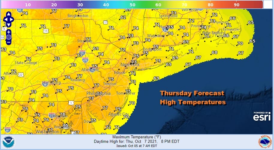
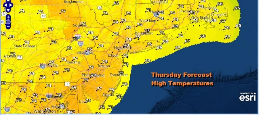
We have gotten it bit of help from high pressure in Northern New England. It has built far enough south to allow for some dry air to move and we have on the whole a partly sunny day underway. There are some clouds over parts of Pennsylvania and points southward thanks to tropical moisture in the Southeast. Some of that moisture has pushed northward but not enough to produce any shower issues. The radars are quiet and will remain so probably through Saturday. Thanks to the sun, we are seeing highs reaching into the low and middle 70s.
SATELLITE

WEATHER RADAR

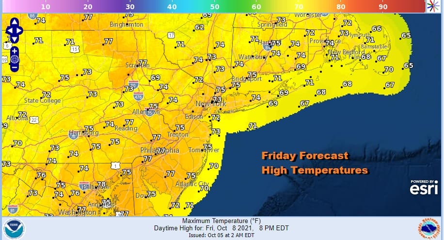
Thanks to high pressure aloft, the air upstairs is dry but that onshore flow and the long nights will bring in clouds tonight with lows in the upper 50s and lower 60s. Those clouds should burn off on Friday so we should see partly sunny skies developing. Friday’s highs will be in the low to middle 70s.
The onshore flow continues over the weekend however the wind direction will turn more to the east rather than the northeast. This creates a moist flow from off the ocean that is stronger than a northeast flow. Low pressure is off the North Carolina coast. That isn’t moving northward. However it will mean additional cloud cover on Saturday and the sun will not be able to burn off those low clouds. That leaves us in a place with lots of clouds though no showers are forecast. Highs will be in the 60s to around 70 or so.

The low to the south is not forecast to become tropical. It will interact with that high to the northeast Sunday to produce cloudy skies and we will throw in the chance for a few scattered showers. Highs Sunday will be in the 60s to near 70. This is not going to be a widespread rain but there could be some patchy drizzle around as well. The onshore flow continues on Monday Columbus Day as the low drifts southwestward and weakens. There still will be clouds around on Monday though we are not putting any showers in the forecast for Columbus Day. Highs Monday will be in the upper 60s to lower 70s. The onshore flow relaxes as we move into next week and a storm comes out of the Rockies and heads into the Western Plains. That should get air masses moving again eventually it we could see sunshine and warm temperatures for the middle of next week. The next cold front probably arrives late next week or early next weekend with a cooler air mass behind it.
BE SURE TO DOWNLOAD THE FREE METEOROLOGIST JOE CIOFFI WEATHER APP &
ANGRY BEN’S FREE WEATHER APP “THE ANGRY WEATHERMAN!

MANY THANKS TO TROPICAL TIDBITS & F5 WEATHER FOR THE USE OF MAPS
Please note that with regards to any severe weather, tropical storms, or hurricanes, should a storm be threatening, please consult your local National Weather Service office or your local government officials about what action you should be taking to protect life and property.


