Clouds Sunday Showers Monday Coastal Storm Onshore Flow Tuesday Through Friday
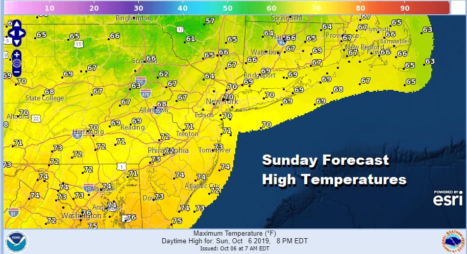
The chilly high and the chilly beautiful Saturday is now giving way to the next cold front and a south south west wind. Clouds have rolled in and they will be with us for the rest of today and into Monday. There could be a few breaks of sun in the mix but clouds will dominate and there is the outside chance for an odd passing brief shower. For 99 percent of you, there won’t be any shower to worry about. Temperatures today will reach the upper 60s and lower 70s.
SATELLITE

REGIONAL RADAR

The air over us is still relatively dry. We are seeing some showers on the regional and local radars that are light, mostly aloft, and very widely scattered. They may show up from time to time on the local radars today but they should not be problematic.
LOCAL RADAR NEW YORK CITY

LOCAL RADAR PHILADELPHIA


Monday brings the next cold front to the coast. It will be a warm and humid day with highs in the mid to upper 70s. Some showers are likely late in the day into Monday night. Then we set the table for some issues for Tuesday through Friday of this coming week. The earlier view was that high pressure in New England would dominate the scene up and down the East Coast with nice weather all week. Now it seems likely that we will be on the other side of that equation.

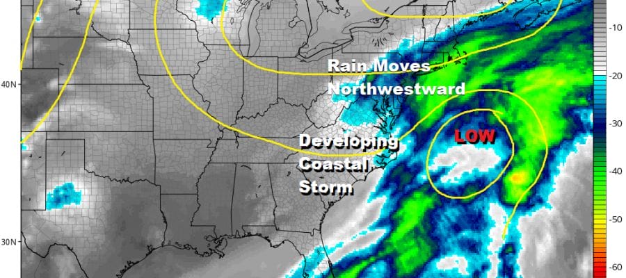
The front is going to stall out just to our south and east Tuesday. Low pressure off the Southeast coast will be moving up the East Coast and will essentially be trapped somewhere between the coast and 70 degrees west as the upper flow collapses. Rain will be backing northwestward from this developing low East of the North Carolina/Southern Virginia coast.
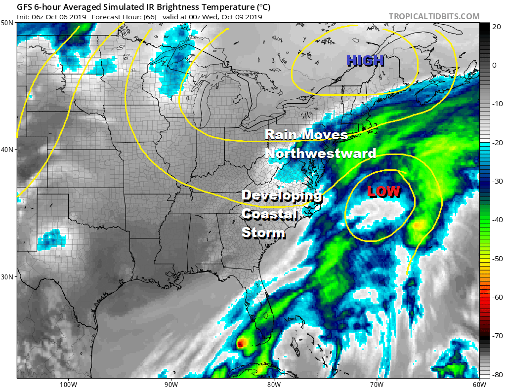
This is going to be week of trying to time areas of rain backing northwestward from the coast and how far inland does the rain get. The first batch will come in on Tuesday from the ocean and pushing inland. Temperatures Tuesday will be just in the 60s.
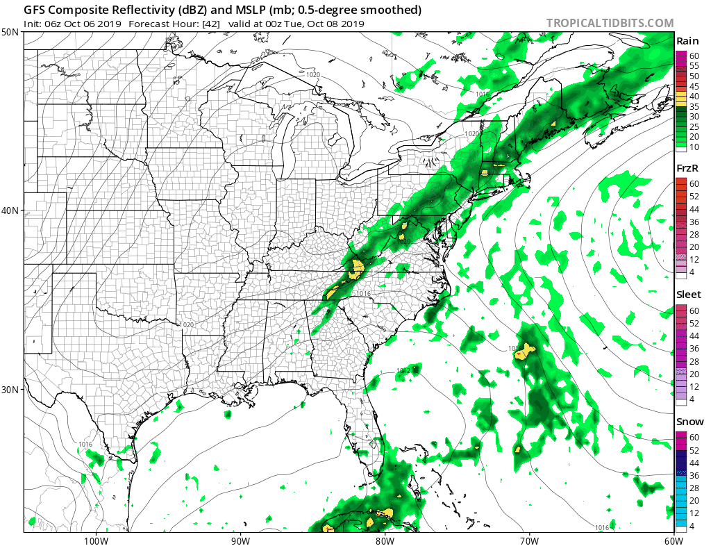
Where the rain doesn’t reach further inland clouds will and we will be dealing with this until the system in the Northern Plains moves far enough east to kick this system out to sea and that won’t happen until late this coming week or the weekend. This could make it a rather cloudy dismal week of weather.
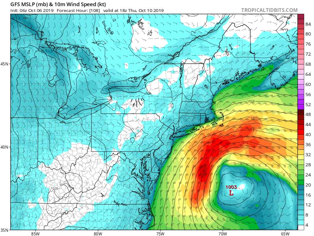
Two issues to consider here for the coast is the tightening pressure gradient and how close gale force winds reach the coast. Certainly gusts are possible if the low center comes close enough to the northwest. The other issue is a bit of a longer shot possibility but the National Hurricane Center is mentioning the chance for subtropical storm development here late this week and given the low will be sitting over ocean water still close to 80 degrees and near the Gulf Stream this is not an impossible scenario.
MANY THANKS TO TROPICAL TIDBITS FOR THE USE OF MAPS
Please note that with regards to any severe weather, tropical storms, or hurricanes, should a storm be threatening, please consult your local National Weather Service office or your local government officials about what action you should be taking to protect life and property.


