Clouds Next Cold Front Approaches Week Ahead Weather Questions Remain
It was a beautiful cool autumn day from start to finish. Skies are clear for now which is allowing for radiational cooling is occurring away from the warmer urban centers. Inland areas are in the 40s as well as areas on Long Island with even a few 30s showing up. However we are not expecting any frost issues tonight as clouds will be coming in. They are starting to show up on the satellite pictures to our west and south. Winds are going to be going around to the south and those two features will be cutting off any additional cooling. Temperatures will eventually settle in the 40s to lower 50s.
SATELLITE

REGIONAL RADAR

Sunday is going to be a warmer day than today but there will be more clouds around with some breaks of sun in the mix with highs reaching the upper 60s and lower 70s (depending on how much sun breaks through). There is a very small chance for a passing late afternoon or nighttime light shower as the atmosphere warms however the vast majority of you won’t see anything. Enjoy the second half of the weekend.

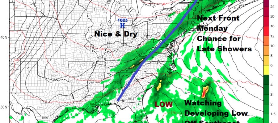
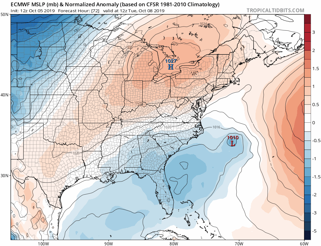
Here comes the next front for Monday and it will be warmer and more humid ahead of it. Some showers will come through late in the day and Monday night. This is a quarter to a half inch rain producer. The earlier view was that the front will move offshore. Models have been showing a low developing off the Southeast coast and heading well out offshore to the northeast. We would have a big high building in New England and the weather this week would nice cool & seasonal.

The northern part of the jet stream brings the cold front through while the southern shortwave energizes a coastal low off the Southeast US coast. The GFS model energizes this shortwave and lifts it northeastward to off the Middle Atlantic coast. The GFS has it tucked in close to the coast bringing rain here and the GFS has a long duration event lasting several days.

However the GFS has a strong low moving from the Central Plains to Minnesota which helps to lift the coastal low close to the coast. This differs strongly with the European which is 24 hours slower with that Plains system. This would suppress the Southeast low well to the south and east.
The onshore easterly flow in either case would certainly argue for clouds for mid and late week but as far as rain goes, it is quite possible that rain develops for the Southeast US and then slides south and east of us later this week. Lots of questions and uncertainties are on the table here. We probably will get some clarity about this on Sunday. For now lets call for lingering clouds and maybe some lingering showers Tuesday morning and call for at least clouds for Wednesday and Thursday with highs in the 60s. We will see what models do overnight and on Sunday to see if we need to do additional forecast adjustments.
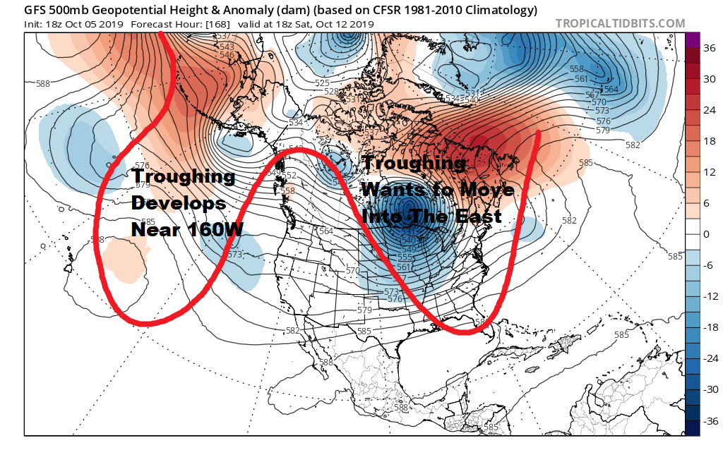
For the longer term there is no doubt that Hurricane Lorenzo has set off a chain reaction weather pattern change. Weather models all see to be centering on the idea of troughing developing along or just of the longitude of Hawaii which favors troughing coming into the Eastern US. The upper high that was dominant in September in the Southern US is totally gone now. This pattern would favor more action with weather systems going forward as well as deliveries of colder than average air masses out of Canada and into the Eastern half of the US over the next couple of weeks at least.
MANY THANKS TO TROPICAL TIDBITS FOR THE USE OF MAPS
Please note that with regards to any severe weather, tropical storms, or hurricanes, should a storm be threatening, please consult your local National Weather Service office or your local government officials about what action you should be taking to protect life and property.