Coastal Subtropical Storm Possible Offshore Later This Week
Before we get to the possibilities for later this week, we are seeing lots of clouds around this afternoon as warmer air moves northward. Temperatures reached the above 70 this afternoon and we are also seeing some scattered showers developing on the regional radar moving northeastward from West Virginia into Pennsylvania. They are headed northeastward but what survives will probably stay well inland and remain scattered in nature.
SATELLITE

REGIONAL RADAR

Some of those scattered showers are showing up on the local Mount Holly radar but not many are showing up on the Upton Radar centered further north and east. For most it remains dry through tonight with cloudy skies. Temperatures overnight will settle in the mid 50s to lower 60s.
LOCAL RADAR NEW YORK CITY

LOCAL RADAR PHILADELPHIA


All remains on schedule for an approaching cold front on Monday which looks to be a warm humid day with highs in the mid to upper 70s. Scattered showers are possible early and then they will become more numerous later in the inland and then reaching the coast Monday evening and overnight.

Rainfall amounts will be higher inland with this front and much less near the coast as the front weakens. One inch plus amounts are possible from Northwest New Jersey to the Hudson Valley and interior Connecticut while they drop dramatically when they reach the coast.

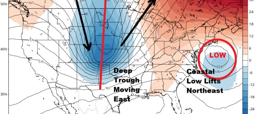
While all this is happening low pressure is going to develop off the southeast US coast. We can already see hints of this from the current satellite picture with clouds and disorganized showers to the east of Florida. The picture just above is the GFS forecast for Tuesday evening. as a low develops and lifts northeast and then turns north and northwest.
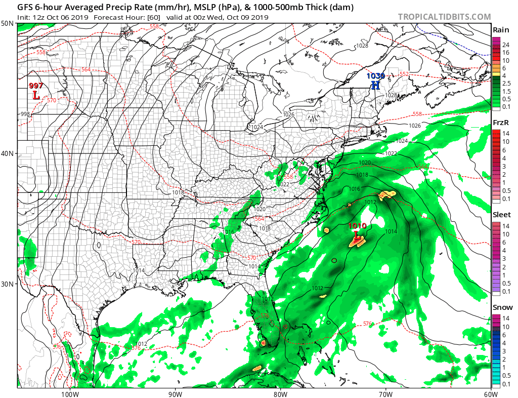
If this afternoon run of the GFS is right then we will see gales and heavy rain along the coast with the possibility of coastal flooding (the full moon thankfully is not until next Monday October 13th). However the European model never lifts the low north of 35 degrees north and then begins to move it southwestward. If this idea is correct then we can go back to the big high to the north dominating and keeping things dry with no worse cloudy skies near the coast and breaks in the clouds inland with some light rain or drizzle possible. The GFS on this particular run stayed in line with the overnight view while the European was more to the south and southeast.
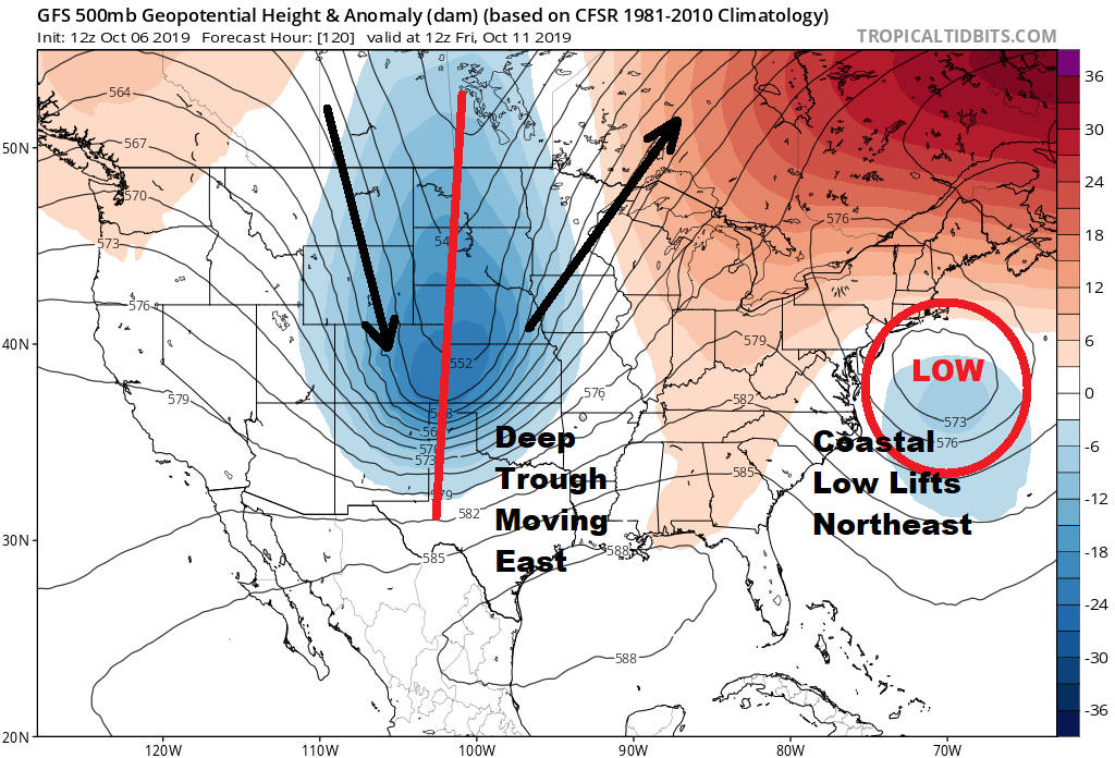
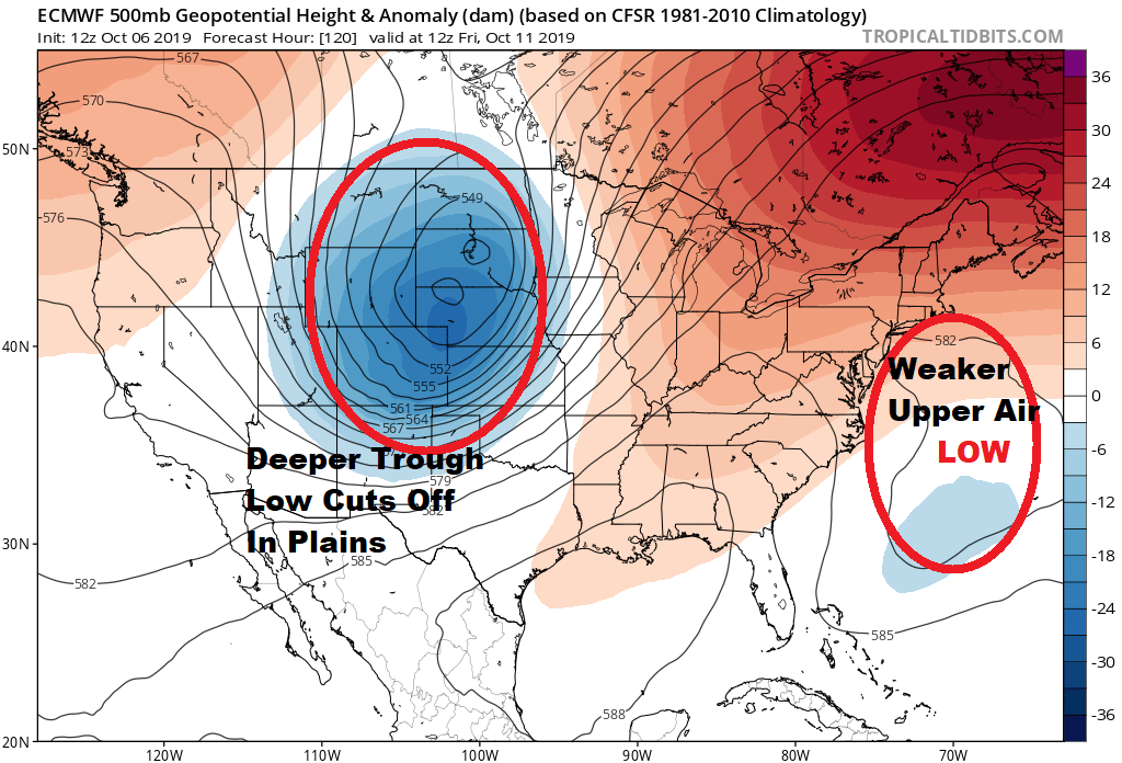
The European and GFS upper air handle the upper features differently with the European showing a well developed upper air storm in the Plains which leaves the east coast upper feature much less defined than the GFS. The GFS upper air acts like a lever and lifts a more well defined coastal low to the northeast and north. Weather models still are having trouble decided what is the right way to go with this. We are going to lean toward the idea that the low will move generally northward and northeastward with impacts along immediate coastal areas of wind and rain beginning Tuesday night and lasting into part of Thursday. The ocean is warm and the possibility of some subtropical development exists though this wouldn’t really materially change any outcome here.
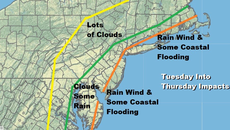
Areas along the immediate coast will experience gales and the chance for coastal flooding at high tide but as we stated earlier, the moon cycle is not in a favorable position for moderate or severe coastal flooding. Late this week the low moves up and out to the northeast as the next front approaches for the weekend. There may not much around for the front to work with as far as showers go so we may just turn cooler and dry over the weekend and next week.
The overall pattern is progressive which means that systems will continue to move along from west to east with no blocking and no big upper high in the east. The atmosphere is no longer locked up and we will continue to see fronts and shots of cold air coming through every few days with brief seasonal warm ups between air masses.
MANY THANKS TO TROPICAL TIDBITS FOR THE USE OF MAPS
Please note that with regards to any severe weather, tropical storms, or hurricanes, should a storm be threatening, please consult your local National Weather Service office or your local government officials about what action you should be taking to protect life and property.


