
Clouds Showers Tuesday Warmer More Humid Wednesday Thursday
It was quite a finish to the Memorial Day holiday weekend with lots of sunshine, deep blue sky, warm but not humid conditions. The weekend wound up being a rather good one all the way around with a minimal amount of shower and thunderstorm activity. Now it is on to Tuesday where low pressure now in the Great Lakes moves eastward and a frontal boundary sets up right on top of us. Clear skies are on the satellite picture this evening. No issues are forecast tonight with clear skies giving way to some late night clouds. Most lows will be in the 50s. Radars are quiet for tonight.
SATELLITE

REGIONAL RADAR

The frontal boundary to our south is going to buckle somewhat on Tuesday which will split the area in 2 weather wise. Central and South Jersey & Southeast Pennsylvania will be warm and humid with highs in the 70s to near 80. There is the chance for showers and thunderstorms and there is the risk for severe weather. To the north in North Jersey and Northeast Pennsylvania into Western areas of the Hudson Valley (west of the Hudson River) a severe weather risk exists here is well.
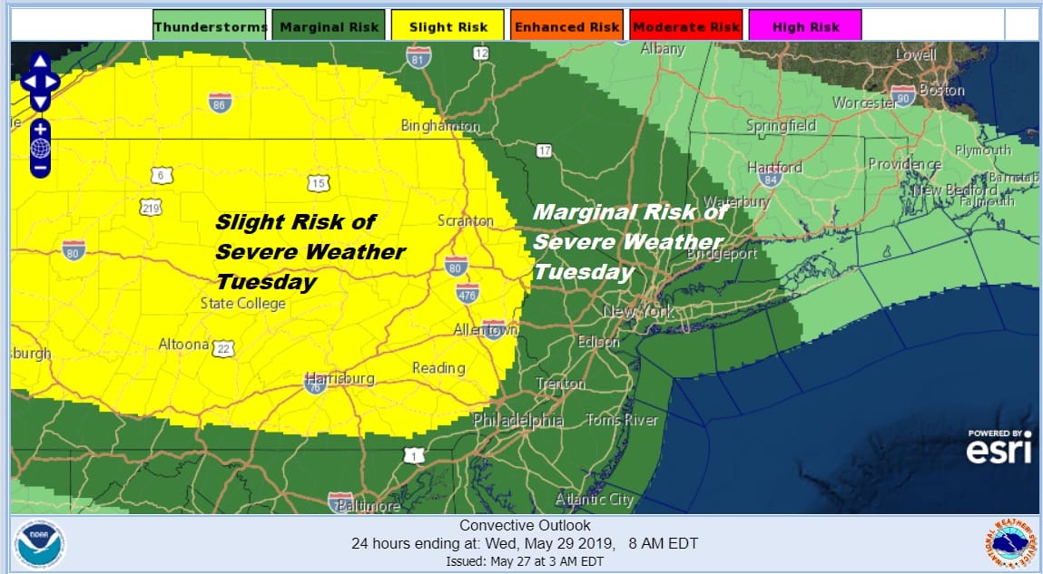
From NYC north and east it will be a battle with that frontal boundary between the cooler onshore flow to the northeast that extends into Southern New England and Long Island. Here temperatures will be in the 60s to near 70.
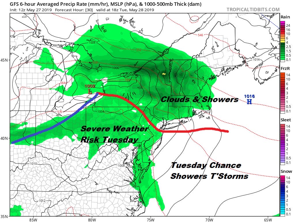
The map above is the GFS model for midday tomorrow. This has showers moving in during the afternoon and evening along with a few thunderstorms. This system will move out Tuesday night but the boundary zone will remain to our south. Wednesday will likely not be too bad with clouds and some sun with highs in the mid 70s to lower 80s. Then the boundary buckles again to bring very warm humid conditions Thursday with showers and thunderstorms late in the day and at night. Highs Thursday will be in the 80s to near 90 with uncomfortable humidity.

The upper air jet stream pattern is one where everything keeps moving along which means a dry air mass arrives for Friday and Saturday with sunshine, warm temperatures, with comfortable humidity. Highs will be in the upper 70s and lower 80s on Friday and 70s to near 80 for both Saturday and Sunday. Right now it appears the weekend will be rain free with nothing more than a few passing clouds.
MANY THANKS TO TROPICAL TIDBITS FOR THE USE OF MAPS
Please note that with regards to any tropical storms or hurricanes, should a storm be threatening, please consult your local National Weather Service office or your local government officials about what action you should be taking to protect life and property.


