
Clouds Rolling In Ahead of Midweek Heat Then Cold Front Follows
The flow of cool air from the northeast is beginning to buckle against hot humid air from the Southeast and Ohio Valley and the result are clouds that now cover much of Maryland northward into upstate NY. The high is off the coast of Massachusetts and we still have a wedge of clear skies in Southern New England this evening but not for long. Temperatures today were confined in the upper 60s to a few lower 70s but now a southeast wind has taken over and we will be locked up in the 60s for the night with 50s in cool spots. Clouds will be around and there could be a few spotty light showers or a little bit of drizzle.
SATELLITE

REGIONAL RADAR

We aren’t seeing much on the regional or local radars this evening. Some light showers are showing up aloft moving across the Catskills and Northeastern Pennsylvania but much of this isn’t reaching the ground. To the south in the hot humid air on the regional radar we are seeing some scattered thunderstorms in Virginia and North Carolina moving southward around the edge of the big upper high sitting in the Gulf States.
LOCAL RADAR NEW YORK CITY

LOCAL RADAR PHILADELPHIA


There are no real changes in the outlook going forward. Tuesday as winds bend more to the south and eventually to the southwest temperatures will start to rise. Skies could become partly sunny on Tuesday after some morning clouds. Highs will reach the mid to upper 70s with lower 80s from Southern New Jersey south and west.
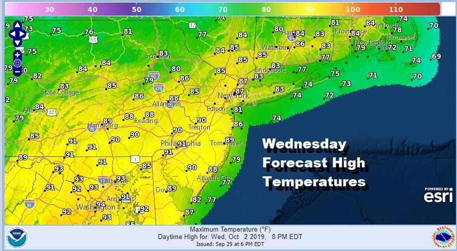
Wednesday is our one day of heat and humidity with highs in the mid 80s to some lower 90s. How high temperatures get will depend on how much sun, and the arrival of a cold front during the afternoon that triggers off some scattered showers and thunderstorms. The front comes through between 2 and 5pm.
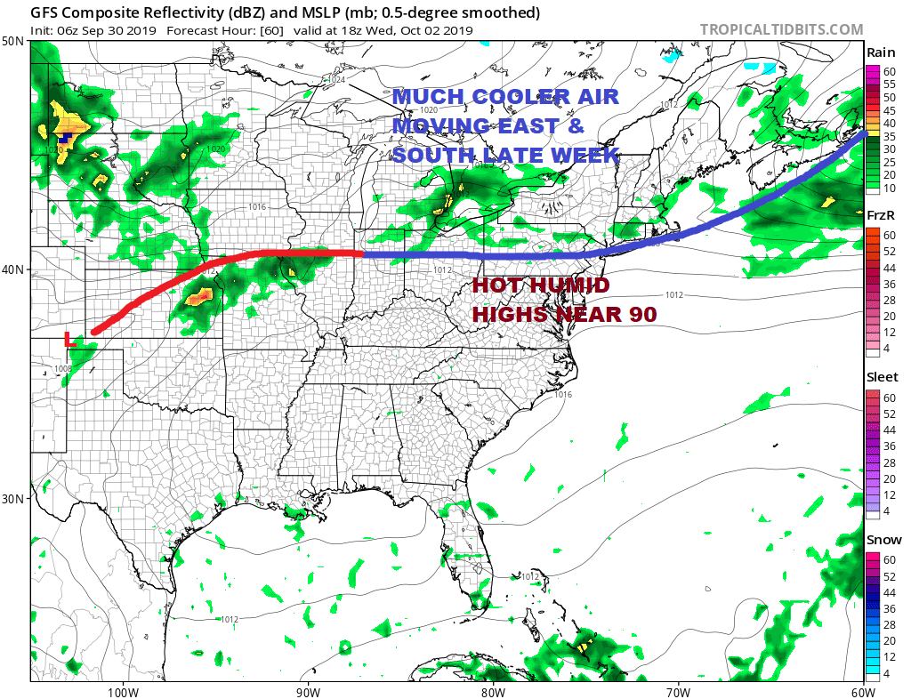
The first shot of cool air builds across Upstate NY & New England and pushes southward into Central New Jersey and Pennsylvania. The southern end of the front stalls and we get a second wave a low pressure moving across the Great Lakes for Thursday. This will bring a better chance for widespread showers and a few thunderstorms during Thursday with some coming in during the early morning hours until just past daybreak..and then a second round with the stronger second cold front later in the day.

Notice that the temperature spread for Thursday is very wide from just into the 60s across Southern New England to the upper 80s and Lower 90s from Southern Pennsylvania southward. There is a solid boundary setting up here for the likelihood of some showers and a few thunderstorms.
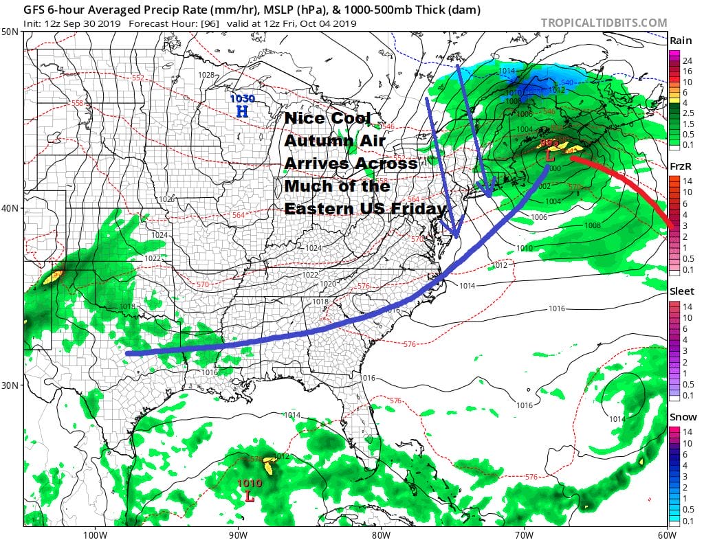
Friday we see cool air arrive everywhere in the Northeast and into the Middle Atlantic states. Friday we should see some sunshine, a nice breeze and most highs will be in the low to mid 60s with some upper 60s and lower 70s further south into Maryland and Delaware. Areas in the Hudson Valley and interior Connecticut however will be hovering in the upper 50s. The weekend starts out dry and cool with sunshine and highs in the 60s Saturday. Sunday we will see sun and arriving clouds as we set up for the next cold front and the chance for widespread showers on Monday.
MANY THANKS TO TROPICAL TIDBITS FOR THE USE OF MAPS
Please note that with regards to any tropical storms or hurricanes, should a storm be threatening, please consult your local National Weather Service office or your local government officials about what action you should be taking to protect life and property.


