Cindy Remnants Heading Northeast Weekend Forecast
Cindy Remnants Heading Northeast Weekend Forecast
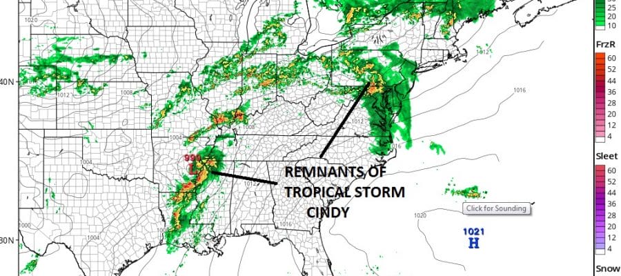
Tropical Storm Cindy continues to weaken into a remnant low and it complicates the Friday and Saturday morning forecast somewhat. There are two separate areas of rain. The first area is well to the northeast of the circulation center which is still well south in East Texas. That first area of showers and downpours will be moving through on Friday and the area will be weakening as it moves northeast.

This to me suggests that Friday we will see a weakening area of downpours moving eastward Friday morning. Then a break in the action until late afternoon as some other downpours and thunderstorms develop in some places. Then the circulation of cindy will move east ahead of a cold front that comes through Saturday morning. What will be left essentially is a narrow band of downpours that moves through Saturday morning and then weather conditions improve quickly from west to east with some sunshine developing in NW New Jersey and the Hudson Valley before lunch time and then along the coast during the early to mid afternoon. The second half of the day and Saturday night look good. Temperatures will be in the upper 70s to mid 80s depending on how much sun develops. Sunday looks great and so does Monday with sunshine and highs in the low to mid 80s both days with low humidity
SATELLITE LOOP

REGIONAL RADAR

LOCAL RADAR NEW YORK CITY

LOCAL RADAR PHILADELPHIA


As far as this evening and tonight goes, no issue with just arriving clouds and increasing humidity. Then we will watch the radars to see what moves through Friday morning.
CINDY REMNANTS RAINFALL FORECAST NAM MODEL
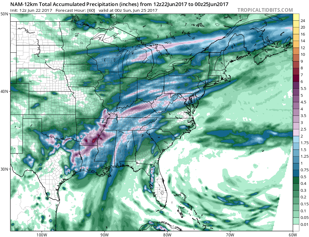
In total rainfall amounts from this are going to be a bit streaky with high variability. Depending on the track of the heaviest downpour some local amounts of 1 to 2 inches are quite possible while those who miss out might see half an inch or even less.
 GET JOE A CIGAR IF YOU LIKE

Weather App

Don’t be without Meteorologist Joe Cioffi’s weather app. It is really a meteorologist app because you get my forecasts and my analysis and not some automated computer generated forecast based on the GFS model. This is why your app forecast changes every 6 hours. It is model driven with no human input at all. It gives you an icon, a temperature and no insight whatsoever.
It is a complete weather app to suit your forecast needs. All the weather information you need is right on your phone. Android or I-phone, use it to keep track of all the latest weather information and forecasts. This weather app is also free of advertising so you don’t have to worry about security issues with your device. An accurate forecast and no worries that your device is being compromised.
Use it in conjunction with my website and my facebook and twitter and you have complete weather coverage of all the latest weather and the long range outlook. The website has been redone and upgraded. Its easy to use and everything is archived so you can see how well Joe does or doesn’t do when it comes to forecasts and outlooks.
Just click on the google play button or the apple store button on the sidebar for my app which is on My Weather Concierge. Download the app for free. Subscribe to my forecasts on an ad free environment for just 99 cents a month.
Get my forecasts in the palm of your hand for less than the cost of a cup of Joe!


