Chilly Today However Warmer Temperatures Arrive Late Week
We have a new air mass that has built down from Canada and that brought in chilly air but it also has brought sunshine. Now we should note that while some places are mostly sunny others are into more of a mix of sun and clouds and we see those clouds in Southeastern Pennsylvania south into Virginia. This is going to put a lid on temperatuers. We should see highs reach the mid 50s to around 60 this afternoon. We are also enjoying dry rain free conditions and quiet radars for the next several days.
SATELLITE

REGIONAL RADAR

Tonight should be mainly clear and cold with most lows in the upper 30s to mid 40s. The we move ahead to a nice day on Wednesday. High pressure will start to settle overhead and we should see temperatures respond by reaching into the 60s. Thursday we will start to develop a west southwest flow and with another day of some sunshine, we should see highs reach the 60s to perhaps near 70. Bear in mind that this brings us back to normal for this time of year. Thursday night we will be bringing a warm front northward and that will likely produce some showers and thunderstorms across Upstate NY and New England
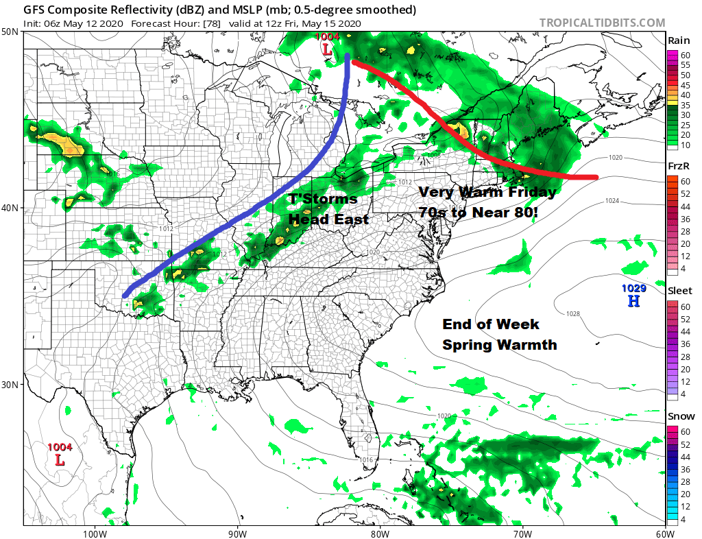
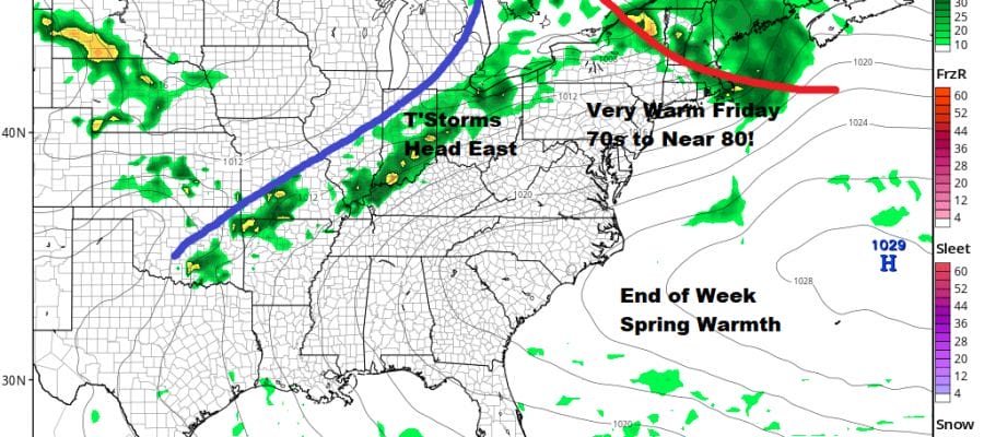
Friday we should be in the warm air and well ahead of a cold front to the west. This gives us sunshine and warm temperatures. We should see highs reach the 70s to near 80 degrees. Late in the day a cold front approaches and there could be some showers and thunderstorms Friday evening.
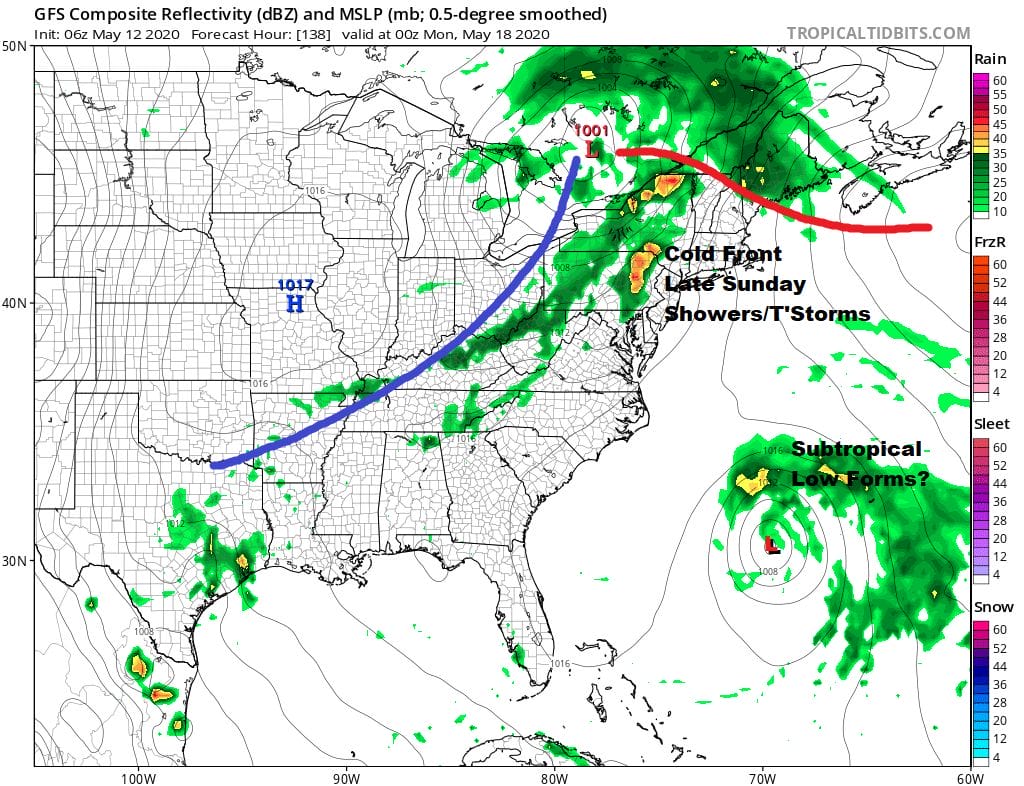
The weekend is should be okay but there are some questions. Saturday we will be in dry air coming down from Canada but the cold front from Friday night stalls to our south and will back northward Saturday night into Sunday. This presents the possibility of some cloud issues at times both Saturday and Sunday. This could possibly hold temperatures back a bit especially near the ocean. Highs should reach 70 or better inland but possibly cooler along the coast and especially near the ocean. Late Sunday a cold front will cause some showers and thunderstorms. Also well off the Southeast US Coast we might see low pressure develop into a subtropical system however it will be well offshore and we don’t see any impact to the US even if this system does develop.
BE SURE TO DOWNLOAD THE FREE METEOROLOGIST JOE CIOFFI WEATHER APP &
ANGRY BEN’S FREE WEATHER APP “THE ANGRY WEATHERMAN!
MANY THANKS TO TROPICAL TIDBITS FOR THE USE OF MAPS
Please note that with regards to any severe weather, tropical storms, or hurricanes, should a storm be threatening, please consult your local National Weather Service office or your local government officials about what action you should be taking to protect life and property.


