Chilly Breezy Thursday Cold Night Columbus Day Weekend
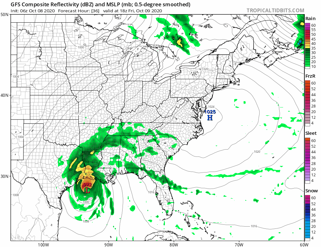
Remnant Delta Rains Late Sunday Monday
WEATHER IN 5 THURSDAY OCTOBER 8, 2020
The up and down nature of our week of weather continues today and we are in the down mode as far as temperatures are concerned. Low pressure is to the northeast and it is a rather strong feature in Southeastern Canada. High pressure is coming in from the west so we are between the two today. This will make for breezy conditions. Also we will see a little instability so look for sunshine mixed with some clouds. Temperatures today at best will be in the low to mid 60s. Radars are quiet in the Northeast and Mid Atlantic and should remain so into Saturday.
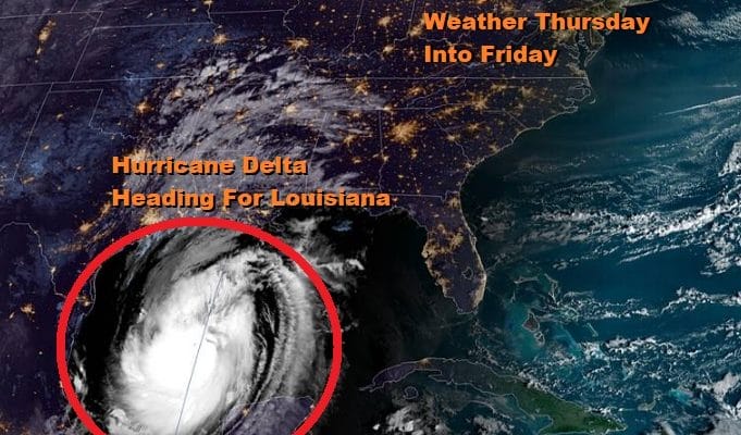
SATELLITE

REGIONAL RADAR

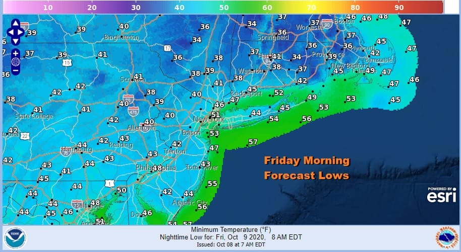
We have a chilly night ahead with clear skies and diminishing winds. Lows along the coast and in the warmer urban settings will settle between 40 & 45 but many inland areas will be in the 30s. There might just enough wind to prevent widespread frosts from developing inland but there may be a few areas in the coldest spots.
Chilly air and this high will be going out to the east a bit faster so we should see temperatures bounce nicely higher on Friday. Sunshine will take highs to the mid 60s to near 70 by afternoon. Then we move on to the holiday weekend. No doubt Saturday will be the best day of the three day holiday weekend. Look for lots of sunshine early and some clouds late. Highs will be in the low to mid 70s.
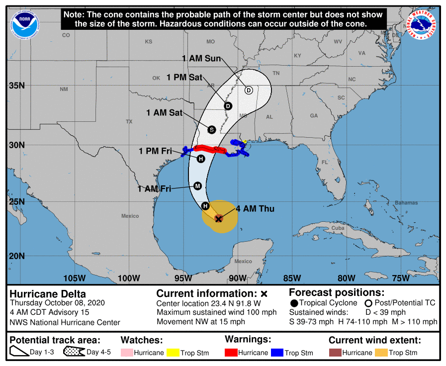
Hurricane Delta is on course for a landfall in Southern Louisiana later Friday as a borderline major hurricane. Max winds are back to 100 mph and conditions favor some strengthening today and tonight.
We are still expecting a cold front pass through the Northeast Saturday evening and stall to the south while high pressure builds in Southeast Canada. The remnant low of Delta with rains will move northeast reaching Virginia Maryland and Delaware Sunday morning and then to NYC Long Island and Southern New England by late afternoon or evening Sunday. Rain should last into Monday afternoon and we could wind up with an inch or two area wide from Eastern Pennsylvania to Southern New England. Temperatures Sunday and Monday will be just in the 60s.
BE SURE TO DOWNLOAD THE FREE METEOROLOGIST JOE CIOFFI WEATHER APP &
ANGRY BEN’S FREE WEATHER APP “THE ANGRY WEATHERMAN!
MANY THANKS TO TROPICAL TIDBITS FOR THE USE OF MAPS
Please note that with regards to any severe weather, tropical storms, or hurricanes, should a storm be threatening, please consult your local National Weather Service office or your local government officials about what action you should be taking to protect life and property.


