Chilly Night Ahead Nice Sunny Friday
Holiday Weekend Nice Saturday Rain Late Sunday Into Monday
WEATHER IN 5 THURSDAY OCTOBER 8, 2020
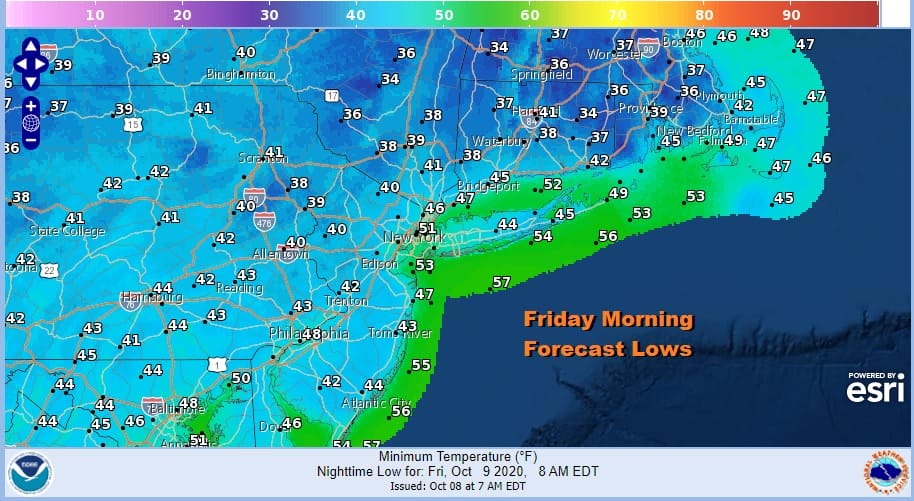
It was a brisk breezy day with a fair amount of sunshine. Now we move ahead to a chilly night. The satellite picture this evening showers clear skies over much of Eastern Pennsylvania to Southern New England. Clouds in Upstate NY and Northern New England will diminish and the winds will drop off overnight. Temperatures will bottom Friday morning in the low to mid 40s in coastal and urban areas and 30s inland.
Radars are on a break in the Northeast and Middle Atlantic states with all the dry air around. We don’t foresee any rain issues into Sunday as high pressure will be in control through Saturday.
SATELLITE

REGIONAL RADAR

We will wrap up the week with sunshine for Friday and temperatures will bounce a little higher than today. Highs will reach 65 to near 70 in most places. Winds will drop off as well. Friday night will be clear and Saturday will be mild with sunshine much of the day. There is a cold front that will pass through Saturday night. It won’t have much with it but it will shift the winds to the northeast into Sunday morning. Saturday highs will be in the low to mid 70s.
HURRICANE DELTA UPDATE
Hurricane Delta has been slowly strengthening today as it continues northwestward in the Western Gulf of Mexico. The lowest pressure has dropped under 960 millibars and sustained winds have increased to 115 mph. Delta is now a major hurricane again. Hurricane Warnings are up for the Louisiana coast from Sabine Pass Texas to Morgan City Louisiana.
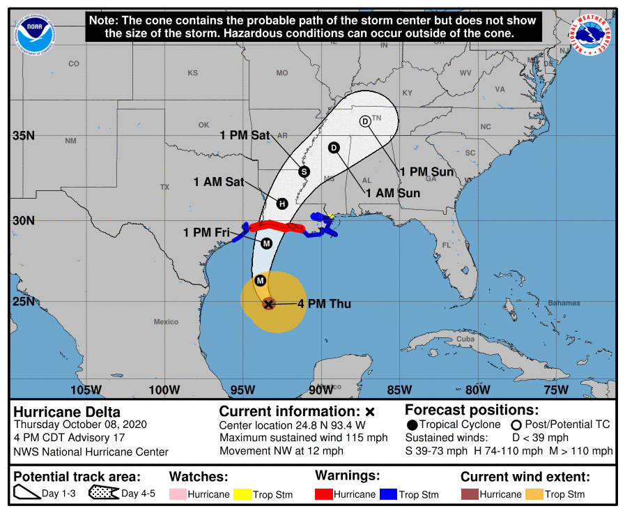
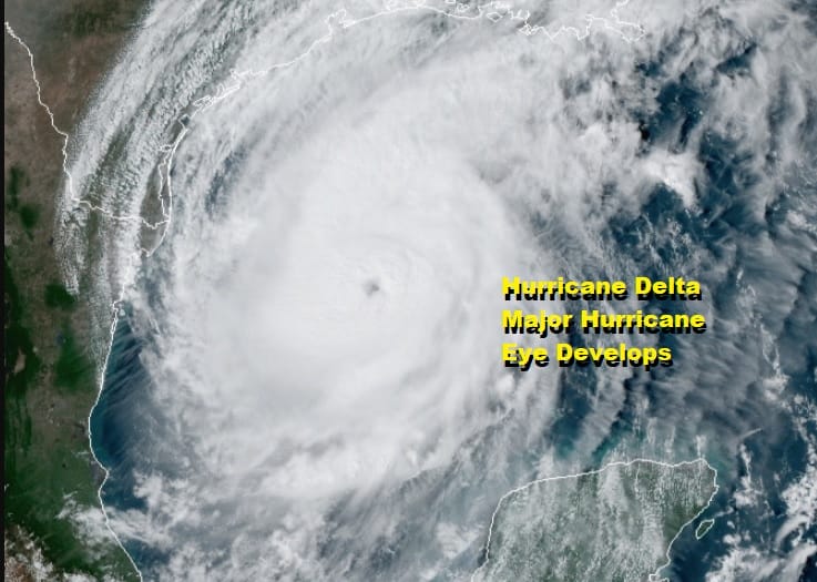
A well defined eye has formed on satellite loops this afternoon. While Delta will be a major hurricane on its final approach to the Louisiana coast, cooler water near the coast and some developing shear are being counted on to weaken the storm a little just before landfall. Fingers crossed on this.
Landfall should be late afternoon or evening Friday in Southwest Louisiana. The storm has been nudging a bit to the west and this increases the direct threat to Lake Charles. This storm will move over the same area that Hurricane Laura did two months ago.

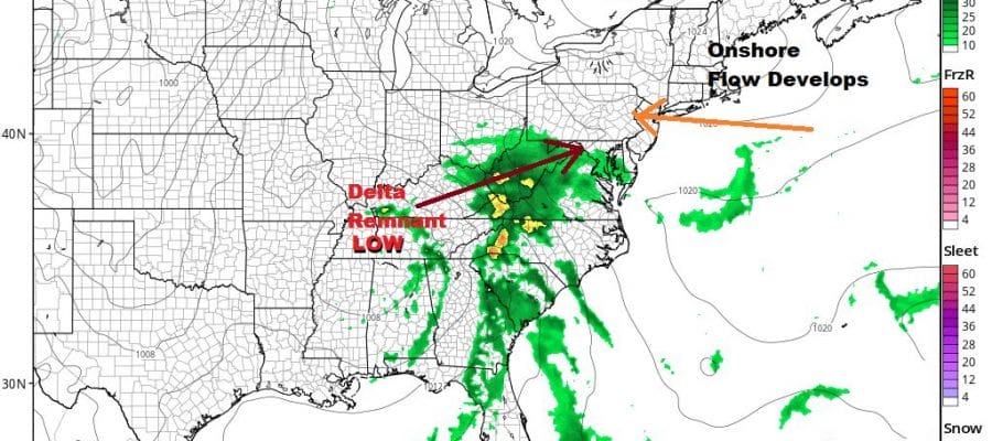
Sunday we will be watching the remnant rains from Delta moving northeastward through Middle Atlantic states. High pressure strengthening in Eastern Canada will help to hold the rain back until Sunday night for Eastern Pennsylvania to Southern New England. The daytime Sunday will see thickening clouds with an ocean wind. Highs will just be in the low to mid 60s. The high should give way to allow the rain to push northward Sunday night into Monday. Columbus day looks cloudy and rainy with highs just into the 60s.
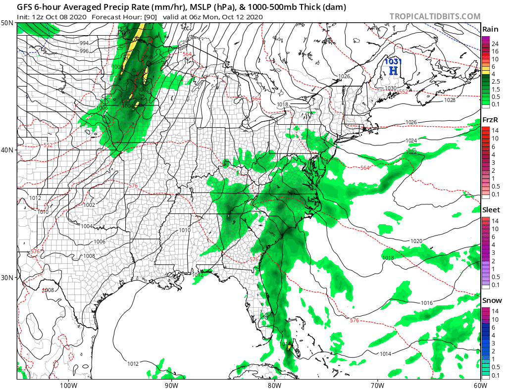
Complicating matters is a deep shortwave trough in the Plains that will be moving quickly eastward. The GFS shows a cold front racing across the Great Lakes and then slowing down as it nears the coast later Tuesday. This may mean that we cold see more showers around Tuesday and possibly into Wednesday before the front gets out of the way. A brief break will be followed by another weather front and another chance for showers at the end of the week.
BE SURE TO DOWNLOAD THE FREE METEOROLOGIST JOE CIOFFI WEATHER APP &
ANGRY BEN’S FREE WEATHER APP “THE ANGRY WEATHERMAN!
MANY THANKS TO TROPICAL TIDBITS FOR THE USE OF MAPS
Please note that with regards to any severe weather, tropical storms, or hurricanes, should a storm be threatening, please consult your local National Weather Service office or your local government officials about what action you should be taking to protect life and property.


