
Cheap Thrill Rain Pattern Continues Next Week As We March Toward New Years

Weather in 5/Joe & Joe Weather Show Latest Podcast
Cheap Thrill Rain Pattern Continues Next Week As We March Toward New Years
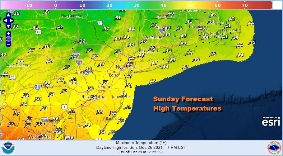
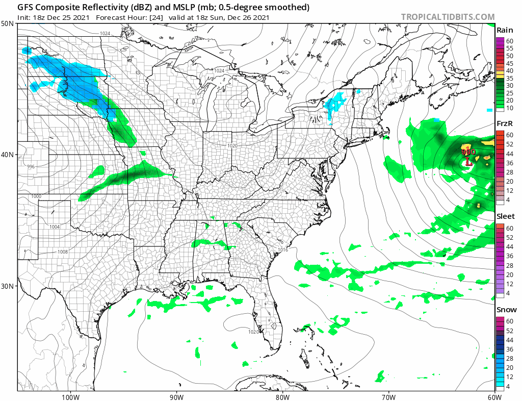
A respite from the rain came on the Chirstmas Day and now we look to the west as we see one more surge of showers. These are tracking further south than indicated yesterday. Low pressure is forming near Cape Cod tonight and that should sweep all the of the remaining showers out to the east. Then we can see weather conditions improve nicely late tonight and for Sunday and a gusty northwest breeze. Temperatures are in the 40s and 30s across Northern New Jersey, NYC and points north and east while it is in the lower 60s across Southern New Jersey, 50s across Southern Pennsylvanian and 60s down to Washington DC and Baltimore.
SATELLITE

WEATHER RADAR

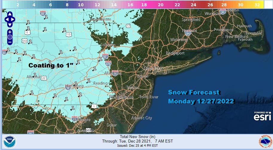
Sunday will be a better day with sunshine and a gusty wind. Highs will generally be in the upper 40s and lower 50s. The next “cheap” thrill is headed east for Sunday night into Monday. This one is a little different in that the track is going to be a little further south than the one on Christmas Eve. Also this one comes during the day verses the overnight. And this one will also slowly get suppressed as the system weakens as it moves southeast.
Snow comes in from the northwest Monday morning and lasts into the early afternoon before it begins to get suppressed to the south and east and the snow is forecast to dissipate from radar screens in the afternoon. Being that it comes during the day and temperatures are not especially ideal, we think that forecasting a coating to at most an inch, mainly on colder surfaces is the best way to go for Pennsylvania.
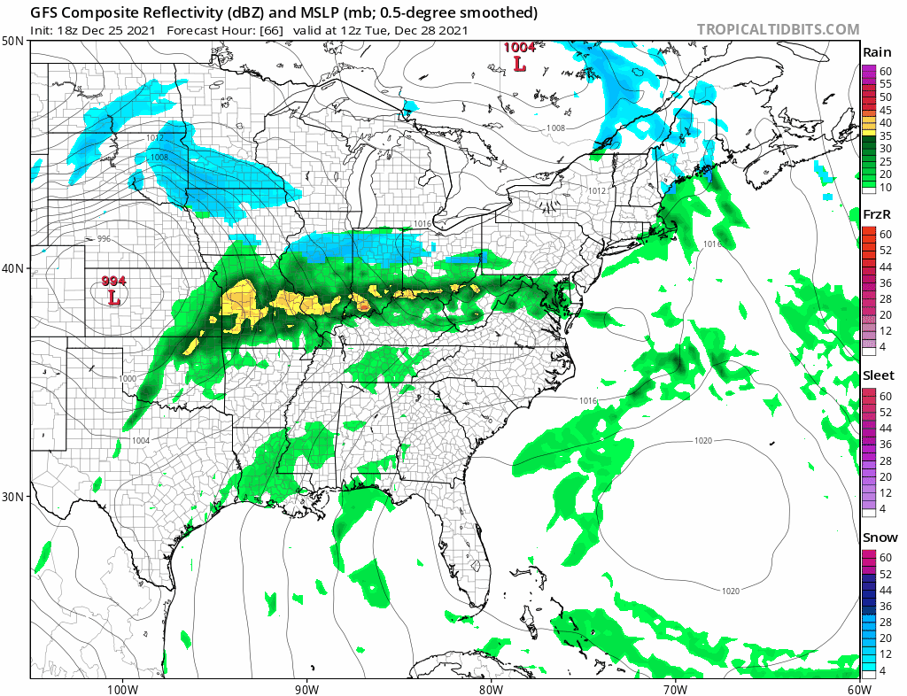
A short break comes Monday night into Tuesday and then another low heads to the west to the Eastern Lakes and this looks to move northeast leaving the support behind. Rain moves up Tuesday night into Wednesday and then here too the rain area is suppressed later tin the day. Some snow is on the front end in Pennsylvania and Southern New York only to see that die out over time. Rain for NYC and New Jersey along with Southern New England Tuesday evening and then it should be mostly done by Wednesday morning.
More rain is likely Thursday as another one of these fast moving weak lows moves in and out. Dry air moves in for Friday New Year’s leaving us with sunshine and a gusty wind but no weather issues. Saturday actually looks to be on the dry side too with sunshine giving way to some late day clouds. No weather issues are forecast for New Year’s day.
BE SURE TO DOWNLOAD THE FREE METEOROLOGIST JOE CIOFFI WEATHER APP &
ANGRY BEN’S FREE WEATHER APP “THE ANGRY WEATHERMAN!

MANY THANKS TO TROPICAL TIDBITS & F5 WEATHER FOR THE USE OF MAPS
Please note that with regards to any severe weather, tropical storms, or hurricanes, should a storm be threatening, please consult your local National Weather Service office or your local government officials about what action you should be taking to protect life and property.


