Wash Rinse Repeat to Finish of 2021 No Major Storms,
Weak Systems Heading East

Weather in 5/Joe & Joe Weather Show Latest Podcast
Wash Rinse Repeat to Finish of 2021 No Major Storms, Weak Systems Heading East
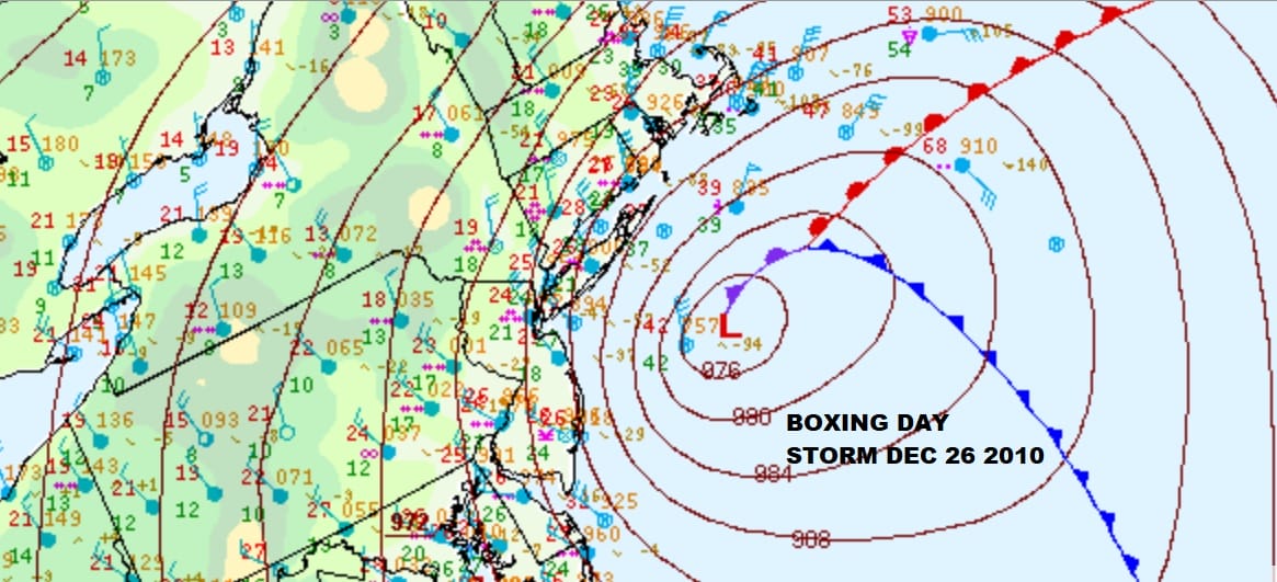
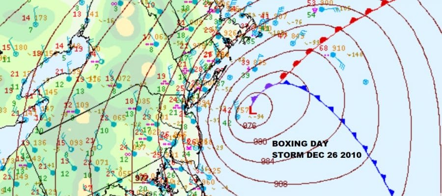
Here we are for the day after Christmas or Boxing Day which of course brings back memories of the Boxing Day Storm of 2010 which is one of the strongest December snowstorms on record for the Northeast. It followed a snow storm also the year before which occurred a few days before Christmas. This was a perfect set up of surface and aloft conditions, cold arctic air into the Eastern US underneath a developing major low off the New Jersey coast. Some areas of New Jersey saw 20 to 30 inches with 1 to 2 feet in surrounding areas.
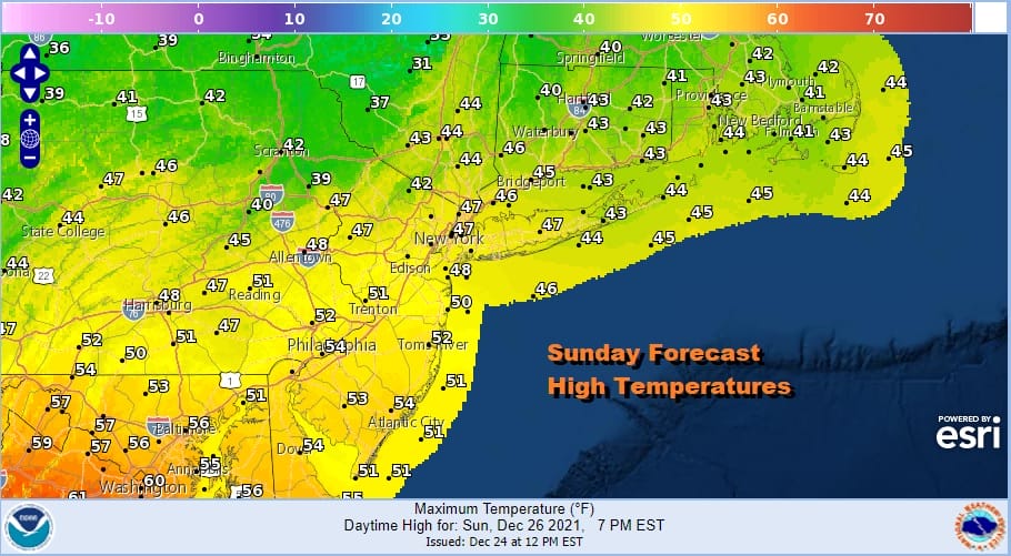
Those are once in a generational event and clearly we are in a totally different place today. Low pressure developed last night east of Cape Cod and is moving to the east. Weather conditions are slowly improving and we have temperatures this morning in the low to mid 40s. We probably saw the highs of the day after midnight before the winds turned to the northwest. Look for increasing amounts of sunshine with highs reaching the mid to upper 40s.
SATELLITE

WEATHER RADAR

Radars are quiet today and now we begin another parade of weak weather systems moving east and some of them that will attempt to break down as they reach the coast. The first one comes Monday as low pressure comes out of the Ohio Valley and weakens as it heads into Pennsylvania.

An area of light snow moves southeast reaches to about NYC and then falls apart Monday afternoon. Snow amounts of a coating to perhaps an inch are possible across Pennsylvania this time around but not much of anything for everyone else. Then the second wave of moisture comes up from the south and with that we get rain later Tuesday into Wednesday. More waves of rain continue through Thursday before we finally dry things out for Friday and the start of the weekend.
Colder air is forecast to spread across the Great Lakes and Northeast as low pressure comes out of the Ohio Valley Sunday and moves to Western Pennsylvania and eventually passing south of the Long Island. We think the GFS is overdone and too cold with this system at first glance. We will give it another look later today on the Joe & Joe Weather Show at 1pm Eastern.
BE SURE TO DOWNLOAD THE FREE METEOROLOGIST JOE CIOFFI WEATHER APP &
ANGRY BEN’S FREE WEATHER APP “THE ANGRY WEATHERMAN!

MANY THANKS TO TROPICAL TIDBITS & F5 WEATHER FOR THE USE OF MAPS
Please note that with regards to any severe weather, tropical storms, or hurricanes, should a storm be threatening, please consult your local National Weather Service office or your local government officials about what action you should be taking to protect life and property.


