Bitter Cold Night Ahead Before Warmer Air Arrives
Bitter Cold Night Ahead Before Warmer Air Arrives
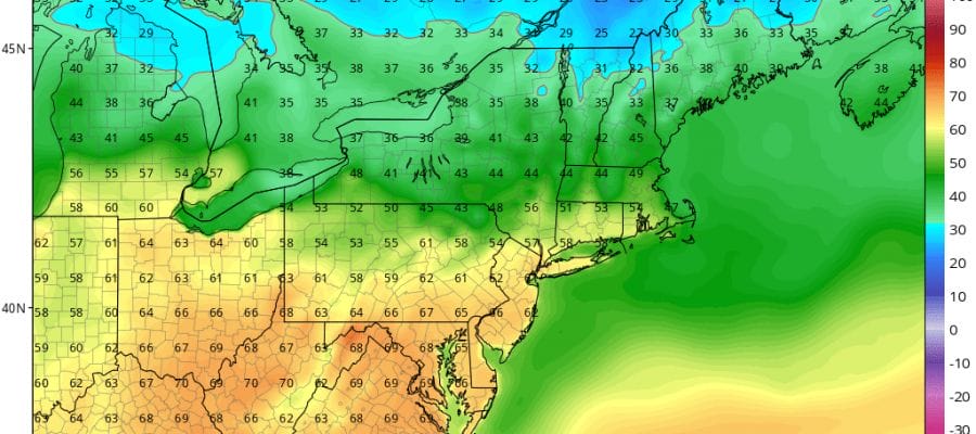
Watching the temperatures and the wind tonight, both are decreasing which is bad and good. At least the bitter cold wind chills will be relieved a bit as winds drop off but the bitter cold temperatures remain as we head into the teens and low 20s. For the middle of March teens to low 20s is bitter cold. This is the equivalent of a night in January with temperatures near or below zero. Thankfully its mid March and it won’t last as moderation begins slightly on Thursday with sunshine and temperatures back into the 40s.
At least from the standpoint of precipitation we don’t have any and skies will be clear tonight and mostly sunny pretty much all day long on Thursday.
SATELLITE LOOP

REGIONAL RADAR

Friday the moderation continues and we do have a warm front approaching that will move through during the morning. There could be a very brief burst of precipitation when it goes by but at worst it looks light and at best it all goes by to our north and we don’t see it at all. Temperatures will head into the 40s and 50s across most of the area. The we watch for Saturday and see just how warm it gets depending on that pesky back door cold front that will be dropping down.
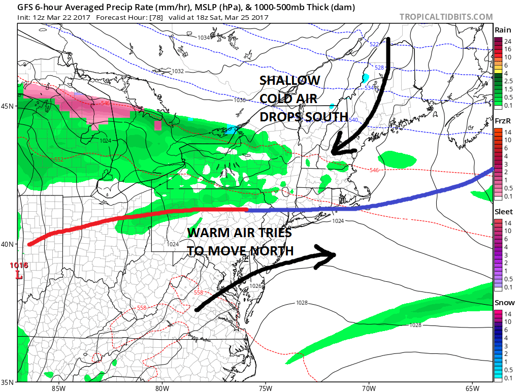
Will it be 60s and 70s to the south or 40s and 50s to the north and which side wins? Check the latest JOESTRADAMUS post for more including a look at Sunday and next week which brings chances for rain.
 GET JOE A CIGAR IF YOU LIKE

SNOW REMOVAL COMPANIES FOR YOUR WINTER NEEDS
LONG ISLAND ROCKLAND COUNTY Connecticut

![]()

ROCKLAND COUNTY TRI STATE SNOW REMOVAL JOHNSTOWN PA


FiOS1 News Weather Forecast For Long Island
FiOS1 News Weather Forecast For New Jersey
FiOS1 News Weather Forecast For Hudson Valley
NATIONAL WEATHER SERVICE SNOW FORECASTS
LATEST JOESTRADAMUS ON THE LONG RANGE
Weather App

Don’t be without Meteorologist Joe Cioffi’s weather app. It is really a meteorologist app because you get my forecasts and my analysis and not some automated computer generated forecast based on the GFS model. This is why your app forecast changes every 6 hours. It is model driven with no human input at all. It gives you an icon, a temperature and no insight whatsoever.
It is a complete weather app to suit your forecast needs. All the weather information you need is right on your phone. Android or I-phone, use it to keep track of all the latest weather information and forecasts. This weather app is also free of advertising so you don’t have to worry about security issues with your device. An accurate forecast and no worries that your device is being compromised.
Use it in conjunction with my website and my facebook and twitter and you have complete weather coverage of all the latest weather and the long range outlook. The website has been redone and upgraded. Its easy to use and everything is archived so you can see how well Joe does or doesn’t do when it comes to forecasts and outlooks.
Just click on the google play button or the apple store button on the sidebar for my app which is on My Weather Concierge. Download the app for free. Subscribe to my forecasts on an ad free environment for just 99 cents a month.
Get my forecasts in the palm of your hand for less than the cost of a cup of Joe!


