Bitter Cold Morning But Warmer Temperatures Coming
Bitter Cold Morning But Warmer Temperatures Coming
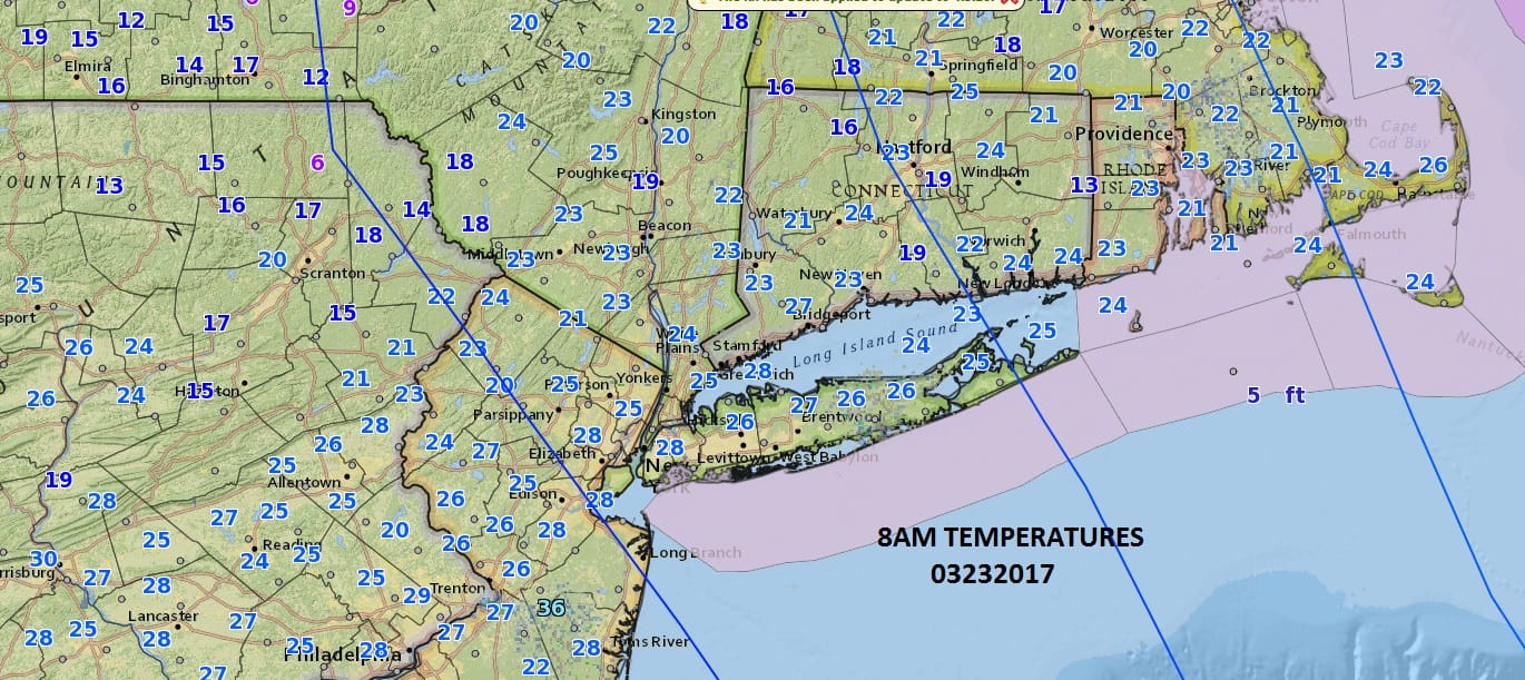
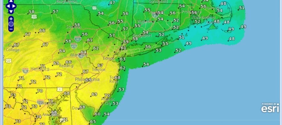
This certainly was a bitter cold morning as temperatures bottomed in the upper teens and lower 20s. The map above from 8am this morning shows temperatures have come off those lows and are now moving their way through the 20s. We do have lots of sunshine and that will be the case all day long with temperatures making it back to the upper 30s and lower 40s.
SATELLITE LOOP

REGIONAL RADAR

Warmer air is beginning to gather momentum in the Plains and moving east. We will see clouds arrive tonight as temperatures hold their own and should be at least 10 to 15 degrees higher than what they were this morning. As the warm air arrives tomorrow morning there could be a brief shower or two..or even a few ice pellets in some inland places but in the end it doesn’t matter. Temperatures should reach into the 50s by late afternoon and that sets us up for a warm Saturday.

It looks like the backdoor cold front to the north won’t pass until later in the afternoon or evening. This should allow most highs to reach the mid 50s north to middle 60s to near 70 as you head into Southern New Jersey and Southeastern Pennsylvania. Ultimately high temperatures will depend on how much cloud cover and wind direction which is especially key for south facing coastal areas like Long Island and Connecticut.
SUNDAY WARM FRONT STALLS SOUTH OF NYC BUT NORTH OF PHILADELPHIA

Sunday we will see low pressure come in from the Ohio Valley and with a stalled front to our south it sets us up for a chilly rain and temperatures not out of the 40s for Northern New Jersey, New York City, Long Island and Connecticut, but for areas like Southern New Jersey (south of 195) and Southeastern Pennsylvania it could be in the 60s for a second day. All of this will depend on the position of the warm front Sunday afternoon.
 GET JOE A CIGAR IF YOU LIKE

SNOW REMOVAL COMPANIES FOR YOUR WINTER NEEDS
LONG ISLAND ROCKLAND COUNTY Connecticut

![]()

ROCKLAND COUNTY TRI STATE SNOW REMOVAL JOHNSTOWN PA


FiOS1 News Weather Forecast For Long Island
FiOS1 News Weather Forecast For New Jersey
FiOS1 News Weather Forecast For Hudson Valley
NATIONAL WEATHER SERVICE SNOW FORECASTS
LATEST JOESTRADAMUS ON THE LONG RANGE
Weather App

Don’t be without Meteorologist Joe Cioffi’s weather app. It is really a meteorologist app because you get my forecasts and my analysis and not some automated computer generated forecast based on the GFS model. This is why your app forecast changes every 6 hours. It is model driven with no human input at all. It gives you an icon, a temperature and no insight whatsoever.
It is a complete weather app to suit your forecast needs. All the weather information you need is right on your phone. Android or I-phone, use it to keep track of all the latest weather information and forecasts. This weather app is also free of advertising so you don’t have to worry about security issues with your device. An accurate forecast and no worries that your device is being compromised.
Use it in conjunction with my website and my facebook and twitter and you have complete weather coverage of all the latest weather and the long range outlook. The website has been redone and upgraded. Its easy to use and everything is archived so you can see how well Joe does or doesn’t do when it comes to forecasts and outlooks.
Just click on the google play button or the apple store button on the sidebar for my app which is on My Weather Concierge. Download the app for free. Subscribe to my forecasts on an ad free environment for just 99 cents a month.
Get my forecasts in the palm of your hand for less than the cost of a cup of Joe!


