
Big Changes Cool Air Arrives
Big Changes Cool Air Arrives
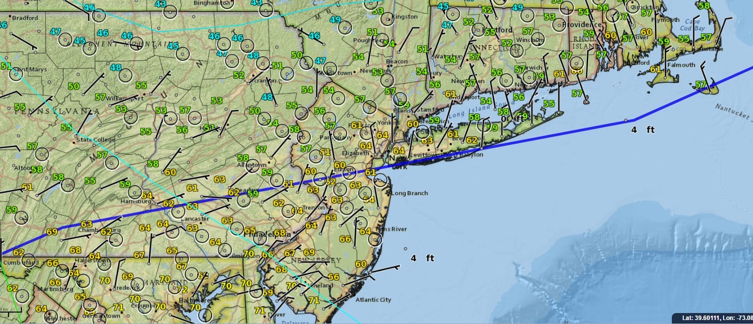
As is always the case this time of year the back door cold front looms large and it is already through the area this morning. As of 4am, temperatures have fallen back into the 50s in most places and the front will continue to advance southward as the morning progresses. Temperatures today in many places will be struggling in the 50s to around 60. As for anything precipitation wise today for now the satellite and radars would not suggest much. There will be lots of clouds developing but there should be a few breaks of sun in the mix as well.
SATELLITE LOOP

REGIONAL RADAR

LOCAL RADAR NEW YORK CITY

LOCAL RADAR PHILADELPHIA


The front will move back north late tonight and Monday as a warm front so we could see some clouds and a few showers overnight (after midnight) as temperatures hold steady. Then we will have clouds and some sun for Monday with a south southwest breeze and temperatures back up into the 70s except 60s for Long Island and Coastal Connecticut. Late Monday and Monday night we have the chance for showers and a few thunderstorms with a front passing through. Dry air follows Tuesday into Wednesday.
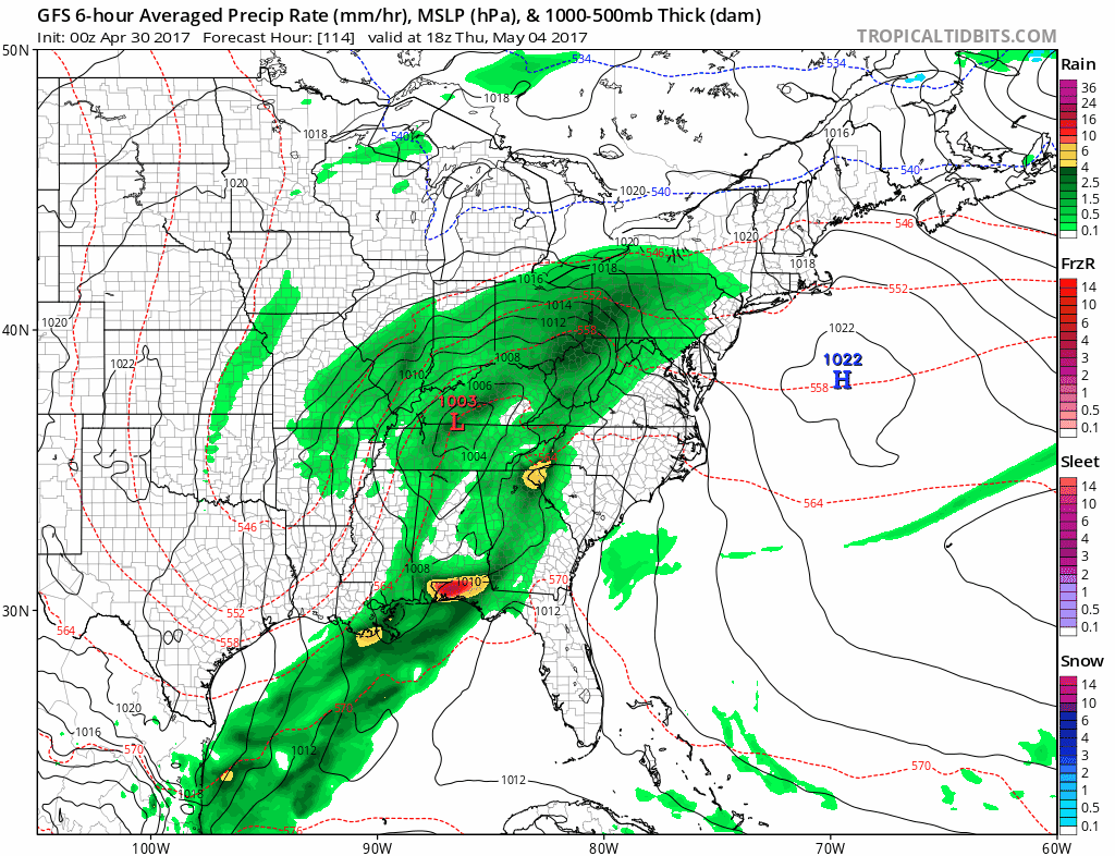
We have been talking about a blocking pattern developing in the atmosphere and weather models have been going back and forth on a prolonged rain event here. Overnight models are back to this idea for rain arriving later on Thursday and lasting into at least part of next weekend. We will address this in a longer range post later today.
 GET JOE A CIGAR IF YOU LIKE

LANDSCAPE COMPANIES FOR YOUR NEEDS
LONG ISLAND ROCKLAND COUNTY Connecticut

![]()

ROCKLAND COUNTY TRI STATE SNOW REMOVAL JOHNSTOWN PA


FiOS1 News Weather Forecast For Long Island
FiOS1 News Weather Forecast For New Jersey
FiOS1 News Weather Forecast For Hudson Valley
NATIONAL WEATHER SERVICE SNOW FORECASTS
LATEST JOESTRADAMUS ON THE LONG RANGE
Weather App

Don’t be without Meteorologist Joe Cioffi’s weather app. It is really a meteorologist app because you get my forecasts and my analysis and not some automated computer generated forecast based on the GFS model. This is why your app forecast changes every 6 hours. It is model driven with no human input at all. It gives you an icon, a temperature and no insight whatsoever.
It is a complete weather app to suit your forecast needs. All the weather information you need is right on your phone. Android or I-phone, use it to keep track of all the latest weather information and forecasts. This weather app is also free of advertising so you don’t have to worry about security issues with your device. An accurate forecast and no worries that your device is being compromised.
Use it in conjunction with my website and my facebook and twitter and you have complete weather coverage of all the latest weather and the long range outlook. The website has been redone and upgraded. Its easy to use and everything is archived so you can see how well Joe does or doesn’t do when it comes to forecasts and outlooks.
Just click on the google play button or the apple store button on the sidebar for my app which is on My Weather Concierge. Download the app for free. Subscribe to my forecasts on an ad free environment for just 99 cents a month.
Get my forecasts in the palm of your hand for less than the cost of a cup of Joe!


