Cooler Air Heading Southeastward As We Sit In The 80s
Cooler Air Heading Southeastward As We Sit In The 80s
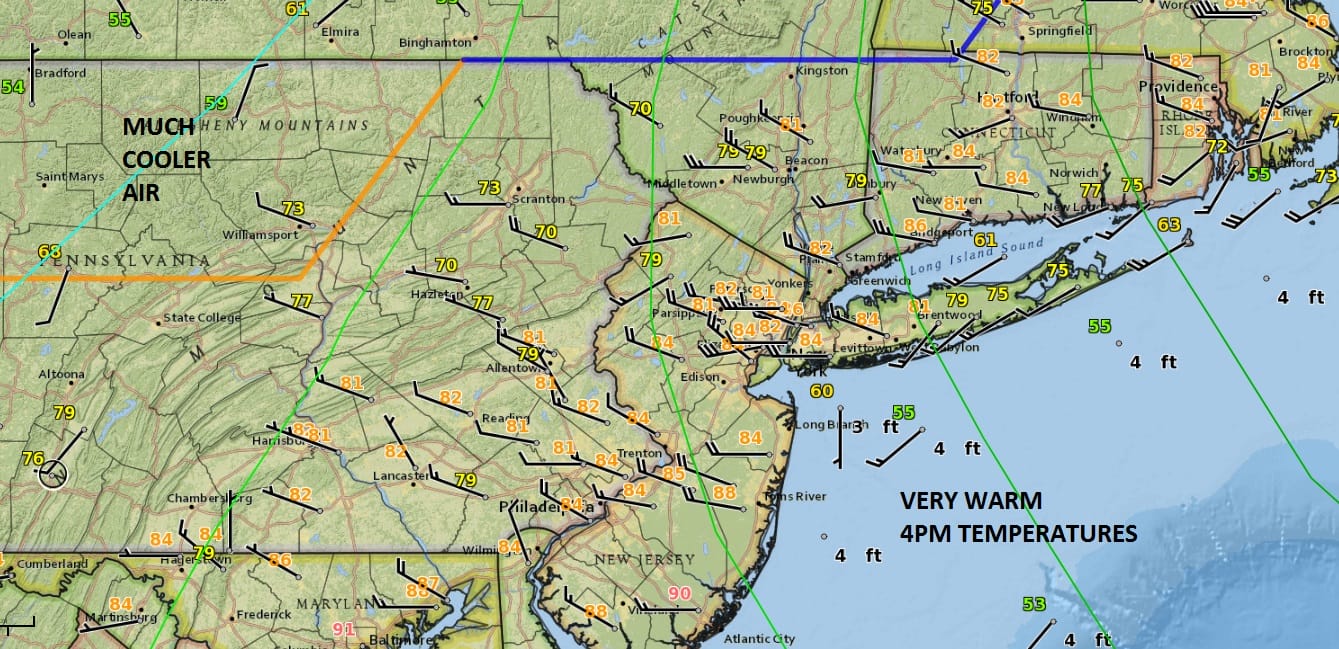
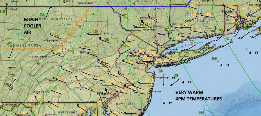
Some sunshine and a west wind is all it takes this time of year to send thermometers soarding and that they did even along coastal areas where the ocean wind is only now beginning to kick in right along the beaches. Temperatures are mostly in the low to mid 80s going into this evening. Cooler air has moved into Northwestern Pennsylvania and that will eventually make its way to the coast overnight and early Sunday morning. There isn’t much happening on the satellite and radar loops other than clouds. Much of the shower and thunderstorm activity remains to the west in the Ohio Valley this evening and except for a passing brief shower that could in theory pop up, I’m thnking we should be dry for the overnight.
SATELLITE LOOP

REGIONAL RADAR

LOCAL RADAR NEW YORK CITY

LOCAL RADAR PHILADELPHIA


Sunday’s temperatures are going to be a big change from today; in some cases by 20 to 25 degrees colder thanks to an ocean wind and cloud cover. There could be some light rain or drizzle and maybe even a passing rain shower or two in the mix but I don’t think it rains all day nor does everyone see rain. I would assume the day will be okay and we will just have to play it by ear.
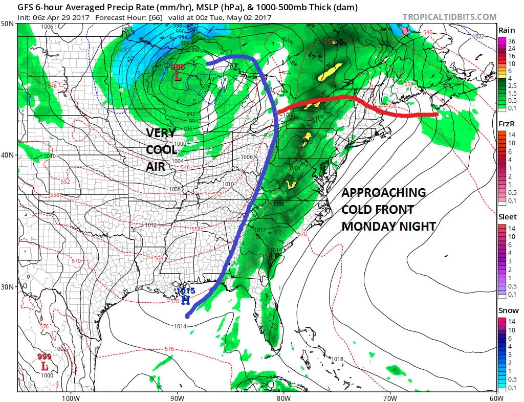
Monday its back the other way with a south southwest wind ahead of a cold front. Clouds and some sunshine will take temperatures up through the 70s to near 80 before the front produces a few showers and perhaps a thunderstorm Monday night. Tuesday and Wednesday will be dry and it will gradually turn cooler as we head into a chilly rain here at the end of the week. We will discuss this further this evening in our long range outlook.
 GET JOE A CIGAR IF YOU LIKE

LANDSCAPE COMPANIES FOR YOUR NEEDS
LONG ISLAND ROCKLAND COUNTY Connecticut

![]()

ROCKLAND COUNTY TRI STATE SNOW REMOVAL JOHNSTOWN PA


FiOS1 News Weather Forecast For Long Island
FiOS1 News Weather Forecast For New Jersey
FiOS1 News Weather Forecast For Hudson Valley
NATIONAL WEATHER SERVICE SNOW FORECASTS
LATEST JOESTRADAMUS ON THE LONG RANGE
Weather App

Don’t be without Meteorologist Joe Cioffi’s weather app. It is really a meteorologist app because you get my forecasts and my analysis and not some automated computer generated forecast based on the GFS model. This is why your app forecast changes every 6 hours. It is model driven with no human input at all. It gives you an icon, a temperature and no insight whatsoever.
It is a complete weather app to suit your forecast needs. All the weather information you need is right on your phone. Android or I-phone, use it to keep track of all the latest weather information and forecasts. This weather app is also free of advertising so you don’t have to worry about security issues with your device. An accurate forecast and no worries that your device is being compromised.
Use it in conjunction with my website and my facebook and twitter and you have complete weather coverage of all the latest weather and the long range outlook. The website has been redone and upgraded. Its easy to use and everything is archived so you can see how well Joe does or doesn’t do when it comes to forecasts and outlooks.
Just click on the google play button or the apple store button on the sidebar for my app which is on My Weather Concierge. Download the app for free. Subscribe to my forecasts on an ad free environment for just 99 cents a month.
Get my forecasts in the palm of your hand for less than the cost of a cup of Joe!


