DOWNLOAD MY NEW FREE JOESTRADAMUS WEATHER APP FOR ALL DEVICES
THE APP IS ABSOLUTELY FREE TO ALL BUT CONSIDERING SUBSCRIBING TO PATREON FOR A WEATHER EXPERIENCE FREE OF ADS, EXCLUSIVE VIDEOS FOR MEMBERS ONLY AND MUCH MORE…STARTS AT $2 A MONTH..MESSAGE ME AT ANY TIME
Beautiful Tuesday Sunshine 70s Shower Overnight Dry Wednesday Thursday
We are done with the coastal low which has now pulled away to the east and we have some time before clouds from a cold front come in from the west. The result today is sunshine with highs reaching the 70s in many locations. It is well deserved and long overdue after the nasty weather of the weekend. Even coastal areas will see temperatures reach into the upper 60s and lower 70s with only local sea breezes coming in during the mid to late after noon.
SATELLITE

REGIONAL RADAR

Radars are quiet right now with only some showers off the coast of Southeastern New England and those are inching away to the east. There isn’t much of anything to the west at the moment. A cold front approaches and moves through early Wednesday morning. We see the chance for a passing shower or two ahead of it. Then clouds will give way to sunshine on Wednesday with highs in the upper 60s. to lower 70s.
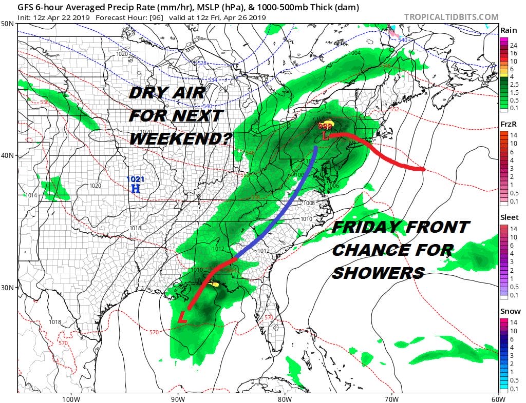
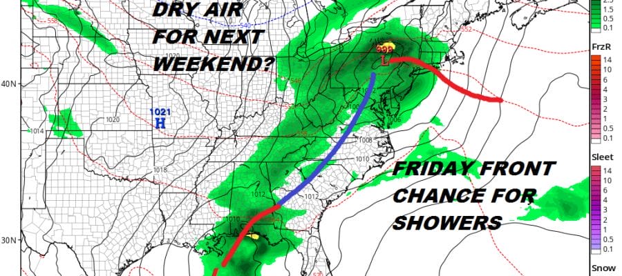
While we seem to have come out of this pattern of well developed cyclones having impact over a period of days, we are instead going to be dealing with a pattern of weather systems and weather fronts moving west to east ever couple of days. At least this allows us to put together a couple of days of nice weather back to back. Thursday looks okay with sunshine and arriving clouds with highs in the 60s to near 70. Then another cold front and another round of showers for Friday. This at least brings a dry start to the weekend.
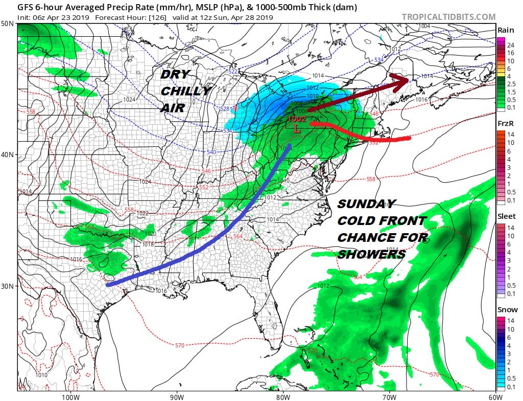
Another cold front looks to arrive later Saturday night into Sunday which could mean another chance for showers and then another shot of dry air follows. As long as weather systems want to track to our north in a fast west to east jet stream it keeps us from getting too involved with onshore flow issues and being gloomy for days at a stretch. Enjoy this beautiful Tuesday with a walk, or take your lunch outside today.
MANY THANKS TO TROPICAL TIDBITS FOR THE USE OF MAPS
Please note that with regards to any tropical storms or hurricanes, should a storm be threatening, please consult your local National Weather Service office or your local government officials about what action you should be taking to protect life and property.


