DOWNLOAD MY NEW FREE JOESTRADAMUS WEATHER APP FOR ALL DEVICES
THE APP IS ABSOLUTELY FREE TO ALL BUT CONSIDERING SUBSCRIBING TO PATREON FOR A WEATHER EXPERIENCE FREE OF ADS, EXCLUSIVE VIDEOS FOR MEMBERS ONLY AND MUCH MORE…STARTS AT $2 A MONTH..MESSAGE ME AT ANY TIME
Coastal Low Pulls Away From Shore Tonight Sunshine Nice Tuesday
A weak surface low and a weak upper low have stacked themselves together and it is spinning away off the New Jersey coast this evening. The low tucked in a bit further west and the rain bands came back further west making for a miserable late afternoon in many areas from the New Jersey shore to Southern New England. Some thunderstorms have actually come in from off the ocean and onshore in some areas of Long Island. Showers in one band have even backed into parts of Eastern Pennsylvania.
SATELLITE

REGIONAL RADAR

Radars are busy here with the low but the system will be pulling out to the east later this evening and then we should see the rains end from west to east. Skies should clear out later tonight as we set up for a nice day on Tuesday.
LOCAL RADAR NEW YORK CITY

LOCAL RADAR DOVER


We should see a day of sunshine for Tuesday thought there is another cold front approaching for Tuesday night and that could mean some clouds arriving later in the day. Highs however should reach the 70s in most places except along the immediate coast. The front Tuesday night produces a shower and then Wednesday and most of Thursday look good with sunshine and some patchy clouds with highs both days in the upper 60s and lower 70s.
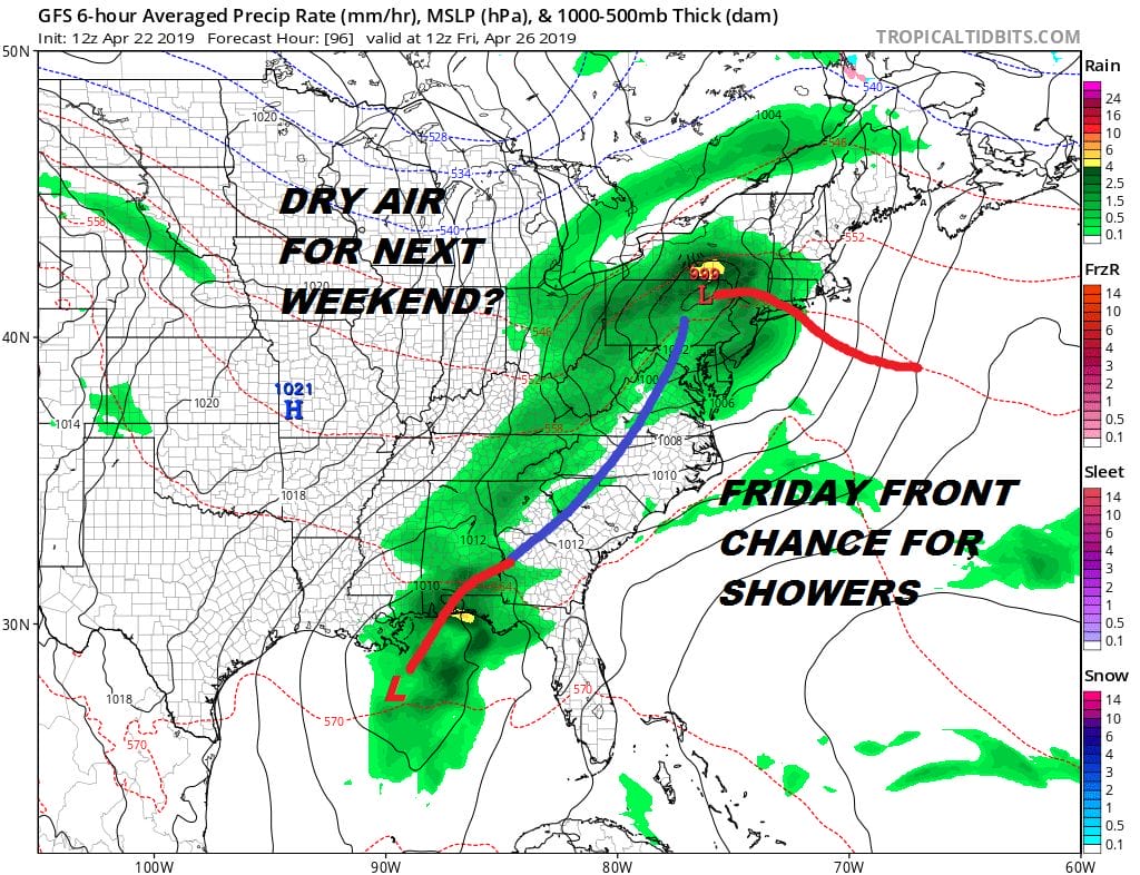
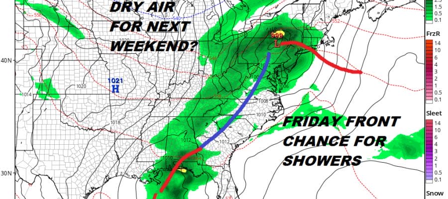
Friday brings a cold front and the likelihood for some showers but once the front clears the coast, dry air should be coming in for next weekend. At least weather systems are starting to move along from west to east and while it doesn’t mean we won’t see showers, at least we can string together a few back to back days of no rain and some sunshine.
MANY THANKS TO TROPICAL TIDBITS FOR THE USE OF MAPS
Please note that with regards to any tropical storms or hurricanes, should a storm be threatening, please consult your local National Weather Service office or your local government officials about what action you should be taking to protect life and property.


