
Beautiful Start to October Weekend Outlook & A Look Ahead To Next Week

Weather in 5/Joe & Joe Weather Show Latest Podcast
Beautiful Start to October Weekend Outlook & A Look Ahead To Next Week
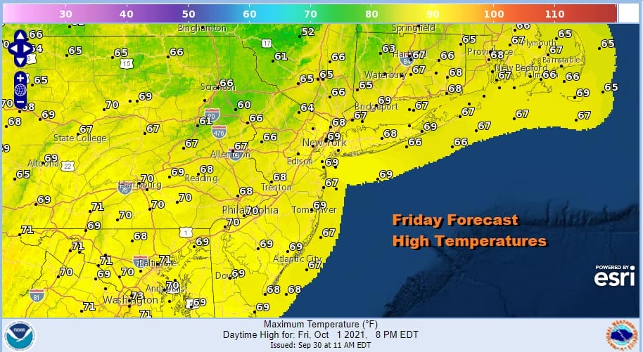
On the lower right of the satellite picture this morning is the western flank of Hurricane Sam which is moving north northwest with 150 mph winds. It is obviously no issue here and even Bermuda will be well to the west of the core of this hurricane. However its very slow movement is holding an upper trough off the East Coast. Than brings us another day of lots of sunshine for Eastern Pennsylvania to Southern New England. Temperatures this afternoon will be in the 60s to around 70 degrees for highs. There are no showers or radar issues to worry about.
SATELLITE

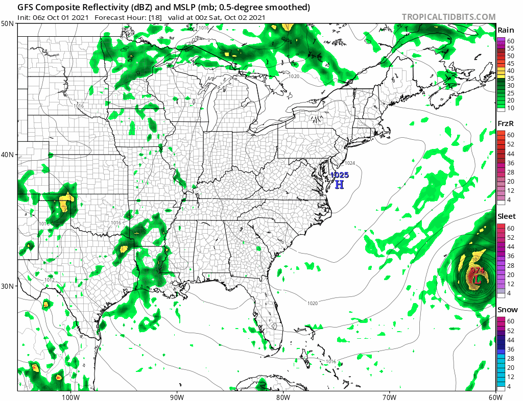
WEATHER RADAR

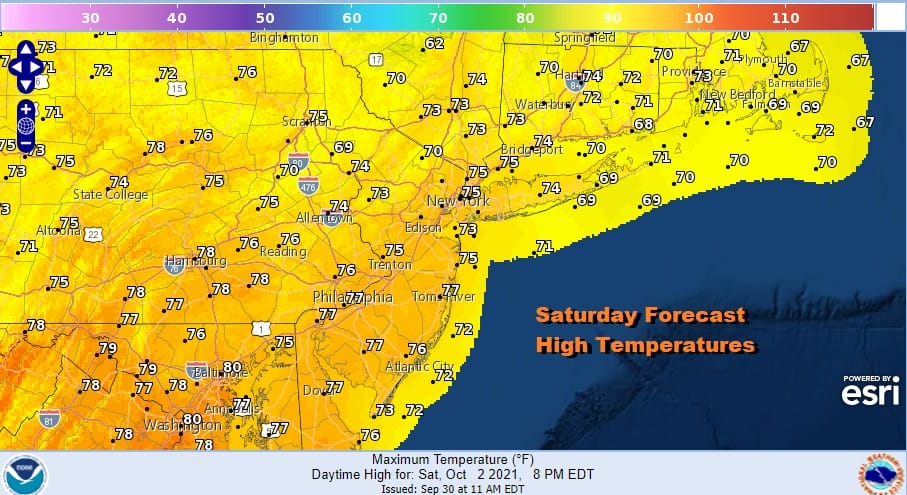
We can now head into what should be a dry rain free weekend even though Saturday will be a better day than Sunday as measured by the amount of sunshine. Saturday sees plenty off it and with a high to the south and a west wind, we should see highs reach the middle to some upper 70s!
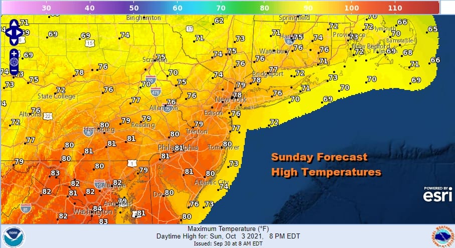
Sunday sees the high offshore and more clouds around. There could be some breaks of sun early but a slow moving front is pressing in from the west. We do not think that the showers will be an issue for Sunday as they should hold off until Sunday night or early Monday. So look for what I would describe as a partly sunny to mostly cloudy day Sunday. It will be rather warm though as highs reach the upper 70s and lower 80s.
Next week we face a totally different pattern for the Eastern US. A deep upper low will be dropping to the Gulf Coast creating a southerly flow along the East Coast but only up to the Middle Atlantic states. To the north the Canadian jet stream settles over the Northeast. This creates a split flow and depending on which side of the split dominates will determine our weather from day to day.
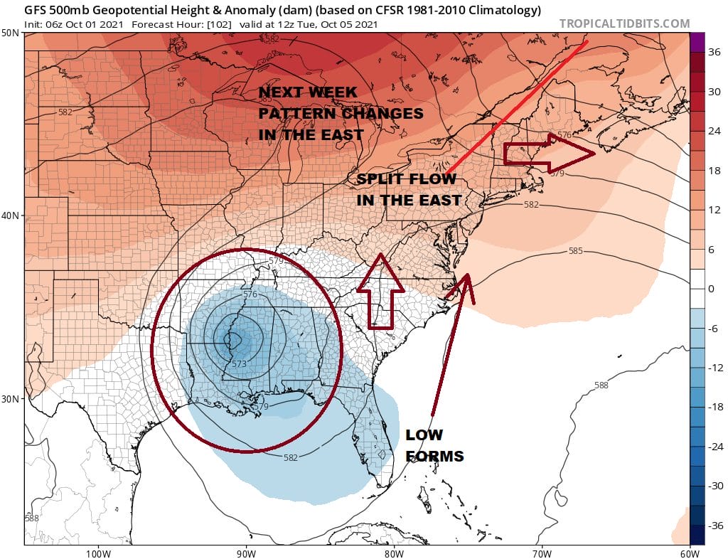
We are also going to have to figure out whether a tropical flow from the Northwest Caribbean to the Southeast US causes a low to form in an area where pressures are going to be low and below average. For now it would see that we will see clouds and perhaps a few scattered showers on Monday. After that it becomes a day to day thing.
High pressure to the north eventually builds into Southeastern Canada and Northern New England which means onshore flow developing for the middle and latter part of next week so that complicates matters also. Dry air won’t be too far away but neither will ocean low clouds and rain to the south. These will be the issues for next week and we will deal with those over the weekend.
BE SURE TO DOWNLOAD THE FREE METEOROLOGIST JOE CIOFFI WEATHER APP &
ANGRY BEN’S FREE WEATHER APP “THE ANGRY WEATHERMAN!

MANY THANKS TO TROPICAL TIDBITS & F5 WEATHER FOR THE USE OF MAPS
Please note that with regards to any severe weather, tropical storms, or hurricanes, should a storm be threatening, please consult your local National Weather Service office or your local government officials about what action you should be taking to protect life and property.


