Beautiful Spring Friday Ahead of Memorial Day Weekend
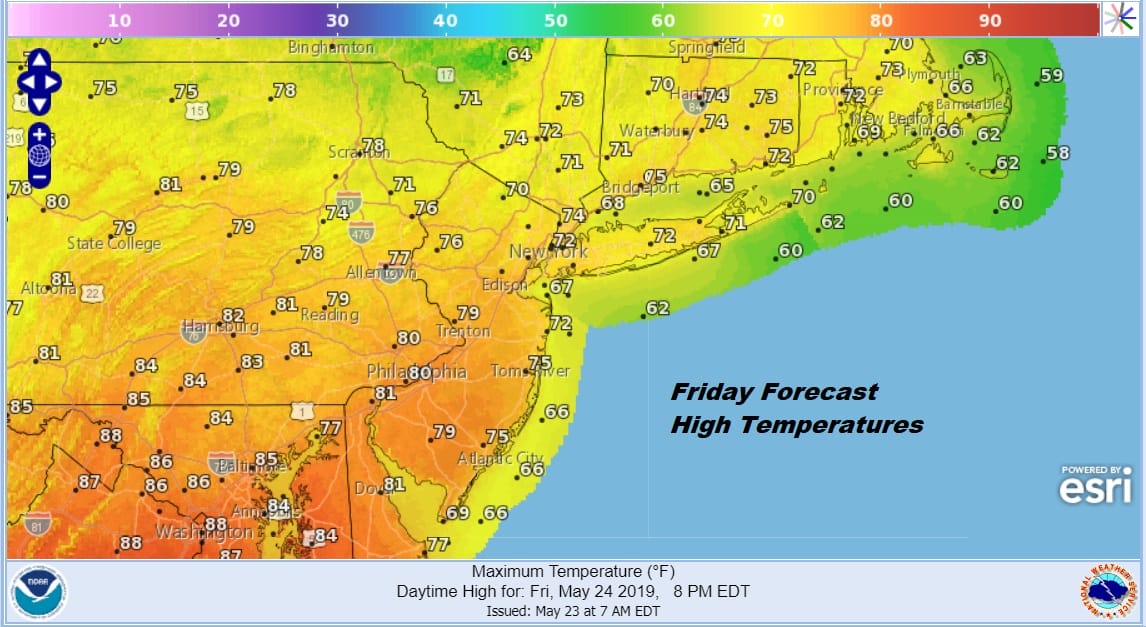
Last night’s brief round of excitement centered around a tornado warning that went up around 10pm for Sussex & Warren Counties in Northwest New Jersey. That came out of an isolated severe thunderstorm that road along Route 80 from Mount Pocono. That came and went with no reports of any issues that I’ve seen. Now it is on to Getaway Friday ahead of the holiday weekend and there are no changes in the outlook for the next 4 days. We cleared out overnight in most areas. Low pressure is in the Gulf of Maine cranking up the wind today but we should see plenty of sunshine with just a few patchy clouds, a gusty wind, and temperatures in the 70s, No rain is forecast through Saturday evening so fill steam ahead to outdoor activities!
SATELLITE

REGIONAL RADAR

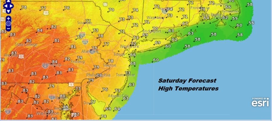
Tonight will be nice and clear with lows in the 50s with the winds easing. Cool spots will be in the 40s. It is on to Saturday with high pressure moving off the coast. Sunshine will be with us most of the day. The winds will be turning to the south which will keep things a little cooler along the coast and a tad warmer inland. Highs will be in the 60s to near 70 coast and 70s to near 80 inland.
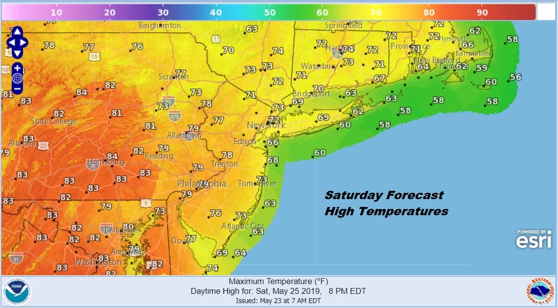
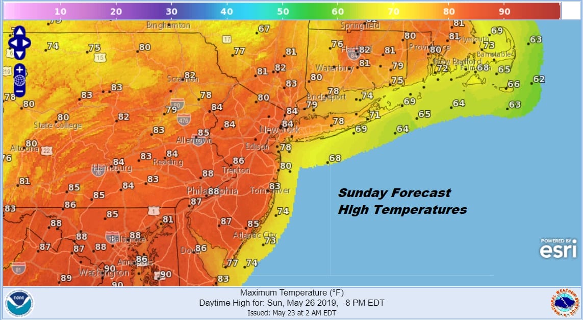
Saturday night will bring the first of 2 opportunities for showers or a thunderstorm. This likely will not be widespread activity and will fall during the nighttime hours causing minimal impact. it also doesn’t appear that any shower or thunderstorm activity will reach severe weather criteria. A cold front comes through Saturday night. Sunday we are back to clouds and some sunshine as the front lingers overhead and another front approaches for Sunday night. Sunday will be the warmest of the three days with hgihs reaching the 80s just about everywhere with sea breezes limited to the immediate coast.
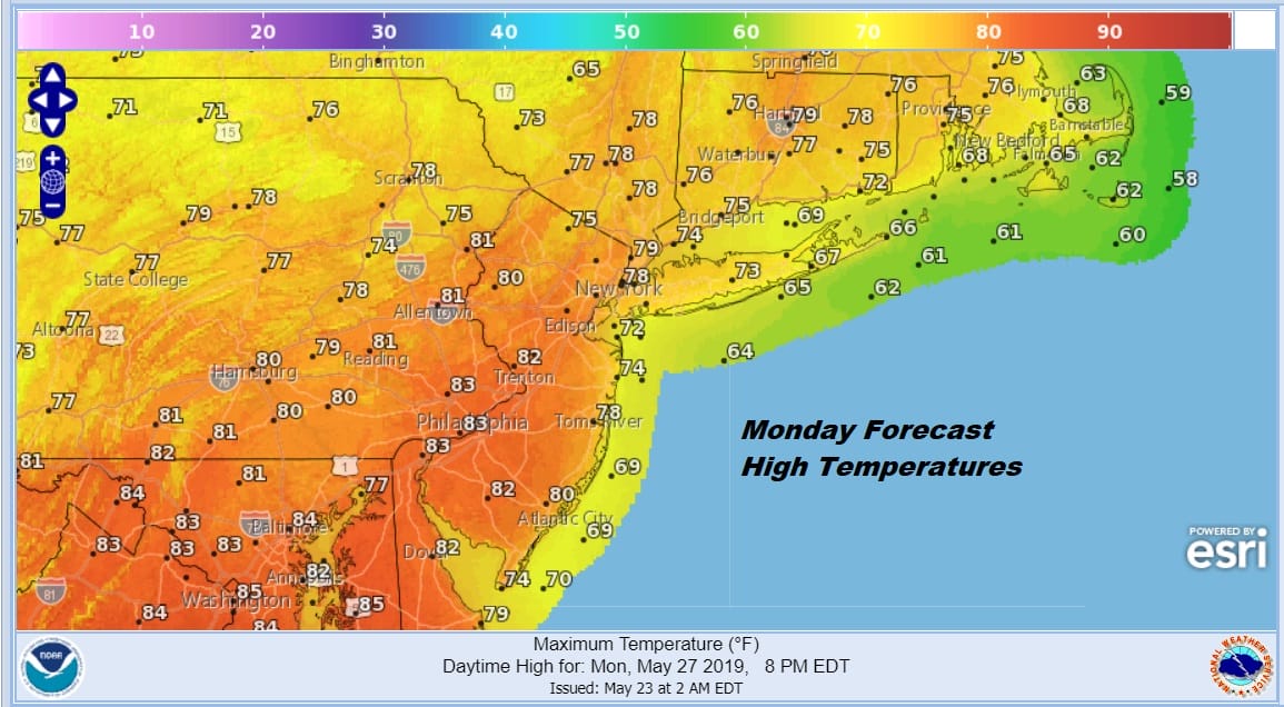
Sunday night brings the chance for a shower or thunderstorm. Then it is on to sunshine for Monday Memorial Day with no weather issues other than some clouds early on and perhaps a few passing clouds from time to time. Highs Monday will be in the mid 70s to lower 80s.
While all this is going on there is a bit of a heatwave that has taken hold of the Southeast US with temperatures in the 90s everyday and that continues over the weekend. That hot air will try and spread northward this week. Initially that creates a warm front with an onshore flow for Tuesday with the chance for showers thunderstorms. Highs will be in the 70s before the warm front passes.
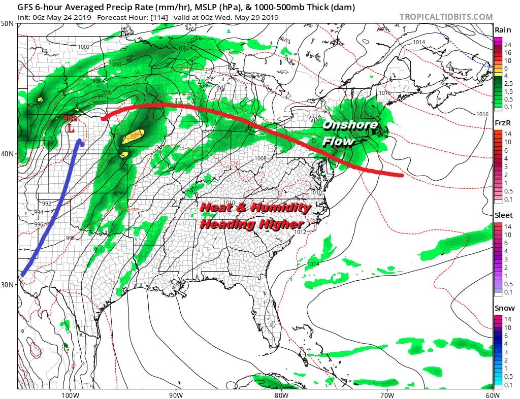
Wednesday and Thursday could be the two very warm to hot days next week with highs in the 80s to near 90 away from the ocean before the next cold front arrives late next week. We seem to be in a pattern where everything moves along which is a good thing. There are no signs of long periods of onshore winds, low clouds, and raw conditions so I guess we are on course for decent manageable weather most of the time in the 7 days.
MANY THANKS TO TROPICAL TIDBITS FOR THE USE OF MAPS
Please note that with regards to any tropical storms or hurricanes, should a storm be threatening, please consult your local National Weather Service office or your local government officials about what action you should be taking to protect life and property.


