Beautiful Saturday Partly Sunny Sunday Dry Air Into Tuesday
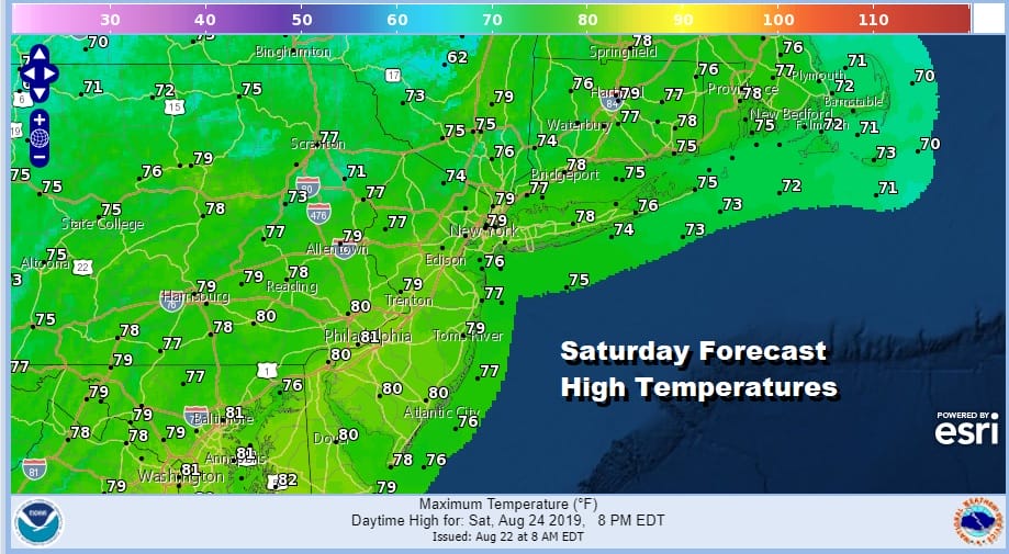
Nothing beats the feeling of a dry air mass arriving after a long stretch of heat and humidity. We have a beautiful Saturday ahead of us with lots of sunshine with nothing more than a few passing clouds. The satellite picture this morning shows the cloud line has moved southward into Virginia. High pressure is building in from the Great Lakes. There are no issues at all as temperatures will be topping out in the 70s to near 80 with a nice light north to northeast breeze. Quite simply it is beautiful out so do enjoy it.
SATELLITE

REGIONAL RADAR

There is nothing to worry about on the regional radar or on the local radars with rains well south into Southern Virginia and into North Carolina. Tonight look for clear skies with most lows in the 50s inland and lower 60s in warmer urban centers and coastal areas. Some clouds may come in from the east by early Sunday morning along the immediate coast.
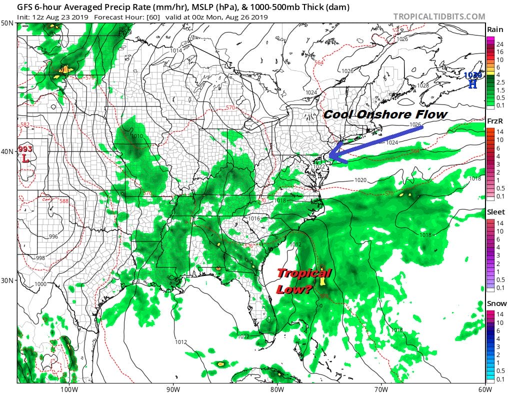
The high heads into the Gulf of Maine and sets up an easterly flow on Sunday. To the south we have the stalled frontal boundary but that boundary is far enough south that we don’t really see issues from that. A weak upper air disturbance will be moving offshore so when you combine all these factors, I’m thinking it should be no worse than partly sunny for Sunday with highs mostly in the low to mid 70s. Perhaps it won’t be as great as Saturday but it will still be rather nice.
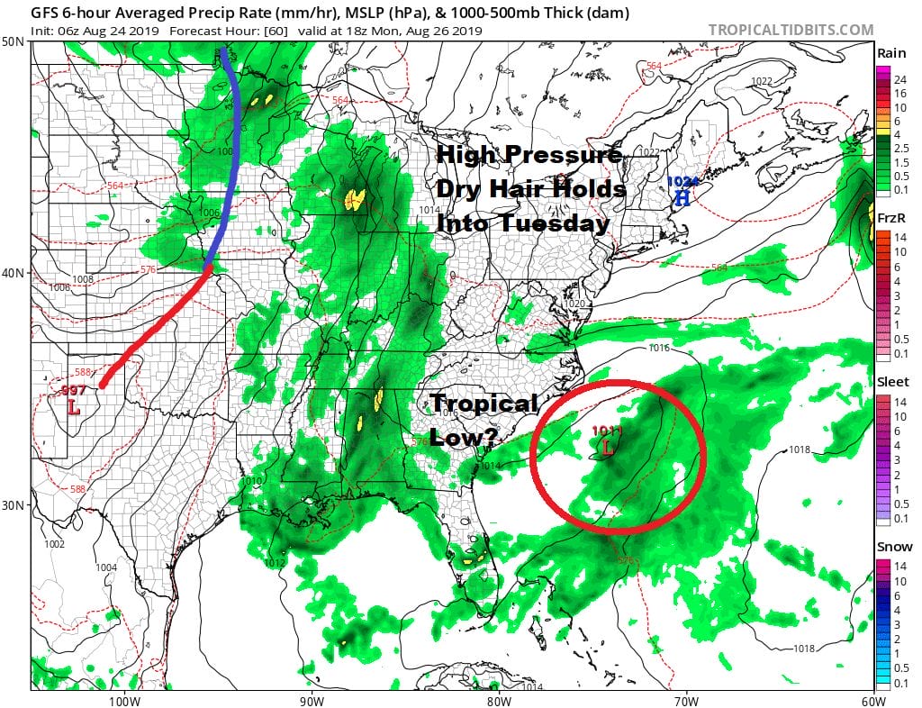
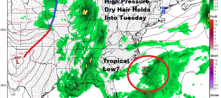
It looks like the high to the east is going to hold on and actually build back westward for Monday and Tuesday which will keep the humidity down. We have the frontal boundary still offshore with a possible tropical system off the Southeast coast. That system may or may not develop. The upper flow will carry it out northeastward offshore regardless and if it does develop it actually could keep things even drier here. Look for some sunshine Monday and Tuesday with highs in the 70s. Later Tuesday clouds will take over as we transition to a warmer more humid air mass for Wednesday. A weak cold front will arrive with a chance for a few showers or a thunderstorm. Right now Thursday looks dry and warm with another weak front coming for late Friday or Saturday and another high with dry seasonal air for much of the Labor Day holiday weekend. It appears we are seeing the summer going out rather quietly.
MANY THANKS TO TROPICAL TIDBITS FOR THE USE OF MAPS
Please note that with regards to any tropical storms or hurricanes, should a storm be threatening, please consult your local National Weather Service office or your local government officials about what action you should be taking to protect life and property.


