Tropical Lows Off Florida Coast & In Tropical Atlantic
We continue to monitor broad low pressure over South Florida that is producing clouds and showers mainly to the east and offshore the Florida east coast. It remains rather disorganized today and with the broad surface low over land today we don’t expect much development. You can see on the satellite loop that the thunderstorm development is definitely offshore and the impact of this system over Florida itself remains rather minimal or at least you wouldn’t notice this difference too much from any other day in August other than perhaps there are a few more clouds around and that is helping to hold temperatures down.
SATELLITE

We may have to wait until later tomorrow or Monday when the low emerges off the East Coast of Florida over the open waters. The National Hurricane Center has this at a 90 percent chance of development over the next 5 days. Now even if this system does develop we continue to see an upper air pattern that favors this system staying out to sea.

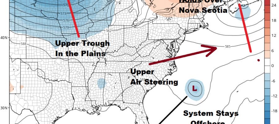
We mentioned on our local weather summary this morning about an upper air disturbance over the Northeast on Sunday. That upper low strengthens over Nova Scotia Monday and Tuesday. This combined with the trough in the Plains keeps the upper air steering winds west southwest across the Eastern US down to Florida. Any system that develops is going to move offshore and stay offshore with no issues. The only way that doesn’t happen is if the low stays weak and lingers over South Florida as a weak system. The bottom line is that if it does the develop it will have no material impact on the weather along the east coast given what we are seeing in the upper air flow.
TROPICAL ATLANTIC SATELLITE LOOP

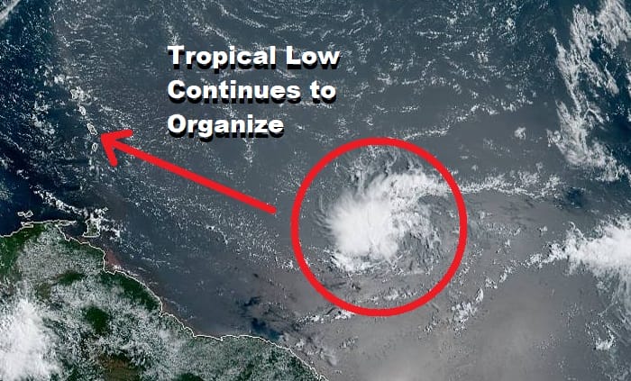
There is a system in the tropical Atlantic about 1000 miles east of the Windward Islands continues to organize and actually looks rather healthy on the satellite loop. The system will continue to track to the west or west northwest for the next several days and conditions are favorable for this system to become a tropical depression over the next day or two.
This system has a shot at becoming a tropical depression or a tropical storm before it reaches the Windward or Leeward Islands next week, however upper air conditions will become more hostile once the system moves into the Eastern Caribbean (assuming it heads on a mostly west track).
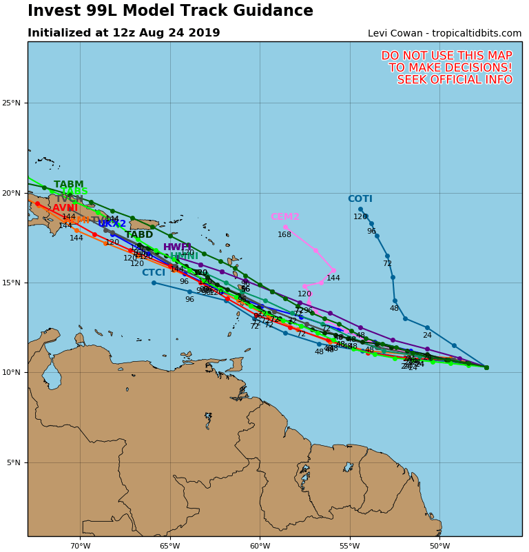
The hurricane tracking models are very consistent with their outlook for this system over the next 5 days. It will be a matter of it surviving (if it develops) the hostile upper winds of the Eastern Caribbean and many systems have been known to weaken rapidly once they cross the islands. The National Hurricane Center has an 80% chance of this system developing into a tropical cyclone over the next 5 days.
MANY THANKS TO TROPICAL TIDBITS FOR THE USE OF MAPS
Please note that with regards to any tropical storms or hurricanes, should a storm be threatening, please consult your local National Weather Service office or your local government officials about what action you should be taking to protect life and property.