Beautiful Dry Air Arrives As We Head into Labor Day Holiday Weekend

Weather in 5/Joe & Joe Weather Show Latest Podcast
Beautiful Dry Air Arrives As We Head into Labor Day Holiday Weekend
Record rainfall, thunderstorms, tornadoes, and what else happened last night are now all gone. Ida is in Eastern Canada and is non tropical. As a result it is bringing down fresh cool Canadian air and it is just in time for the Labor Day holiday weekend. We haven’t been lucky with holiday weekends this summer but this one will be better, not perfect but better, Today will be a partly to mostly sunny day, it will be breezy and cool with highs just into the 70s for highs. We can shut the radars off for awhile.
SATELLITE

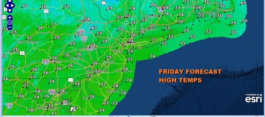
Tonight will be clear breezy and cold with area lows in the 50s. This takes us to Friday which will be a mostly sunny day and on the cool side with highs just in the low to mid 70s. High pressure will still be building in and humidity levels will be very low. Another cool night into Saturday morning is forecast with lows in the 50s to near 60.
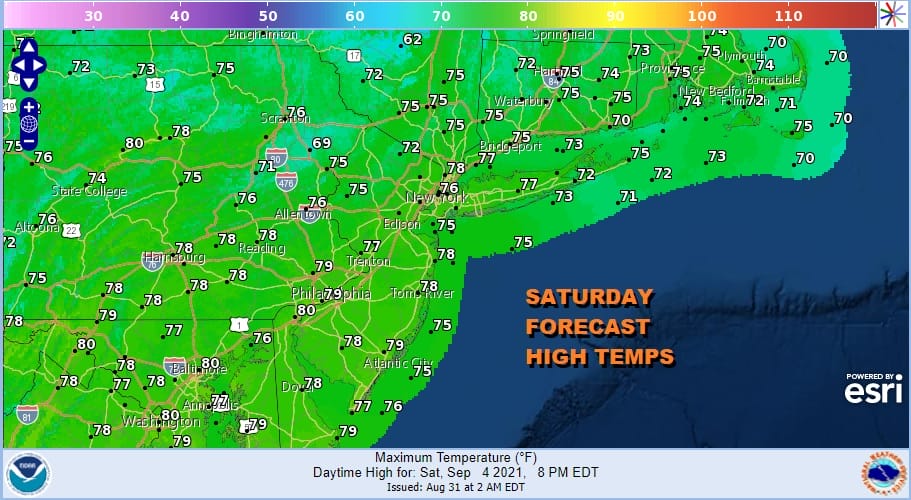
Saturday will be mostly sunny and still nice and dry with highs in the mid to upper 70s. Saturday night we will see temperatures hold somewhat as the high moves offshore and we look ahead to a cold front coming on Sunday. Since the air is dry ahead of the front and dry behind it, showers should be few and far between. So we will call it partly sunny with a small risk for a shower or thunderstorm. Highs will be in the upper 70s and lower 80s.
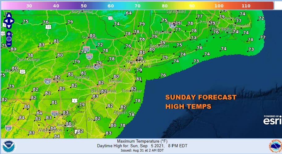
Sunday we have a cold front approaching and moving through. Since the air is dry ahead of it and dry behind it we aren’t expecting much other than a late day shower or thunderstorm that will be scattered around. Otherwise it looks to be a partly sunny day with highs in the upper 70s and lower 80s.
Monday Labor Day looks good with sunshine and a few clouds. Humidity levels will be reasonable and highs will reach into the lower 80s with a few upper 70s in cooler areas north and northwest of the coast. Overall it looks like a good weekend with few if any issues.

Next week looks rather uneventful. The next cold front after the one for Sunday is on Wednesday with the chance for a shower or thunderstorm but overall it looks to be a good week of weather. September is usually a month of nice weather with more frequent intrusions of dry cooler air from Canada. No hurricane are on the horizon though next week what will be major Hurricane Larry could make a close pass to Bermuda before moving out to sea. Ida was the third storm to impact the Northeast and Northern Mid Atlantic and hopefully the last.
BE SURE TO DOWNLOAD THE FREE METEOROLOGIST JOE CIOFFI WEATHER APP &
ANGRY BEN’S FREE WEATHER APP “THE ANGRY WEATHERMAN!

MANY THANKS TO TROPICAL TIDBITS & F5 WEATHER FOR THE USE OF MAPS
Please note that with regards to any severe weather, tropical storms, or hurricanes, should a storm be threatening, please consult your local National Weather Service office or your local government officials about what action you should be taking to protect life and property.


