Bad Hair Weather Monday Hot Highs 90s Late Week Humidity Relief
Bad Hair Weather Monday Hot Highs 90s
Late Week Humidity Relief
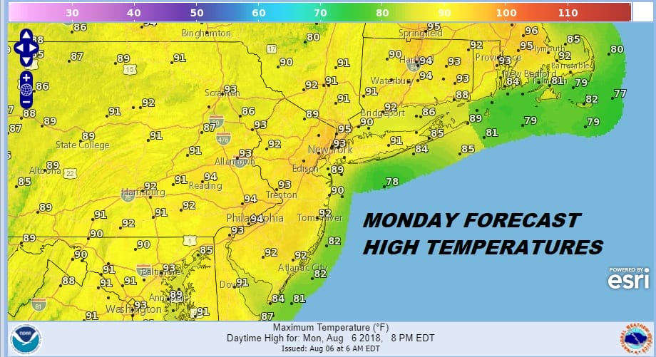
The launching pad is set for blast off this morning with another day of heat humidity and overall bad hair weather. Yes we will have sunshine but no we will not have any showers and thunderstorms to deal with for the second consecutive day. Highs will reach 90 to 95. We are at the time of year where the sea breeze tends to have minimal impact with water temperatures now in the mid to upper 70s.
EASTERN SATELLITE

REGIONAL RADAR

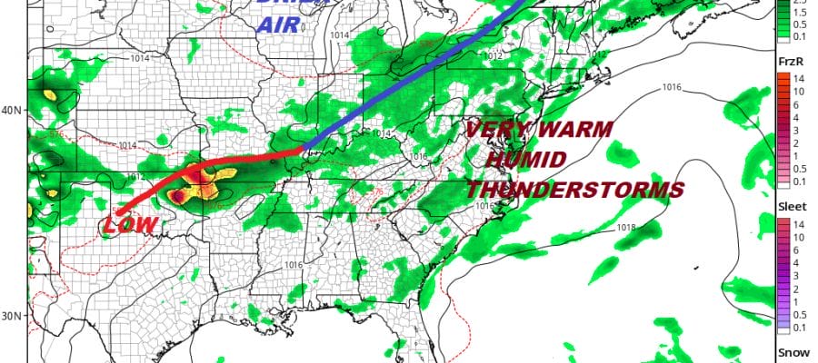
It is cloud free on the satellite loops this morning across the Northeast & Middle Atlantic States and the radars remain free and clear of any downpours or thunderstorms and should be free of rain into Tuesday. Tuesday will be another hot and humid day with highs in the lower 90s. A cold front begins to approach Tuesday night but it will likely struggle to move through here on Wednesday.
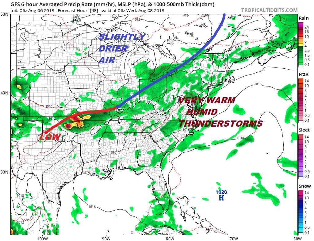
We will probably begin to see thunderstorms running around Tuesday evening and overnight. Wednesday will be a very warm to borderline hot day with the risk for thunderstorms before slightly drier air comes in for Thursday and Friday bringing slight humidity relief. The early weekend outlook shows humidity returning and the threat for thunderstorms returning as well though whole day washouts at this point seem unlikely.
Please note that with regards to any tropical storms or hurricanes, should a storm be threatening, please consult your local National Weather Service office or your local government officials about what action you should be taking to protect life and property.
 GET JOE A CIGAR IF YOU LIKE

LATEST JOESTRADAMUS ON THE LONG RANGE


