AUTUMN COOL WEATHER NIGHT AHEAD
STALLED FRONT RAIN SOUTH JERSEY SUNDAY
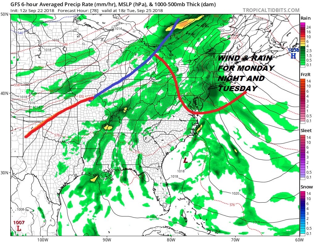
WIND RAIN ARRIVE MONDAY NIGHT TUESDAY
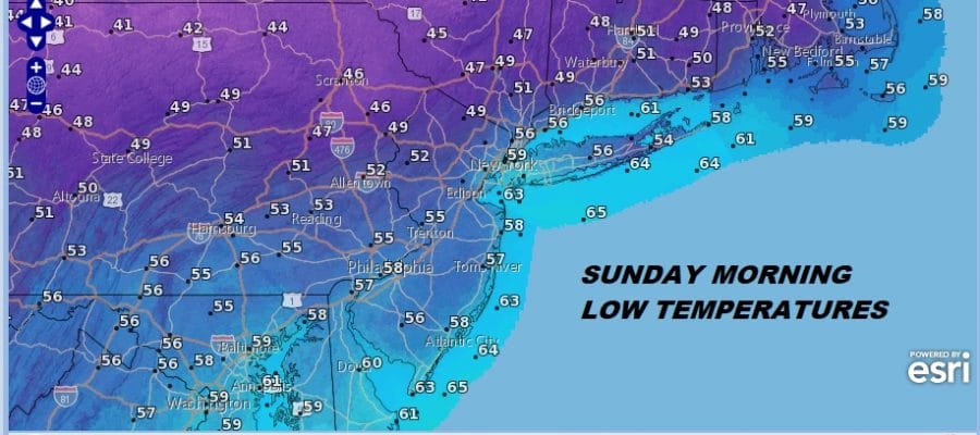
It isn’t often that the weather switches over in timing for the change of season but every once in awhile it does sync up and we seem to have that going on this weekend. Cooler drier air on a fresh north wind took over on Saturday and we are looking ahead to a cool night especially north and west of the coast where lows will be in the 40s. 50s will be common elsewhere including warmer urban locations.
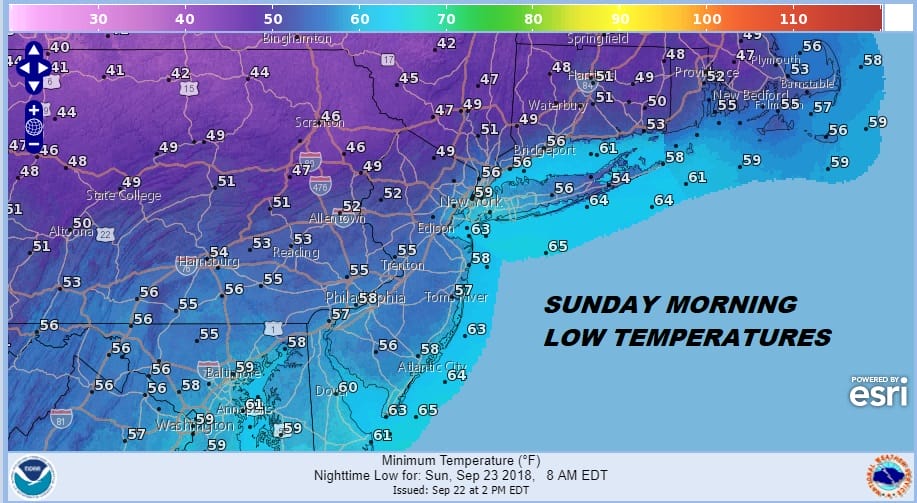
Clouds are close by and will be gradually increasing tonight. Last night’s cold front is doing with many cold fronts have done in the last month which is to stall out to our south. There will be a little wave developing on the front that will bring some light rain to Southern New Jersey and Southeastern Pennsylvania late tonight and Sunday morning. To the north is dry air from a building high. That dry air will push southward later Sunday pushing rain out and there might even be some breaks in the cloud cover Sunday afternoon from New York City and Northern New Jersey north and east into Southern New England and Long Island. Temperatures will be just in the 60s where clouds are stubborn but it could reach 70 or lower 70s where breaks develop Sunday afternoon.
EASTERN SATELLITE

REGIONAL RADAR

The push of dry air is temporary however as the front will begin to crawl northward. Clouds come back rather quickly on Monday and the wind will begin to pick up from off the ocean especially Monday night and Tuesday with the tightening pressure gradient. Highs Monday will just be in the 60s. Rain crawls northward and begins to overspread the region Monday night with rain heavy at times into at least part of Tuesday with most highs in the 60s until the warm front goes by.
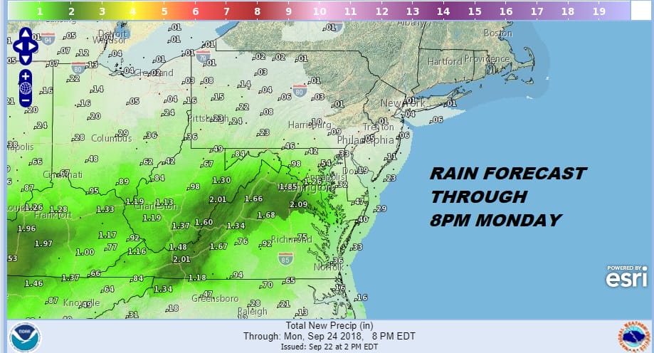
Through Monday evening the rain won’t amount to much but notice the areas to the south across the interior Mid Atlantic will be in the 1 to 2 inch zone through Monday evening with more to come. Look for those amounts to build higher and that is the rain that is headed here.
That warm front does eventually make it through and Wednesday will be a warm humid day with temperatures back into the 80s. There is the chance for showers and thunderstorms. The front will attempt to move through but it may stall out again on Thursday producing more rain before drier cooler air begins to move in later Friday and for next weekend.
One system of note is low pressure off the Southeast Coast Tuesday afternoon which is a system that is well to the east of the Southeast Coast at the moment and rather weak. While conditions will be somewhat favorable for development, note that none of the Global models really do much of anything with it so it should not have a big impact regarding additional rains for the Carolinas. You can read more about this and the other 3 tropical systems including a tropical depression east of the Windwards, a potential subtropical storm in the Central Atlantic and new Tropical Storm Kirk in the Eastern Atlantic.
SUBSCRIBE TO PATREON FOR A WEATHER EXPERIENCE FREE OF ADS, EXCLUSIVE VIDEOS FOR MEMBERS ONLY AND MUCH MORE…STARTS AT $2 A MONTH..MESSAGE ME AT ANY TIME

MANY THANKS TO TROPICAL TIDBITS FOR THE USE OF MAPS
Please note that with regards to any tropical storms or hurricanes, should a storm be threatening, please consult your local National Weather Service office or your local government officials about what action you should be taking to protect life and property.
LATEST JOESTRADAMUS ON THE LONG RANGE