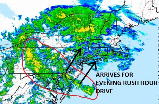
Heavy rain is coming for the evening rush hour for the New York City metro area as it moves now


Heavy rain is coming for the evening rush hour for the New York City metro area as it moves now

Coastal flooding Long Island and New Jersey at high tide today will be minimal with tides running about 1 foot

Rain, Thunderstorms, Flooding, Threat for Severe Weather, that’s the forecast for today and tonight. The first part of the day

MARINE FORECAST FOR LONG ISLAND SMALL CRAFT ADVISORY IN EFFECT GALE WARNINGS IN EFFECT BEGINNING 2PM WEDNESDAY Synopsis: HIGH PRESSURE

Thunderstorms, Heavy Rain, Flooding; all three are possible Wednesday and Wednesday night as the Storm Prediction Center has placed a

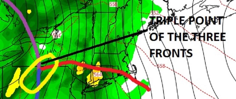
The threat for rain and flooding continues for Wednesday with the arrivial of a strong cold front that will be