Rain, Thunderstorms, Flooding, Threat for Severe Weather, that’s the forecast for today and tonight. The first part of the day consists of over running rain ahead of a strong frontal system. The warm from comes through first late this afternoon which will set the table for possible thunderstorms the first part of tonight. Leaves are coming down and some drains may be blocked so poor drainage areas stand the greatest risk for flooding.

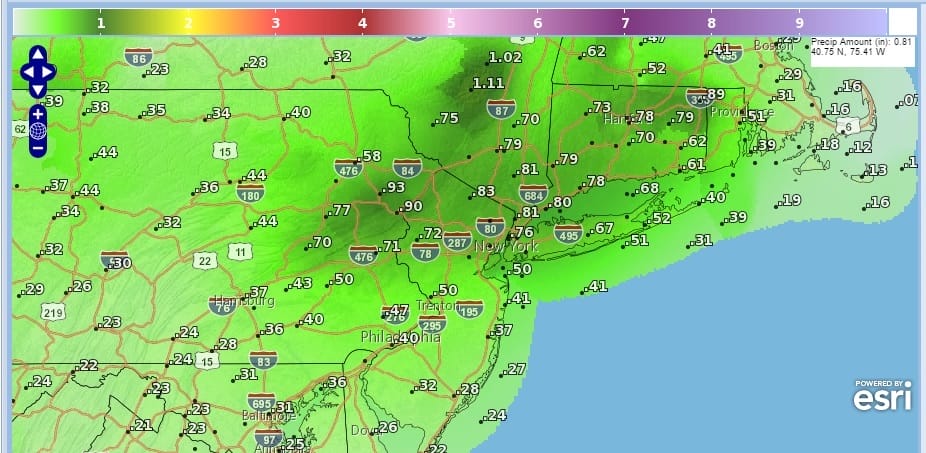
Rain will develop this morning during the morning drive, first across Eastern Pennsylvania, Southern and Central New Jersey and should spread to Eastern areas of Connecticut and Long Island by mid morning. The first round of rain should produce 1/2 inch amounts on average with some spots getting a little bit more. It seems northern areas are a little more favored as they spend more time waiting for the warm front to come through. Northern New Jersey and Long Island northward to the Hudson Valley seem to well with this first over running round. In addition there should be a gusty southeast to south wind which will cause some coastal flooding issues though they should be minor in my view and will tend to favor south facing shorelines. The full moon yesterday is already causing higher than normal tides.
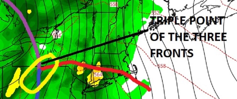
Part two comes between 8pm and 2am as the strong cold front approaches. At this point the warm front will have passed to our north and temperatures will rise through the 60s to even near 70 in some places between that time frame. That rise in temperatures is very significant as it setting the stage for the cold front to move through with the “triple point” of the warm front, cold front, and occluded front.

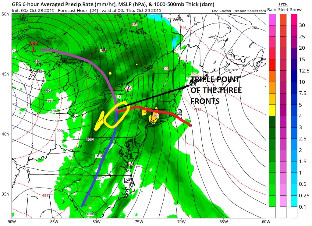
How this triple point swings to the coast will be key. Strong thunderstorms will develop south of that warm front and as they move through they should produce some very heavy downpours in the 6 hours between 8am and 2am.

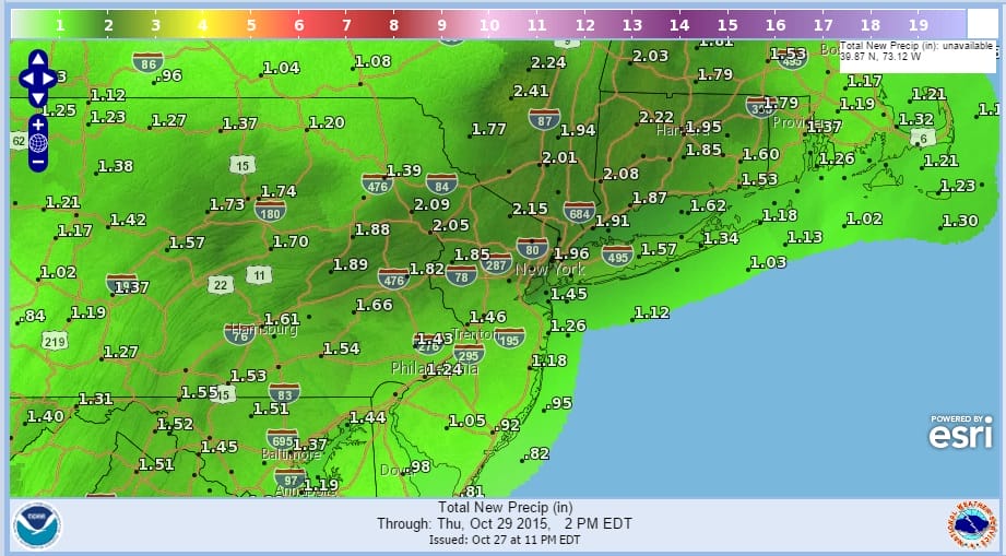
Total rain amounts forecast by the National Weather Service fall into the 1.50 to 2.00 range give or take a little but I think these numbers could be conservative in some areas given the convective nature of the precipitation so local amounts could run 50 percent higher than forecast.
 A couple of things. The wind and coastal flood issue should probably have one additional tide cycle before the winds shift to the west relieving any issue. The second thing is that once the front passes there could be some residual shower activity until it all clears the coast by daybreak. Plenty of warm air will be left over on Thursday morning so temperatures Thursday could top the low to mid 70s before colder air comes in. Then its back to sunshine and dry for Friday and the start of the weekend with highs Friday in the 50s.
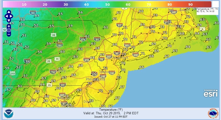
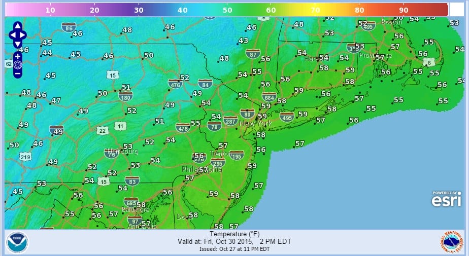
Right now longer range the weekend is looking good. Halloween should be sunny with highs again in the 50s. Sunday may see some clouds as warmer air tries to return and a weather system goes by to our north. Im leaving rain out of the forecast for Sunday though a shower can’t be completely ruled out at this point. Highs Sunday should make it back into the 60s.
Gale warnings and Coastal Flood Advisories are up so check the marine forecast page for the latest wind, wave, and tidal conditions.
Severe weather means be prepared so download my weather app and subscribe to my forecasts. Available for Android or I Phone.


