August Weekend Underway A Few Pop Up Thunderstorms
The weekend is underway & today is the very warm and very humid part of the weekend. The frontal boundary to the south has clouds from the Atlantic back into the Carolinas. There will be no issues from those clouds or the showers that go with it. We will be looking at some sunshine today with highs in the 80s. There is the chance for a pop up shower or thunderstorm but they should be brief and mainly inland. If you do get a downpour or a thunderstorm it shouldn’t last long as these storms tend to come and go in 20 to 30 minutes.
SATELLITE

REGIONAL RADAR

To the northwest is a cold front that will be moving southeastward and passing through overnight. There is a chance there could be an isolated shower or thunderstorm with that front during the overnight hours but for the most part it passes through as a non event. Lows will be in the upper 60s to lower 70s.
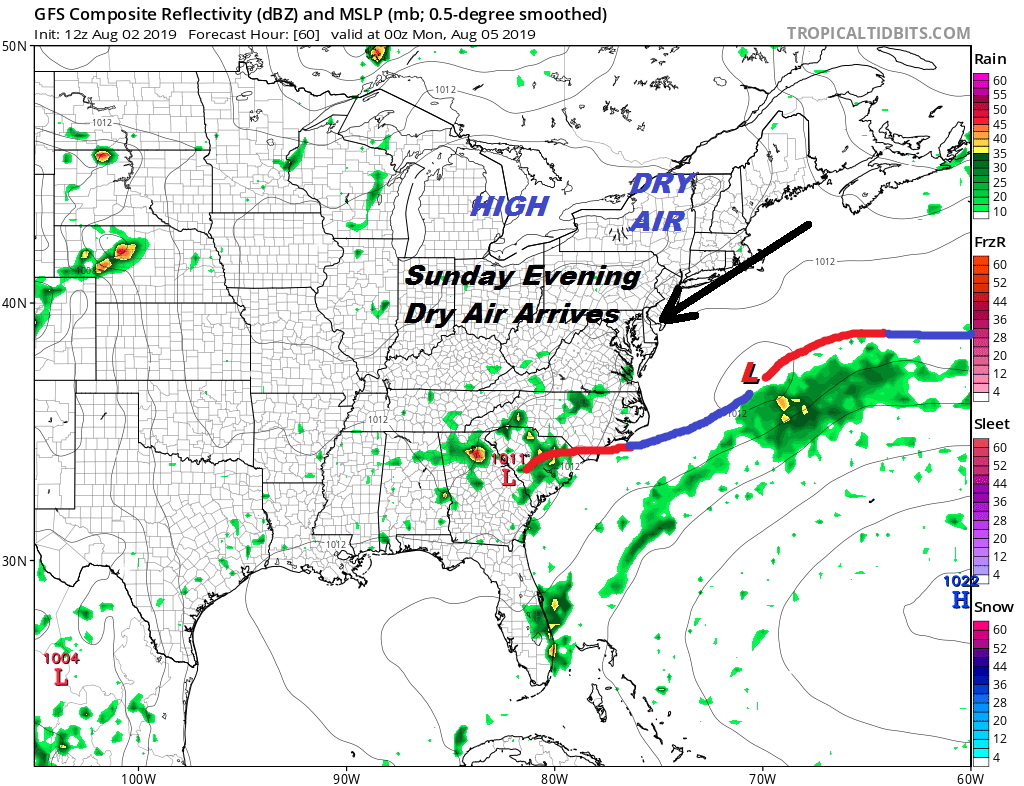
Sunday brings in the beginning of a drier air mass and we should start to see humidity levels drop during the afternoon. We will see sunshine and Sunday will be warmer but it will feel less sticky. Highs will be in the mid to upper 80s. We see the dew points plunging Sunday night into Monday bringing real humidity relief.

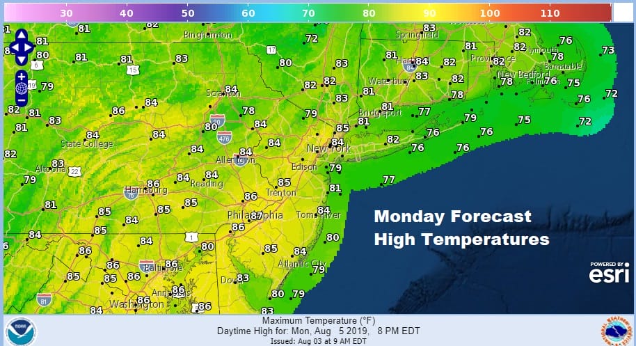
Monday should be a really nice day of sunshine and low humidity with highs mostly in a range of 80 to 85 but the drop in the humidity will be most welcomed and refreshing. There may be some high clouds coming in from the south during the afternoon especially in areas from South Jersey and Southern Pennsylvania southward.
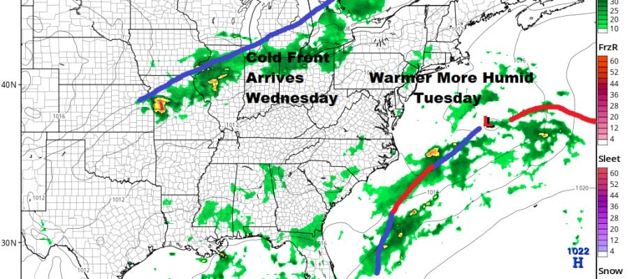
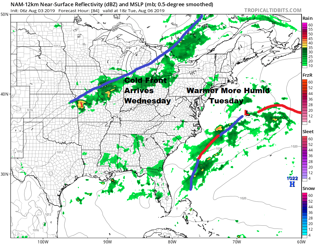
This week after Monday will be about cold fronts coming through every couple of days. The first of these fronts will arrive on Wednesday so we will begin the process of turning warmer and more humid Tuesday with highs in the 80s and the chance for a pop up downpour or a thunderstorm.
Wednesday the cold front nears the coast along with a rather strong upper trough and that means thunderstorms are likely. In fact judging by the look of the overall jet stream pattern for Wednesday there could be the risk for severe weather again. Lately severe weather events have outperformed the models. The jet stream pattern is very active with several short waves in play. The lead one that arrives for Wednesday appears to be the strongest one in this flow.
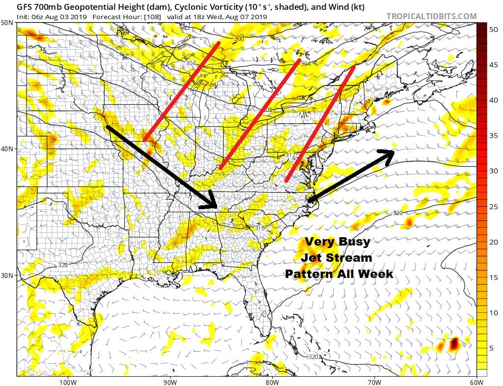
Wednesday we will see humid conditions with likelihood of afternoon and evening thunderstorms and we will be evaluating the severe weather risk as we draw closer. The upper flow is busy so more cold fronts are coming and more chances for thunderstorms late next week and probably into next weekend.
MANY THANKS TO TROPICAL TIDBITS FOR THE USE OF MAPS
Please note that with regards to any tropical storms or hurricanes, should a storm be threatening, please consult your local National Weather Service office or your local government officials about what action you should be taking to protect life and property.


